
ROSETTA-Ice — Ross Ice Shelf, Antarctica
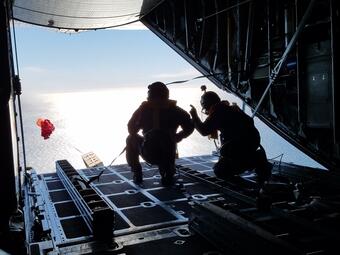
ROSETTA-Ice is a large, NSF-funded, multi-disciplinary and multi-institutional project with several major goals focused on the full ice shelf system of the Ross Ice Shelf that include the ice, underlying seafloor bathymetry, and ocean interaction. Methods include the first comprehensive LC-130-based airborne geophysical survey of the Ross Ice Shelf to measure ice thickness and accumulation (ice-penetrating radars), map the ice surface (LiDAR and surface imagery), and identify geology and depth of the Ross embayment below the ice shelf (gravimeters and magnetometer), as well as deployment of ocean profiler drifters along the shelf edge to profile temperature, salinity, and velocity.
The Ross Ice Shelf (RIS)

The Ross Ice Shelf (RIS) region is a locus of significant interactions between its geotectonic setting, ice sheet, and ocean that have important ramifications across multiple disciplines. With an area of 487,000 km2, roughly the size of France, RIS ranges in thickness from 1,200 m closest to the grounding line to less than 300 m closer to the calving front along the Ross Sea. The edge of the ice shelf along the Ross Sea rises by as much as 50 m above the water. The Ross Ice Shelf is currently close to steady state but geological records indicate that it can disintegrate rapidly, which would accelerate grounded ice loss from catchments equivalent to 11.6 m of global sea level rise, motivating a climate interest in the region.
Prominent features in the bed topography below the floating RIS are broad, steep-sided, bedrock plateaus at 100 to 350 m below sea level, that are transected by glacial troughs reaching depths of 700 m or more. Recent studies suggest that a change in the flux of ocean heat into the ocean cavities underlying ice shelves is the most likely trigger for rapid future ice sheet mass loss within the coming decades to centuries. On longer time scales, the RIS mass budget may also be sensitive to changes in surface mass balance and ice advection across the grounding line. The current understanding of the shelf ice thickness and seafloor bathymetry below RIS is based on the 1970’s Ross Ice Shelf Geophysical and Glaciological Survey (RIGGS), with about 100 data points on a roughly 55-km grid across the entire shelf.

Goal of ROSETTA-Ice
The overarching goal of ROSETTA-Ice during the 2015-2017 field seasons is to address fundamental questions of the structure and stability of RIS within the geotectonic framework for the Ross Embayment by focusing on the following key objectives:
- Acquire the first comprehensive high resolution airborne geophysical data over RIS to support ice, ocean, and geotectonic studies with 10-km and 55-km line and tie-line spacing, respectively.
- Acquire key oceanographic measurements along front of RIS.
- Digitize, re-analyze and make more widely available RIGGS seismic and related geophysical data.
- Use airborne gravity data with RIGGS seismic constraints to improved models of seabed bathymetry for the Ross Embayment, including under RIS.
- Use the new aeromagnetic and gravity data to advance our understanding of the geotectonic framework of the region.
- Use airborne ice-penetrating radar, LiDAR, and imaging to map RIS thickness and ice draft, and constrain RIS structure including basal channels, accumulation history, distribution of crevasses and marine ice.
- Improve models of ice/ocean interaction with improved morphology, bathymetry and hydrographic observations, and investigate sensitivity of the RIS to future climate states.


The project partners include an integrated science and engineer airborne team from Lamont-Doherty Earth Observatory (LDEO), glaciologists from Scripps, geologists from Colorado College, oceanographers from Earth and Space Research, geophysicists from U.S. Geological Survey, gravimeter support from GNS Science and Dynamic Gravity Systems, and air support from the New York Air National Guard 109th Airlift Wing.
Related Project Links
- LDEO ROSETTA-Ice project page
- LDEO ROSETTA data portal
- LDEO News Release of Nature Geoscience paper
- New York Times three-part series coverage of the project | Virtual-Reality Film " A Shifting Continent"


Federal funding for these activities were provided by the National Science Foundation under National Science Foundation 0958658, 1443534, 1443498, 1443677, 1443497, and 1341688, and NASA NNX16AJ65G. Major private funding was provided by the Moore Foundation.
Any opinions, findings, and conclusions or recommendations expressed in this material are those of the author(s) and do not necessarily reflect the views of the National Science Foundation, NASA, or Moore Foundation.
Return to Geology, Geophysics, and Geochemistry Science Center
ROSETTA-Ice is a large, NSF-funded, multi-disciplinary and multi-institutional project with several major goals focused on the full ice shelf system of the Ross Ice Shelf that include the ice, underlying seafloor bathymetry, and ocean interaction. Methods include the first comprehensive LC-130-based airborne geophysical survey of the Ross Ice Shelf to measure ice thickness and accumulation (ice-penetrating radars), map the ice surface (LiDAR and surface imagery), and identify geology and depth of the Ross embayment below the ice shelf (gravimeters and magnetometer), as well as deployment of ocean profiler drifters along the shelf edge to profile temperature, salinity, and velocity.
The Ross Ice Shelf (RIS)
The Ross Ice Shelf (RIS) region is a locus of significant interactions between its geotectonic setting, ice sheet, and ocean that have important ramifications across multiple disciplines. With an area of 487,000 km2, roughly the size of France, RIS ranges in thickness from 1,200 m closest to the grounding line to less than 300 m closer to the calving front along the Ross Sea. The edge of the ice shelf along the Ross Sea rises by as much as 50 m above the water. The Ross Ice Shelf is currently close to steady state but geological records indicate that it can disintegrate rapidly, which would accelerate grounded ice loss from catchments equivalent to 11.6 m of global sea level rise, motivating a climate interest in the region.
Prominent features in the bed topography below the floating RIS are broad, steep-sided, bedrock plateaus at 100 to 350 m below sea level, that are transected by glacial troughs reaching depths of 700 m or more. Recent studies suggest that a change in the flux of ocean heat into the ocean cavities underlying ice shelves is the most likely trigger for rapid future ice sheet mass loss within the coming decades to centuries. On longer time scales, the RIS mass budget may also be sensitive to changes in surface mass balance and ice advection across the grounding line. The current understanding of the shelf ice thickness and seafloor bathymetry below RIS is based on the 1970’s Ross Ice Shelf Geophysical and Glaciological Survey (RIGGS), with about 100 data points on a roughly 55-km grid across the entire shelf.
Goal of ROSETTA-Ice
The overarching goal of ROSETTA-Ice during the 2015-2017 field seasons is to address fundamental questions of the structure and stability of RIS within the geotectonic framework for the Ross Embayment by focusing on the following key objectives:
- Acquire the first comprehensive high resolution airborne geophysical data over RIS to support ice, ocean, and geotectonic studies with 10-km and 55-km line and tie-line spacing, respectively.
- Acquire key oceanographic measurements along front of RIS.
- Digitize, re-analyze and make more widely available RIGGS seismic and related geophysical data.
- Use airborne gravity data with RIGGS seismic constraints to improved models of seabed bathymetry for the Ross Embayment, including under RIS.
- Use the new aeromagnetic and gravity data to advance our understanding of the geotectonic framework of the region.
- Use airborne ice-penetrating radar, LiDAR, and imaging to map RIS thickness and ice draft, and constrain RIS structure including basal channels, accumulation history, distribution of crevasses and marine ice.
- Improve models of ice/ocean interaction with improved morphology, bathymetry and hydrographic observations, and investigate sensitivity of the RIS to future climate states.
The project partners include an integrated science and engineer airborne team from Lamont-Doherty Earth Observatory (LDEO), glaciologists from Scripps, geologists from Colorado College, oceanographers from Earth and Space Research, geophysicists from U.S. Geological Survey, gravimeter support from GNS Science and Dynamic Gravity Systems, and air support from the New York Air National Guard 109th Airlift Wing.
Related Project Links
- LDEO ROSETTA-Ice project page
- LDEO ROSETTA data portal
- LDEO News Release of Nature Geoscience paper
- New York Times three-part series coverage of the project | Virtual-Reality Film " A Shifting Continent"
Federal funding for these activities were provided by the National Science Foundation under National Science Foundation 0958658, 1443534, 1443498, 1443677, 1443497, and 1341688, and NASA NNX16AJ65G. Major private funding was provided by the Moore Foundation.
Any opinions, findings, and conclusions or recommendations expressed in this material are those of the author(s) and do not necessarily reflect the views of the National Science Foundation, NASA, or Moore Foundation.
Return to Geology, Geophysics, and Geochemistry Science Center