
ROSETTA-Ice Flight Plan Map
Detailed Description
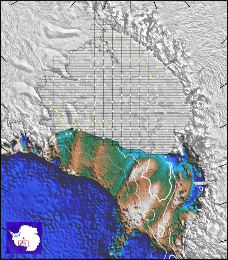
ROSETTA-Ice Flight Plan Map location and airborne survey coverage. Colors north of the Ross Ice Shelf indicate seafloor bathymetry from Bedmap2 compilation. Figure 1b from Tinto and others, 2019, https://doi.org/10.1038/s41561-019-0370-2.
Sources/Usage
Public Domain.
Figure 1b from https://doi.org/10.1038/s41561-019-0370-2
Tinto, K.J., Padman, L., Siddoway, C.S., Springer, S.R., Fricker, H.A., Das, I., Caratori Tontini, F., Porter, D.F., Frearson, N.P., Howard, S.L., Siegfried, M.R., Mosbeux, C., Becker, M.K., Bertinato, C., Boghosian, A., Brady, N., Burton, B.L., Chu, W., Cordero, S.I., Dhakal, T., Dong, L., Gustafson, C.D., Keeshin, S., Locke, C., Lockett, A., O’Brien, G., Spergel, J.J., Starke, S.E., Tankersley, M., Wearing, M.G., and Bell, R.E., 2019, Ross Ice Shelf response to climate driven by the tectonic imprint on seafloor bathymetry: Nature Geoscience, published online 27 May 2019, https://doi.org/10.1038/s41561-019-0370-2.
Related

ROSETTA-Ice — Ross Ice Shelf, Antarctica
Related