HBBS Participates in Brave Wilderness Episode Shoot
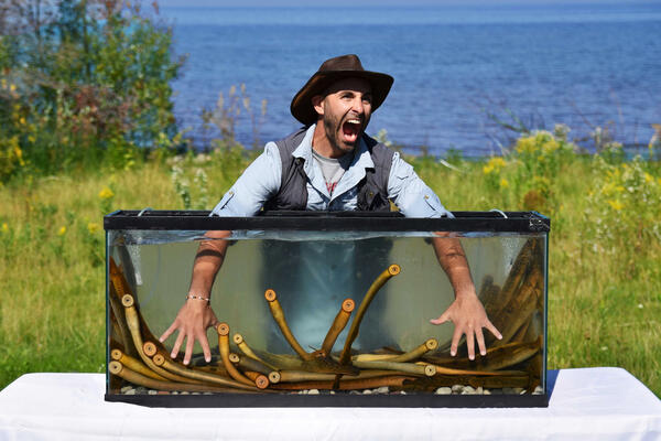
HBBS Participates in Brave Wilderness Episode ShootBrave Wilderness host, Coyote Peterson, holds his hands in a tank of live sea lamprey while filming the first of two sea lamprey-focused episodes for the show’s YouTube channel. GLSC communications associate, Dr. Andrea Miehls, assisted the Brave Wilderness team while filming in multiple remote locations across northeastern Michigan.