The Idaho National Laboratory Project Office (INLPO) conducts drilling and coring operations to monitor and sample groundwater, obtain basalt and sediment cores for analysis, and study the physical properties of the subsurface through geophysical logging. This information is crucial for enhancing our scientific understanding of the eastern Snake River Plain (ESRP) and its aquifer, particularly concerning subsidence and the movement of groundwater and contaminants within the aquifer.
Research Drilling and Coring
The USGS INL Project Office operates two drill rigs to support core drilling and the construction of new monitoring wells (Twining and others, 2021; Twining and others, 2023). Our skilled drillers and scientists are experienced in drilling through fractured rock and sediment, as well as in preserving, labeling, and describing continuous rock and sediment cores using established protocols. The drill core collected from the INL is carefully boxed and archived at the Core Storage Library, where it is made available for examination and sampling by USGS, INL, and university researchers for various projects.
USGS INLPO Drilling Equipment
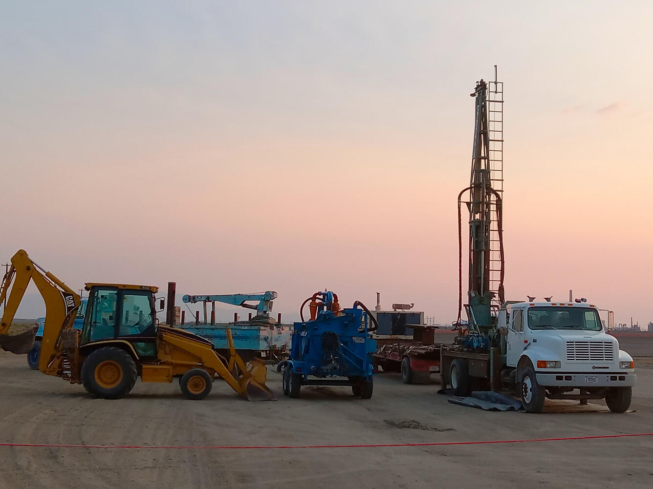
The USGS INL Project Office is equipped with geotechnical coring capabilities, rotary drilling rigs, and soil probing equipment to facilitate drilling activities, geologic material collection, and the construction of monitoring wells of varying sizes and depths. Our auxiliary equipment includes semi-trucks, trailers, water haulers, air compressors, mud systems for drilling, service trucks with cranes, backhoes, forklifts, and a variety of other support equipment. We maintain a laydown yard with access to a wide range of drilling materials and supplies.
Geotechnical Core Drilling Rig
Our primary geotechnical core drilling rig is a 1998 Christensen CS1500. We also have various core tooling systems available, accommodating core sizes of approximately PQ (3.3 in.), HQ (2.5 in.), and NQ (1.9 in.) to meet diverse project needs and borehole depths.

Rotary Drilling Equipment
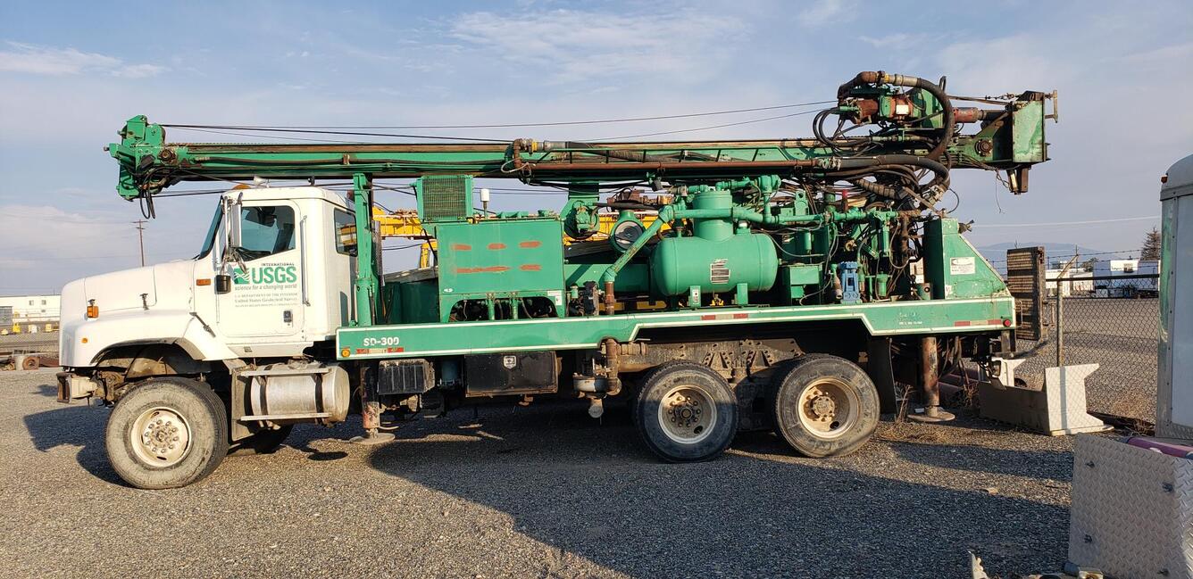
The 2002 SD300 rig is utilized for various rotary drilling projects, well workovers, and well construction. This rig is primarily employed to construct monitoring wells following the core drilling phase. For specific inquiries regarding the capabilities of this equipment, please contact us.

Soil Probing Systems
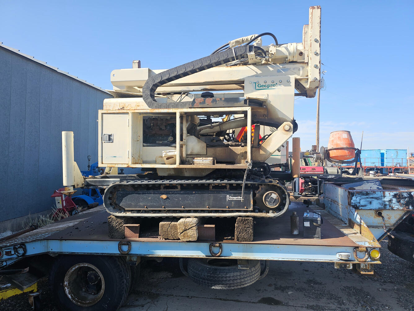
We have several shallow soil probe systems available for continuous soil sampling and the construction of shallow monitoring wells. These include a Geoprobe track-mounted system and an AMS Power Probe trailer-mounted system, both designed to support shallow sediment core collection. A variety of tooling and liner materials are available for soil preservation and sampling.

Completion summary for Borehole TAN-2336 at Test Area North, Idaho National Laboratory, Idaho Completion summary for Borehole TAN-2336 at Test Area North, Idaho National Laboratory, Idaho
Completion summary for boreholes USGS 148, 148A, and 149 at the Materials and Fuels Complex, Idaho National Laboratory, Idaho Completion summary for boreholes USGS 148, 148A, and 149 at the Materials and Fuels Complex, Idaho National Laboratory, Idaho
The Idaho National Laboratory Project Office (INLPO) conducts drilling and coring operations to monitor and sample groundwater, obtain basalt and sediment cores for analysis, and study the physical properties of the subsurface through geophysical logging. This information is crucial for enhancing our scientific understanding of the eastern Snake River Plain (ESRP) and its aquifer, particularly concerning subsidence and the movement of groundwater and contaminants within the aquifer.
Research Drilling and Coring
The USGS INL Project Office operates two drill rigs to support core drilling and the construction of new monitoring wells (Twining and others, 2021; Twining and others, 2023). Our skilled drillers and scientists are experienced in drilling through fractured rock and sediment, as well as in preserving, labeling, and describing continuous rock and sediment cores using established protocols. The drill core collected from the INL is carefully boxed and archived at the Core Storage Library, where it is made available for examination and sampling by USGS, INL, and university researchers for various projects.
USGS INLPO Drilling Equipment
The USGS INL Project Office is equipped with geotechnical coring capabilities, rotary drilling rigs, and soil probing equipment to facilitate drilling activities, geologic material collection, and the construction of monitoring wells of varying sizes and depths. Our auxiliary equipment includes semi-trucks, trailers, water haulers, air compressors, mud systems for drilling, service trucks with cranes, backhoes, forklifts, and a variety of other support equipment. We maintain a laydown yard with access to a wide range of drilling materials and supplies.
Geotechnical Core Drilling Rig
Our primary geotechnical core drilling rig is a 1998 Christensen CS1500. We also have various core tooling systems available, accommodating core sizes of approximately PQ (3.3 in.), HQ (2.5 in.), and NQ (1.9 in.) to meet diverse project needs and borehole depths.

Rotary Drilling Equipment
The 2002 SD300 rig is utilized for various rotary drilling projects, well workovers, and well construction. This rig is primarily employed to construct monitoring wells following the core drilling phase. For specific inquiries regarding the capabilities of this equipment, please contact us.

Soil Probing Systems
We have several shallow soil probe systems available for continuous soil sampling and the construction of shallow monitoring wells. These include a Geoprobe track-mounted system and an AMS Power Probe trailer-mounted system, both designed to support shallow sediment core collection. A variety of tooling and liner materials are available for soil preservation and sampling.


