
Water Use and Availability
Water Use and Availability
These are our active and completed studies related to water use and availability.
Filter Total Items: 23

Characterizing the Water Resources of the Camas Prairie, Southern Idaho
Southern Idaho's Camas Prairie is a 730-square-mile basin nestled between the Mount Bennett Hills and the Soldier Mountains and drained by Camas Creek. The area is culturally significant to native peoples who have gathered the bulbs of the common camas for food. Since the late 19th century, the basin has also been an important agricultural area. Camas Creek contributes water to Magic Reservoir, a...

Characterizing the Water Resources of the Mountain Home Plateau, Southern Idaho
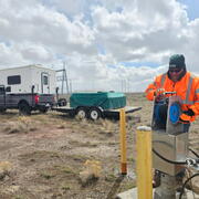
Residents, businesses, agricultural producers, and Mountain Home Air Force Base all rely on the Mountain Home Plateau's groundwater resources. Declining groundwater levels raise concerns about the sustainability of the regional aquifer. The Idaho Department of Water Resources (IDWR) needs updated information about the groundwater resources of the Mountain Home Plateau to help administer water...

Estimating Spring Discharge to the Snake River, Milner Dam to King Hill, Southern Idaho
Groundwater discharges to the Snake River from numerous volcanic rock springs along the northern canyon wall between Milner Dam and King Hill. Water-resource managers need to be able to quantify the amount of this water to understand the eastern Snake River Plain aquifer's recharge, storage, and discharge. When completed, this study will provide the Idaho Department of Water Resources with an...

Bathymetric Survey of the Mores Creek Arm of Lucky Peak Lake
In 2004, about 90 migrating elk and 25 mule deer broke through thin ice and drowned as they attempted to cross the Mores Creek arm of Lucky Peak Lake upstream of the Highway 21 bridge. To prevent any similar incidents, reservoir managers and wildlife biologists needed a better understanding of water depths over a range of reservoir pool elevations.

American Falls Reservoir Bathymetry
In cooperation with the Bureau of Reclamation, we surveyed the bathymetry within an area of about 500 acres of American Falls Reservoir between River Miles 713 and 714 August 6-8, 2019. The bathymetric survey provided high-resolution detail of a proposed treatment area for an aeration system that is being developed to support water quality during the American Falls spillway concrete repair project...

Monitoring Streamflow in Remote Headwater Streams
Remote headwater streams are important sources of water that are not well understood. Working with other USGS science centers across the country, we are developing methods for estimating streamflow in these environments. Data from these efforts will contribute to improving our understanding of water availability and how drought may be affecting these stream ecosystems.

Groundwater Quality and Quantity Trends in the Middle Snake River Region, South-Central Idaho
Groundwater-quality and groundwater-level data have been collected by the USGS and various state agencies in the mid-Snake area since at least the early 1990s. However, no trend analyses have been conducted on the data since 2012. Assessing groundwater-quality trends will help resource managers determine if they should continue or modify current nutrient management practices. Groundwater-level...

Characterizing the Water Resources of the Big Lost River Valley
In cooperation with the Idaho Department of Water Resources, we are working to improve the scientific understanding of the Big Lost River basin's water resources. This improved understanding will support effective resource management.

Groundwater-Flow Model for the Treasure Valley and Surrounding Area
in partnership with the Idaho Department of Water Resources (IDWR) and the Idaho Water Resource Board (IWRB), we are developing a numerical groundwater-flow model of the Treasure Valley and surrounding area. Resource managers will use the model to simulate potential human and climatic effects on groundwater for water-supply planning and management.
INLPO Water Monitoring
The U.S. Geological Survey (USGS) first characterized the water resources of the Idaho National Laboratory (INL) area prior to the establishment of nuclear reactor testing facilities in 1949. Since then, the USGS has maintained monitoring networks for groundwater quality and water levels at the INL. These efforts provide essential data on hydrologic trends and track the movement of radioactive and...

Wood River Valley Groundwater-Flow Model
Rapid population growth in the Wood River Valley since the 1970s has caused concern about the long-term sustainability of the groundwater resource. Water-resource planners and managers, as well as other decision makers, need a tool for water rights administration and water-resource management and planning.

Streamflow Evaluation for Wild and Scenic Rivers, Owyhee Canyonlands Wilderness
Several river segments in the Owyhee Canyonlands Wilderness have been designated as “Wild and Scenic” under the Omnibus Public Lands Management Act of 2009. This designation is intended to protect the “outstanding remarkable values” (ORVs) in this area—specifically fish and wildlife habitat, scenic and geological features, and recreational opportunities. The Bureau of Land Management (BLM) is...