
Chesapeake Bay
Chesapeake Bay
Filter Total Items: 2

2012 SPARROW Models for the Northeast: Total Phosphorus, Total Nitrogen, Suspended Sediment, and Streamflow
The 2012 SPAtially Referenced Regression On Watershed attributes (SPARROW) Models measure the damaging contaminants of phosphorus, nitrogen, and suspended sediment in streamflow throughout the Northeast United States. Through various types of watershed management practices, loads of nutrients and suspended sediment are significantly reduced within the stream network in impounded reaches, and...
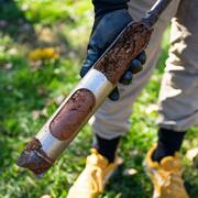
Geomorphology and Sediment Team
Our Geomorphology Team works across all spatial scales to optimize monitoring, modeling, and interpretative work tailored to the needs of our cooperators. We have extensive experience in leveraging large geospatial datasets and advanced GIS analyses to meet these needs, and our methods include hydraulic flow modeling, sediment source tracking, watershed-wide GIS-based morphological analyses...