
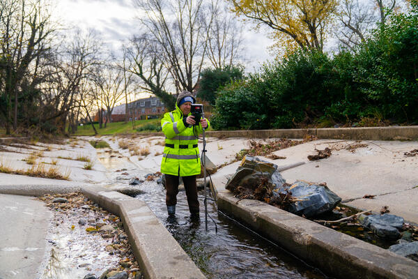
Hydrologic technician Jeremy Malen services a water-quality sensor along the Susquehanna River in Maryland.
Multimedia
Explore our collection of photos and videos of USGS water science in Maryland, Delaware, and Washington, D.C.
Images
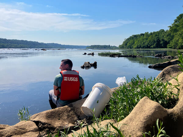
Susquehanna River near Darlington Water Quality
Hydrologic technician Jeremy Malen services a water-quality sensor along the Susquehanna River in Maryland.
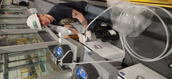
Physical scientist collecting water samples at the Hydrologic Instrumentation Facility (HIF)
Physical scientist collecting water samples at the Hydrologic Instrumentation Facility (HIF)Tyler Bowser, Physical Scientist with the USGS Maryland-Delaware-D.C. Water Science Center, collecting water samples during 6PPD-quinone (6PPD-Q) transport experiments in the HIF tilting flume.
UAS Aerial Imagery Testing Day
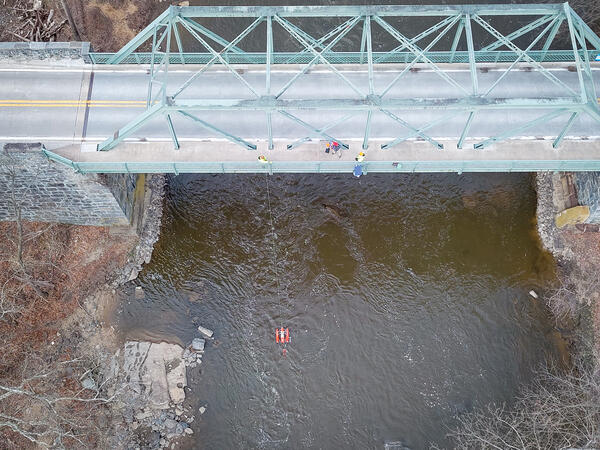
An aerial view of hydrologic technicians on a truss bridge above Brandywine Creek measuring streamflow with an ADCP.
An aerial view of hydrologic technicians on a truss bridge above Brandywine Creek measuring streamflow with an ADCP.
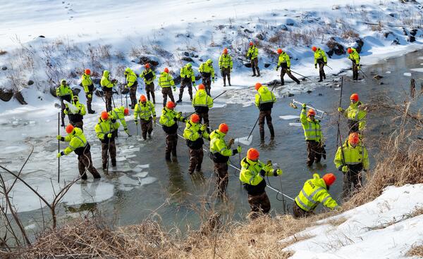
Northwest Branch Anacostia River Ice Measurement Composite
Northwest Branch Anacostia River Ice Measurement CompositeA photo composite of 31 images showing hydrologic technicians Nick Giro, Ashley Ryan, and Augustine Barquin breaking up an icy river and measuring streamflow in the Northwest Branch Anacostia River at Brentwood, MD (USGS-01651003).
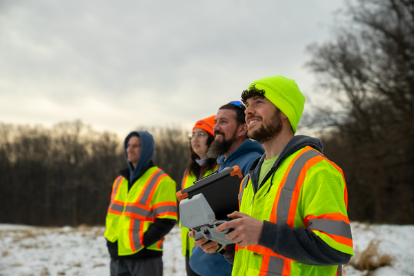
NGWOS Small Drone Training in Maryland
Nick Giro, Chris Lewis, Leah Staub, and Jeremy Malen observing a small aerial drone (off camera) during training.
Nick Giro, Chris Lewis, Leah Staub, and Jeremy Malen observing a small aerial drone (off camera) during training.
Streamflow Measurement at West Herring Branch
Hydrologic technician Mike Geissel obtains a streamflow measurement at West Branch Herring Run at Idlewylde, MD, USGS-01585200.
Fall 2025 Photo Contest Winner: David Fisher, Honorable Mention category.
Hydrologic technician Mike Geissel obtains a streamflow measurement at West Branch Herring Run at Idlewylde, MD, USGS-01585200.
Fall 2025 Photo Contest Winner: David Fisher, Honorable Mention category.
Videos

Using Drones To Study Rivers From Above
The Next Generation Water Observing Program (NGWOS) supports the advancement of water resources observations in order to assess water availability, management, and prediction across the US’s major hydrologic regions.
The Next Generation Water Observing Program (NGWOS) supports the advancement of water resources observations in order to assess water availability, management, and prediction across the US’s major hydrologic regions.

USGS On the Road - Remotely Sampling a Stream for Contaminants
USGS On the Road - Remotely Sampling a Stream for ContaminantsTyler and Laura as they replace an auto sampler after a large rain event. USGS scientists use these samplers to log river conditions before, during, and after a storm.
USGS On the Road - Remotely Sampling a Stream for Contaminants
USGS On the Road - Remotely Sampling a Stream for ContaminantsTyler and Laura as they replace an auto sampler after a large rain event. USGS scientists use these samplers to log river conditions before, during, and after a storm.

Studying Anacostia River Quality with DOEE
The USGS and D.C.’s DOEE have been working together to monitor water quality in the Anacostia, in support of the District's goal of expanding access to the water for local communities. DOEE relies on data and continuous monitoring from USGS to support important decisions about public safety and the accessibility of the area’s natural resources.
The USGS and D.C.’s DOEE have been working together to monitor water quality in the Anacostia, in support of the District's goal of expanding access to the water for local communities. DOEE relies on data and continuous monitoring from USGS to support important decisions about public safety and the accessibility of the area’s natural resources.

Studying the Water Quality of the Anacostia River
The USGS and D.C.’s DOEE have been working together to monitor water quality in the Anacostia, in support of the District's goal of expanding access to the water for local communities. DOEE relies on data and continuous monitoring from USGS to support important decisions about public safety and the accessibility of the area’s natural resources.
The USGS and D.C.’s DOEE have been working together to monitor water quality in the Anacostia, in support of the District's goal of expanding access to the water for local communities. DOEE relies on data and continuous monitoring from USGS to support important decisions about public safety and the accessibility of the area’s natural resources.

Your Future at USGS: Discover the MD-DE-DC Water Science Center
Your Future at USGS: Discover the MD-DE-DC Water Science CenterDiscover what a career in science with the U.S. Geological Survey looks like. The Maryland-Delaware-DC Water Science Center is home to skilled scientists of many disciplines: hydrologists, geomorphologists, geographers, data scientists, statisticians, biologists, technicians, and more. You name it, we need it.

USGS On the Road - Flooding in Westernport, MD
Westernport, Maryland was one of the hardest hit towns during the mid-May flooding in Western Maryland, where Georges Creek flooded an elementary school in Westernport, MD, prompting the emergency rescue of schoolchildren.
Westernport, Maryland was one of the hardest hit towns during the mid-May flooding in Western Maryland, where Georges Creek flooded an elementary school in Westernport, MD, prompting the emergency rescue of schoolchildren.