



Photo shows a person in a kayak pulling stream gaging equipment along the Las Vegas Wash at USGS monitoring site 09419749. This streamflow data is very important for managing water resources in Las Vegas Valley.
Images
Images intro.
Filter Total Items: 91
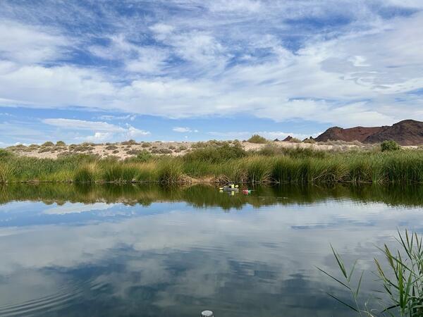
Kayak Streamflow Measurement on Las Vegas Wash
Photo shows a person in a kayak pulling stream gaging equipment along the Las Vegas Wash at USGS monitoring site 09419749. This streamflow data is very important for managing water resources in Las Vegas Valley.
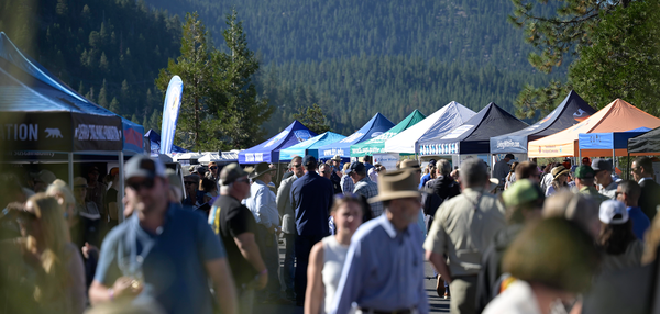
tahoe_wide.png
Scientists from the California and Nevada Water Science Centers attended the 30th annual Lake Tahoe Summit to discuss the work the USGS is doing in the Tahoe Basin. This year’s event was hosted by Nevada senator Jacky Rosen and featured, American rock climber and author, Tommy Caldwell, as keynote speaker.
Scientists from the California and Nevada Water Science Centers attended the 30th annual Lake Tahoe Summit to discuss the work the USGS is doing in the Tahoe Basin. This year’s event was hosted by Nevada senator Jacky Rosen and featured, American rock climber and author, Tommy Caldwell, as keynote speaker.
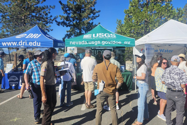
More attendees gather at the USGS booth at the 2026 Tahoe Summit
More attendees gather at the USGS booth at the 2026 Tahoe SummitMore attendees gather at the USGS booth at the 2026 Tahoe Summit. More attendees gather at the USGS booth at the 2026 Tahoe Summit.
More attendees gather at the USGS booth at the 2026 Tahoe Summit
More attendees gather at the USGS booth at the 2026 Tahoe SummitMore attendees gather at the USGS booth at the 2026 Tahoe Summit. More attendees gather at the USGS booth at the 2026 Tahoe Summit.
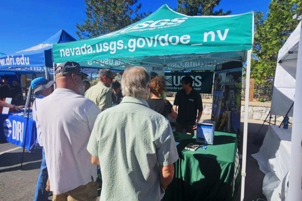
Attendees gather at the USGS booth at the 2026 Tahoe Summit
Attendees gather at the USGS booth at the 2026 Tahoe SummitAttendees gather at the USGS booth at the 2026 Tahoe Summit. Attendees gather at the USGS booth at the 2026 Tahoe Summit.
Attendees gather at the USGS booth at the 2026 Tahoe Summit
Attendees gather at the USGS booth at the 2026 Tahoe SummitAttendees gather at the USGS booth at the 2026 Tahoe Summit. Attendees gather at the USGS booth at the 2026 Tahoe Summit.
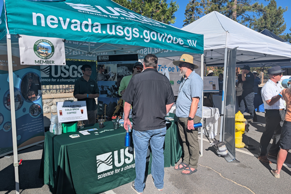
Even more attendees gather at the USGS booth at the 2026 Tahoe Summit
Even more attendees gather at the USGS booth at the 2026 Tahoe SummitEven more attendees gather at the USGS booth at the 2026 Tahoe Summit. Even more attendees gather at the USGS booth at the 2026 Tahoe Summit.
Even more attendees gather at the USGS booth at the 2026 Tahoe Summit
Even more attendees gather at the USGS booth at the 2026 Tahoe SummitEven more attendees gather at the USGS booth at the 2026 Tahoe Summit. Even more attendees gather at the USGS booth at the 2026 Tahoe Summit.
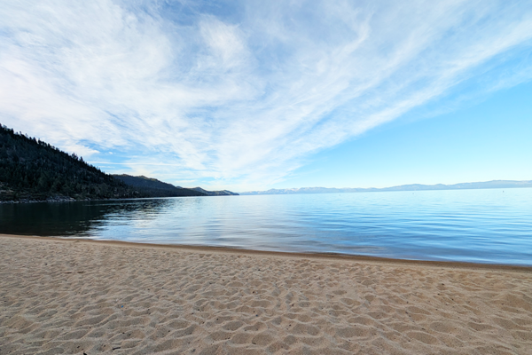
Lake Tahoe, CA in August 2026
Lake Tahoe, CA in August 2026. Lake Tahoe, CA in August 2026.
Lake Tahoe, CA in August 2026. Lake Tahoe, CA in August 2026.
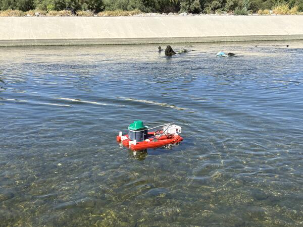
Remote Controlled ADCP in Las Vegas Wasteway
Photo shows a remote‑controlled ADCP boat deployed in the Las Vegas Wasteway near east Las Vegas, Nevada, at USGS monitoring site USGS‑09419679. The instrument measures stream velocities.
Photo shows a remote‑controlled ADCP boat deployed in the Las Vegas Wasteway near east Las Vegas, Nevada, at USGS monitoring site USGS‑09419679. The instrument measures stream velocities.
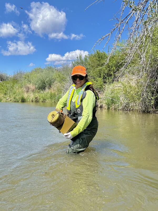
Photograph of Venus Cruz
USGS Hydrologist Venus Cruz collecting a passive pesticides sampler at USGS monitoring location10300000, West Walker River Near Hudson, NV.
USGS Hydrologist Venus Cruz collecting a passive pesticides sampler at USGS monitoring location10300000, West Walker River Near Hudson, NV.
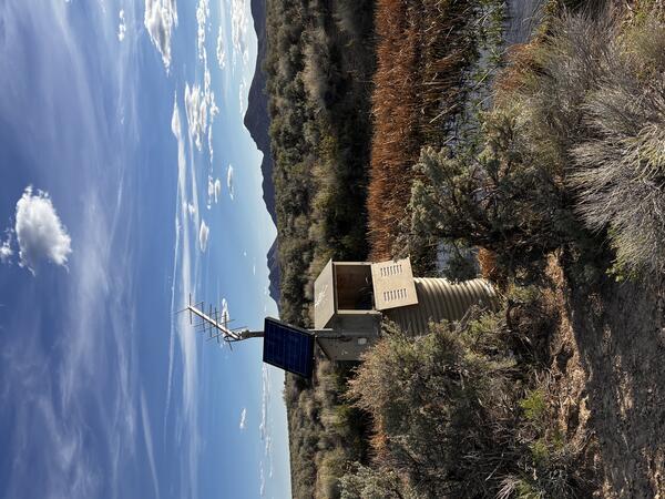
Continuous springflow monitoring at Preston Big Spring
Continuous springflow monitoring at Preston Big SpringPhoto shows USGS solar‑powered monitoring station 09415510 used to measure springflow at Preston Big Spring.
Continuous springflow monitoring at Preston Big Spring
Continuous springflow monitoring at Preston Big SpringPhoto shows USGS solar‑powered monitoring station 09415510 used to measure springflow at Preston Big Spring.
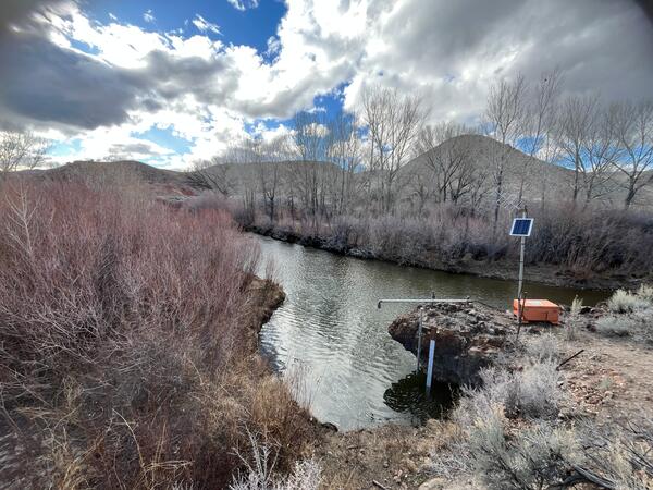
East Walker River streamgaging
Photo shows new streamflow monitoring equipment installed to measure flow at a specific point on the East Walker River.
Photo shows new streamflow monitoring equipment installed to measure flow at a specific point on the East Walker River.
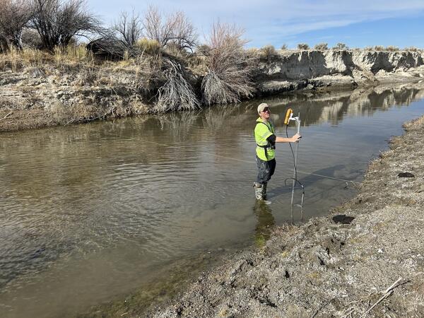
East Walker River streamgaging
Photo shows new streamgaging on the Humboldt River near Rose Creek, Nevada.
Photo shows new streamgaging on the Humboldt River near Rose Creek, Nevada.
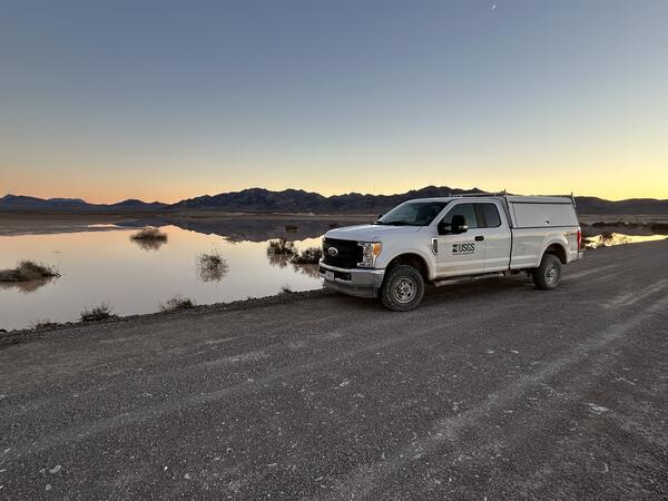
Amargosa Flat playa north of Ash Meadows at dusk
Photograph of Amargosa Flat playa north of Ash Meadows at dusk. For more information, visit the Amargosa Integrated Monitoring Network.
Photograph of Amargosa Flat playa north of Ash Meadows at dusk. For more information, visit the Amargosa Integrated Monitoring Network.
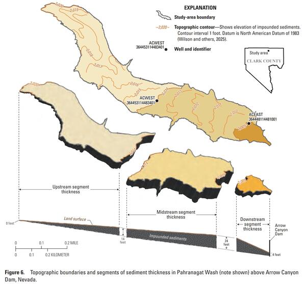
Sediment thickness figure from SIR 2025-5106
Figure from SIR 2025-5106 showing sediment thickness in Pahranagat Wash behind Arrow Canyon dam.
Figure from SIR 2025-5106 showing sediment thickness in Pahranagat Wash behind Arrow Canyon dam.
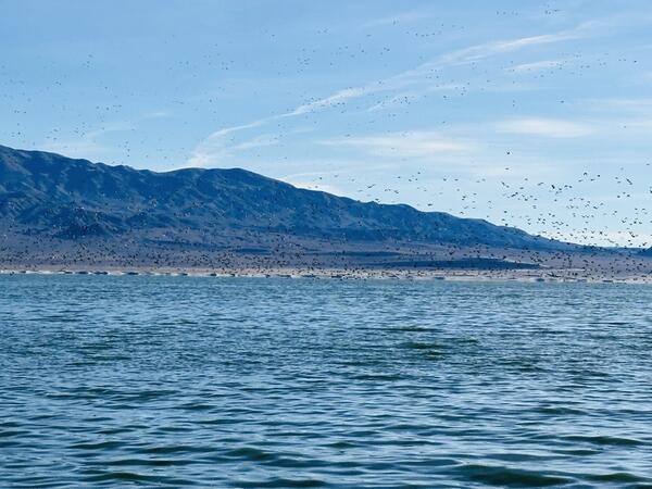
Walker Lake migratory birds
Photo of Walker Lake with migratory birds. USGS data on Walker Lake available on Walker Basin Hydro Mapper.
Photo of Walker Lake with migratory birds. USGS data on Walker Lake available on Walker Basin Hydro Mapper.
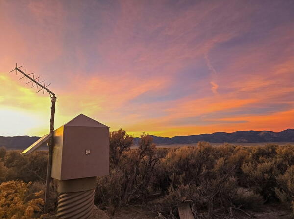
Monitoring Location 393310114475001
- Photograph of the USGS groundwater monitoring location 393310114475001 in White Pine County, Nevada.
- Photograph of the USGS groundwater monitoring location 393310114475001 in White Pine County, Nevada.
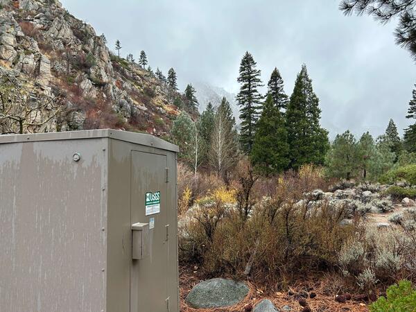
Monitoring Location 10310000: West Fork Carson River at Woodfords
Monitoring Location 10310000: West Fork Carson River at WoodfordsPhotograph of the monitoring location 10310000 on the West Fork Carson River at Woodfords.
Monitoring Location 10310000: West Fork Carson River at Woodfords
Monitoring Location 10310000: West Fork Carson River at WoodfordsPhotograph of the monitoring location 10310000 on the West Fork Carson River at Woodfords.
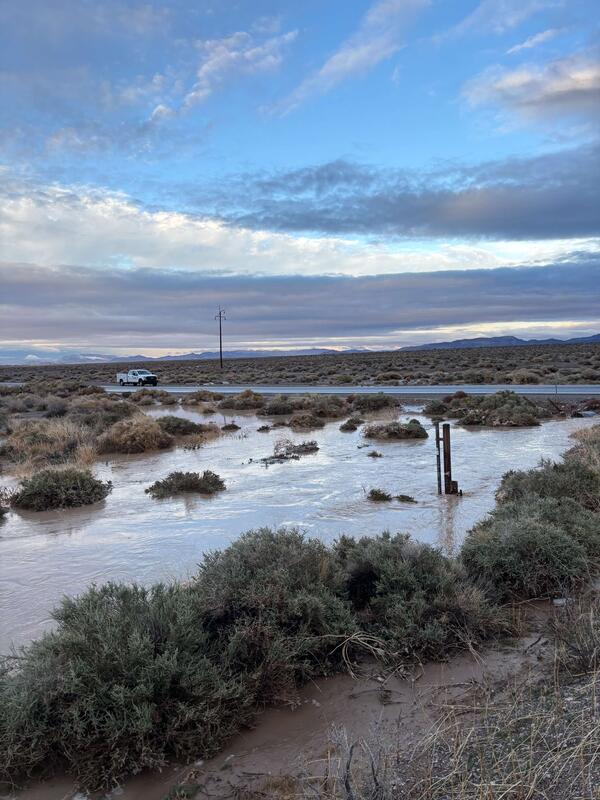
Monitoring Location 10251259: Amargosa River at HWY 127 Near CA-NV State Line
Monitoring Location 10251259: Amargosa River at HWY 127 Near CA-NV State LinePhotograph of the monitoring location 10251259 on the Amargosa River at HWY 127 Near CA-NV State Line.
Monitoring Location 10251259: Amargosa River at HWY 127 Near CA-NV State Line
Monitoring Location 10251259: Amargosa River at HWY 127 Near CA-NV State LinePhotograph of the monitoring location 10251259 on the Amargosa River at HWY 127 Near CA-NV State Line.
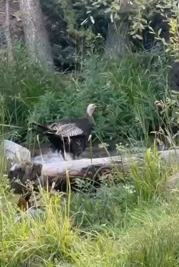
Wild Turkey Near Lehman Creek Near Baker, NV Monitoring Location 10251259
Wild Turkey Near Lehman Creek Near Baker, NV Monitoring Location 10251259Photograph of a turkey crossing Lehman Creek near the monitoring location 10243260.
Wild Turkey Near Lehman Creek Near Baker, NV Monitoring Location 10251259
Wild Turkey Near Lehman Creek Near Baker, NV Monitoring Location 10251259Photograph of a turkey crossing Lehman Creek near the monitoring location 10243260.
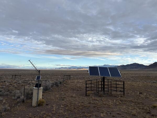
1000-Foot-Deep Well Monitoring Location 374215114453101
1000-Foot-Deep Well Monitoring Location 374215114453101Photograph of the USGS deep well monitoring location 374215114453101 and solar panel equipment.
1000-Foot-Deep Well Monitoring Location 374215114453101
1000-Foot-Deep Well Monitoring Location 374215114453101Photograph of the USGS deep well monitoring location 374215114453101 and solar panel equipment.
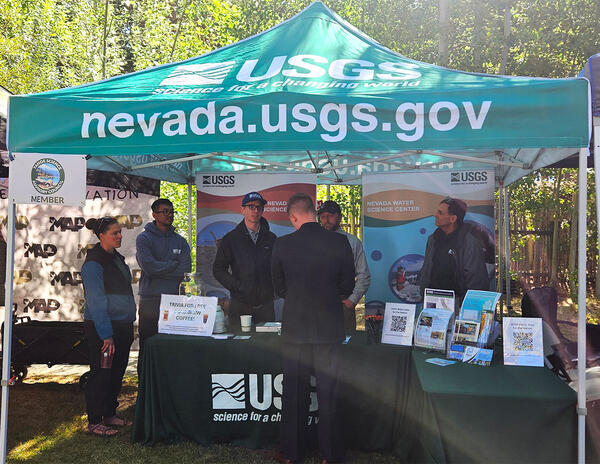
USGS booth at 2025 Tahoe Summit.
USGS booth at 2025 Tahoe Summit. Pictured from left, Sara Doyle (NV WSC), Zach Hood (NV WSC), David Smith (NV WSC), Ed Parvin (CAWSC) and Mark Dickman (CAWSC). Photograph by Ramon Naranjo (NV WSC) on 8/6/25.
USGS booth at 2025 Tahoe Summit. Pictured from left, Sara Doyle (NV WSC), Zach Hood (NV WSC), David Smith (NV WSC), Ed Parvin (CAWSC) and Mark Dickman (CAWSC). Photograph by Ramon Naranjo (NV WSC) on 8/6/25.
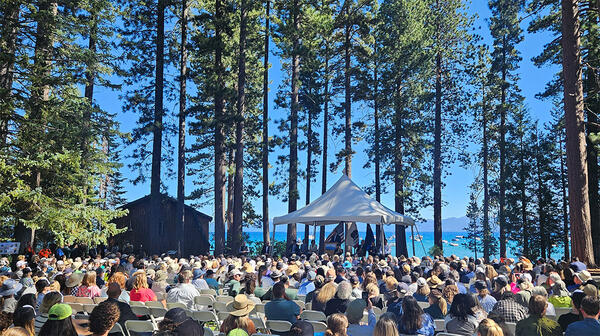
Crowd gathered at 2025 Tahoe Summit
Crown gathered at 2025 Tahoe Summit. The Lake Tahoe Summit is an annual event that brings local, federal, and state leaders together to discuss ways to protect Lake Tahoe and strengthen the partnership underlying the Lake Tahoe Environmental Improvement Program.
Crown gathered at 2025 Tahoe Summit. The Lake Tahoe Summit is an annual event that brings local, federal, and state leaders together to discuss ways to protect Lake Tahoe and strengthen the partnership underlying the Lake Tahoe Environmental Improvement Program.