
USGS Booth at 2023 Tahoe Summit - Wednesday, August 9th, 2023, with host Sen. Alex Padilla
Images
Images intro.
Filter Total Items: 75

USGS Booth at 2023 Tahoe Summit
USGS Booth at 2023 Tahoe Summit - Wednesday, August 9th, 2023, with host Sen. Alex Padilla

Cover - 2023 Lake Tahoe Summit Info Sheet
Cover - 2023 Lake Tahoe Summit Info Sheet. Title: 2023 Lake Tahoe Water Monitoring and Research Activities
Cover - 2023 Lake Tahoe Summit Info Sheet. Title: 2023 Lake Tahoe Water Monitoring and Research Activities

Walking the shallows of Lake Abert, Oregon
Lake Abert, Oregon is one of the 20 terminal lakes identified by USGS partners as priority ecosystems for study by the Saline Lakes Ecosystems IWAA.
By
Ecosystems Mission Area, Water Resources Mission Area, Species Management Research Program, Water Availability and Use Science Program, Forest and Rangeland Ecosystem Science Center, Fort Collins Science Center, Nevada Water Science Center, Oregon Water Science Center, Utah Water Science Center, Western Ecological Research Center (WERC), Saline Lake Ecosystems Integrated Water Availability Assessment

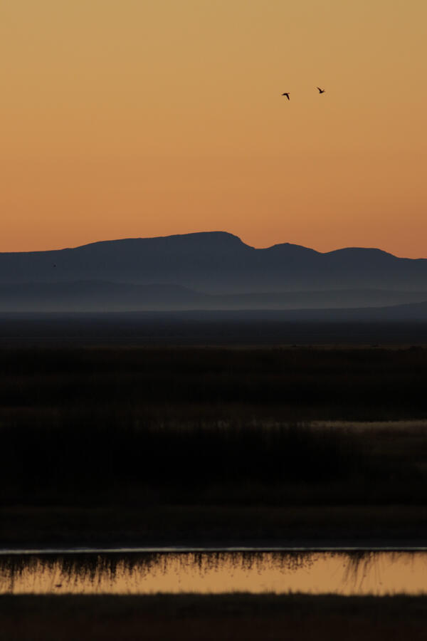
Avocets flying above Farmington Bay Wildlife Management Area, Utah
Avocets flying above Farmington Bay Wildlife Management Area, UtahThe Saline Lake Ecosystems IWAA Waterbird Movement Project began tagging American Avocets in March 2023 to track their movements across the landscape. Tracking data from these birds will help scientists better understand why these birds choose to use the terminal lake and wetland habitats they do in the Great Basin.
By
Ecosystems Mission Area, Water Resources Mission Area, Species Management Research Program, Water Resources Research Act Program, Forest and Rangeland Ecosystem Science Center, Fort Collins Science Center, Nevada Water Science Center, Oregon Water Science Center, Utah Water Science Center, Western Ecological Research Center (WERC), Saline Lake Ecosystems Integrated Water Availability Assessment
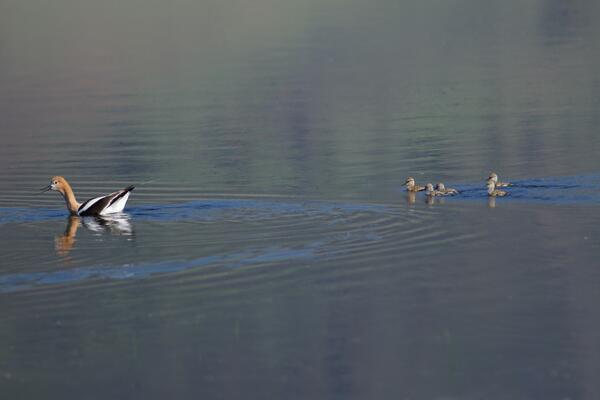
American Avocet trailed by chicks
American Avocet are a bird that relies heavily on the Saline Lakes ecosystem during their spring migration periods. Over 50% of these birds exist here. Part of their use includes using the terminal lakes there to breed.
By
Ecosystems Mission Area, Water Resources Mission Area, Species Management Research Program, Forest and Rangeland Ecosystem Science Center, Fort Collins Science Center, Nevada Water Science Center, Oregon Water Science Center, Utah Water Science Center, Western Ecological Research Center (WERC), Saline Lake Ecosystems Integrated Water Availability Assessment
Summer Lake Wildlife Area
Photograph of Summer Lake Wildlife Area, an important stopping spot for migratory birds on their spring and fall migration flights.
By
Ecosystems Mission Area, Water Resources Mission Area, Species Management Research Program, Forest and Rangeland Ecosystem Science Center, Fort Collins Science Center, Nevada Water Science Center, Utah Water Science Center, Western Ecological Research Center (WERC), Saline Lake Ecosystems Integrated Water Availability Assessment

Mason Valley, Nevada
Agriculture fields in Mason Valley, Nevada. This area was studied for a Scientific Investigations Report 2022-5123.
Agriculture fields in Mason Valley, Nevada. This area was studied for a Scientific Investigations Report 2022-5123.

Lone goose at sunrise at Summer Lake Wildlife Area
Lone goose at sunrise at Summer Lake Wildlife AreaLooking east on Bullgate Pond at sunrise with lone tule white-fronted goose (Anser albifrons elgasi) in upper right, Summer Lake Wildlife Area, near Summer Lake, Oregon.
By
Ecosystems Mission Area, Water Resources Mission Area, Species Management Research Program, Water Availability and Use Science Program, Forest and Rangeland Ecosystem Science Center, Fort Collins Science Center, Nevada Water Science Center, Oregon Water Science Center, Utah Water Science Center, Western Ecological Research Center (WERC), Saline Lake Ecosystems Integrated Water Availability Assessment
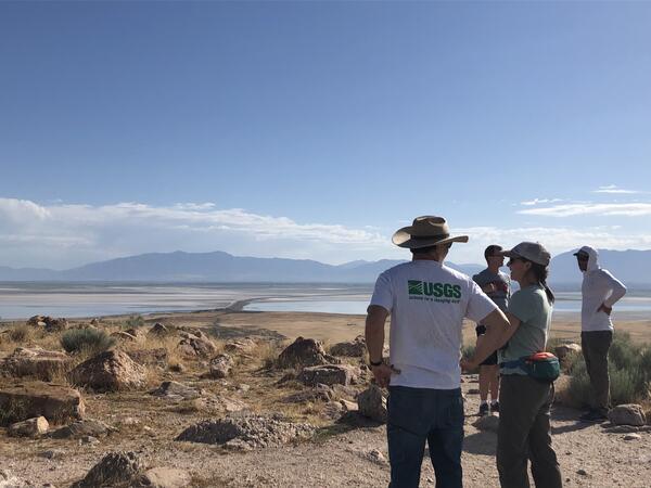
Scientist looking out onto the GSL from Antelope Island
Scientist looking out onto the GSL from Antelope IslandThese scientists are working on The Great Salt Lake to determine the amount of water and qualities of it. This will help them in developing better management techniques that will work to support the migratory birds that frequent the area.
By
Ecosystems Mission Area, Water Resources Mission Area, Species Management Research Program, Forest and Rangeland Ecosystem Science Center, Fort Collins Science Center, Nevada Water Science Center, Oregon Water Science Center, Utah Water Science Center, Western Ecological Research Center (WERC), Saline Lake Ecosystems Integrated Water Availability Assessment
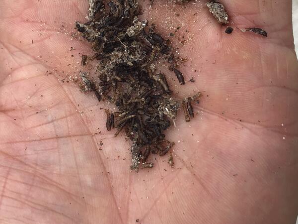
Brine fly pile
These brine flies are an important fuel source for migratory birds, giving them energy for long flights.
By
Ecosystems Mission Area, Water Resources Mission Area, Species Management Research Program, Forest and Rangeland Ecosystem Science Center, Nevada Water Science Center, Oregon Water Science Center, Utah Water Science Center, Western Ecological Research Center (WERC), Saline Lake Ecosystems Integrated Water Availability Assessment

Integrated model boundaries used in Carson Valley groundwater evaluation model.
Integrated model boundaries used in Carson Valley groundwater evaluation model.Integrated model boundaries used in evaluating the effects of groundwater management options on water resources in the Carson Valley, Douglas County, NV.

Lake Tahoe Hydro Mapper
Lake Tahoe is a beautiful Alpine Lake in the Sierra Nevada. Known for its deep, clear water, Lake Tahoe is the second deepest lake in the United States, with a maximum depth of 1,645 feet. The average depth of Lake Tahoe is 1,000 feet.
Lake Tahoe is a beautiful Alpine Lake in the Sierra Nevada. Known for its deep, clear water, Lake Tahoe is the second deepest lake in the United States, with a maximum depth of 1,645 feet. The average depth of Lake Tahoe is 1,000 feet.

Population growth in Douglas County, NV between 1969 and 2020
Population growth in Douglas County, NV between 1969 and 2020Graph showing population growth in Douglas County, NV between 1969 and 2020. Data sourced from Nevada Economic Analysis Project compiled by the Regional Income and Product Divisions of the Bureau of Economic Analysis, U.S. Department of Commerce (11-16-2021).

DH-81 sampler at Trout Creek near Tahoe Valley, CA
DH-81 sampler at Trout Creek near Tahoe Valley, CAPhoto of sample taken using DH-81 sampler at Trout Creek near Tahoe Valley, CA
DH-81 sampler at Trout Creek near Tahoe Valley, CA
DH-81 sampler at Trout Creek near Tahoe Valley, CAPhoto of sample taken using DH-81 sampler at Trout Creek near Tahoe Valley, CA

USGS hydrologist sampling at Trout Creek near Tahoe Valley, CA
USGS hydrologist sampling at Trout Creek near Tahoe Valley, CAPhoto of USGS hydrologist collecting a sediment sample at Trout Creek near Tahoe Valley, CA
USGS hydrologist sampling at Trout Creek near Tahoe Valley, CA
USGS hydrologist sampling at Trout Creek near Tahoe Valley, CAPhoto of USGS hydrologist collecting a sediment sample at Trout Creek near Tahoe Valley, CA

East Fork Carson River below Markleeville Creek near Markleeville, CA
East Fork Carson River below Markleeville Creek near Markleeville, CAWintertime at monitoring location USGS 10308200 East Fork Carson River below Markleeville Creek near Markleeville, CA

Historic pumping over time Carson Valley, NV
The graph shows historic pumping over time in Carson Valley, NV. Between the 1970s and early 2000’s, Carson Valley underwent rapid population growth and total pumping increased by an order of magnitude, from 3,360 acre-feet in 1970 to 31,100 in 2004.
The graph shows historic pumping over time in Carson Valley, NV. Between the 1970s and early 2000’s, Carson Valley underwent rapid population growth and total pumping increased by an order of magnitude, from 3,360 acre-feet in 1970 to 31,100 in 2004.

East Fork Carson River below Markleeville Creek near Markleeville, CA
East Fork Carson River below Markleeville Creek near Markleeville, CAEarly spring at monitoring location USGS 10308200 East Fork Carson River below Markleeville Creek near Markleeville, CA.
East Fork Carson River below Markleeville Creek near Markleeville, CA
East Fork Carson River below Markleeville Creek near Markleeville, CAEarly spring at monitoring location USGS 10308200 East Fork Carson River below Markleeville Creek near Markleeville, CA.
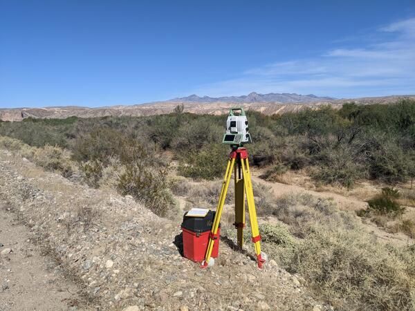
Terrestrial laser scanner survey of floodplain at Stuart Ranch, near Rox, Nevada
Terrestrial laser scanner survey of floodplain at Stuart Ranch, near Rox, NevadaSurveying a floodplain at Stuart Ranch, near Rox, Nevada, with a terrestrial laser scanner. The scanner collects millions of points to build a 3D map of the land surface.

Ruby Lake National Wildlife Reserve
Ruby Lake National Wildlife Refuge lies at the southern end of Ruby Valley in northeast Nevada. For more information visit the Ruby Lake NWR website.
By
Ecosystems Mission Area, Water Resources Mission Area, Land Management Research Program, Water Availability and Use Science Program, Climate Adaptation Science Centers, Forest and Rangeland Ecosystem Science Center, Fort Collins Science Center, Nevada Water Science Center, Oregon Water Science Center, Utah Water Science Center, Western Ecological Research Center (WERC), Saline Lakes Ecosystems Integrated Water Availability Assessment

Water year 2021 streamflow summary for the Upper Truckee River at South Lake Tahoe, USGS Site 10336610.
Water year 2021 streamflow summary for the Upper Truckee River at South Lake Tahoe, USGS Site 10336610.Water year 2020 streamflow summary for the Upper Truckee River at South Lake Tahoe, USGS Site 10336610.