
USGS Hydrologist Venus Cruz collecting a passive pesticides sampler at USGS monitoring location10300000, West Walker River Near Hudson, NV.
Images
Images intro.
Filter Total Items: 81
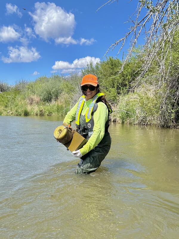
Photograph of Venus Cruz
USGS Hydrologist Venus Cruz collecting a passive pesticides sampler at USGS monitoring location10300000, West Walker River Near Hudson, NV.
East Walker River streamgaging
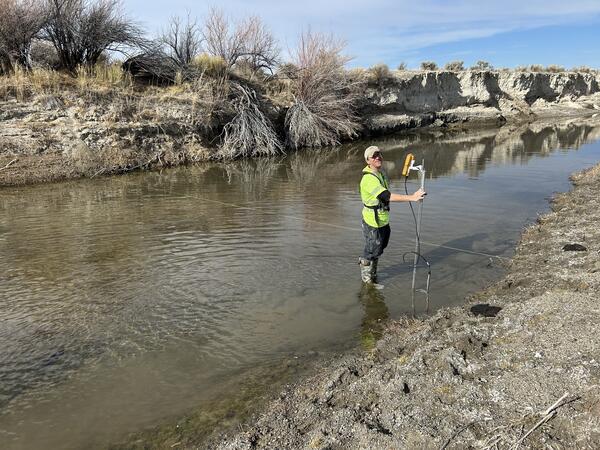
Photo shows new streamflow monitoring equipment installed to measure flow at a specific point on the East Walker River.
Photo shows new streamflow monitoring equipment installed to measure flow at a specific point on the East Walker River.
East Walker River streamgaging
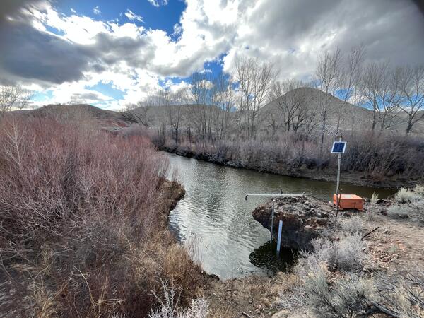
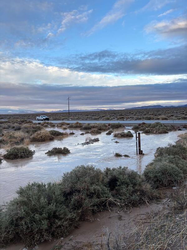
Photo shows new streamgaging on the Humboldt River near Rose Creek, Nevada.
Photo shows new streamgaging on the Humboldt River near Rose Creek, Nevada.
Amargosa Flat playa north of Ash Meadows at dusk
Photograph of Amargosa Flat playa north of Ash Meadows at dusk. For more information, visit the Amargosa Integrated Monitoring Network.
Photograph of Amargosa Flat playa north of Ash Meadows at dusk. For more information, visit the Amargosa Integrated Monitoring Network.
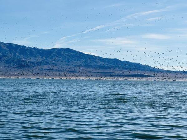
Walker Lake migratory birds
Photo of Walker Lake with migratory birds. USGS data on Walker Lake available on Walker Basin Hydro Mapper.
Photo of Walker Lake with migratory birds. USGS data on Walker Lake available on Walker Basin Hydro Mapper.
Monitoring Location 393310114475001
- Photograph of the USGS groundwater monitoring location 393310114475001 in White Pine County, Nevada.
- Photograph of the USGS groundwater monitoring location 393310114475001 in White Pine County, Nevada.
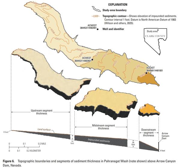
Sediment thickness figure from SIR 2025-5106
Figure from SIR 2025-5106 showing sediment thickness in Pahranagat Wash behind Arrow Canyon dam.
Figure from SIR 2025-5106 showing sediment thickness in Pahranagat Wash behind Arrow Canyon dam.
Monitoring Location 10310000: West Fork Carson River at Woodfords
Monitoring Location 10310000: West Fork Carson River at WoodfordsPhotograph of the monitoring location 10310000 on the West Fork Carson River at Woodfords.
Monitoring Location 10310000: West Fork Carson River at Woodfords
Monitoring Location 10310000: West Fork Carson River at WoodfordsPhotograph of the monitoring location 10310000 on the West Fork Carson River at Woodfords.
Monitoring Location 10251259: Amargosa River at HWY 127 Near CA-NV State Line
Monitoring Location 10251259: Amargosa River at HWY 127 Near CA-NV State LinePhotograph of the monitoring location 10251259 on the Amargosa River at HWY 127 Near CA-NV State Line.
Monitoring Location 10251259: Amargosa River at HWY 127 Near CA-NV State Line
Monitoring Location 10251259: Amargosa River at HWY 127 Near CA-NV State LinePhotograph of the monitoring location 10251259 on the Amargosa River at HWY 127 Near CA-NV State Line.
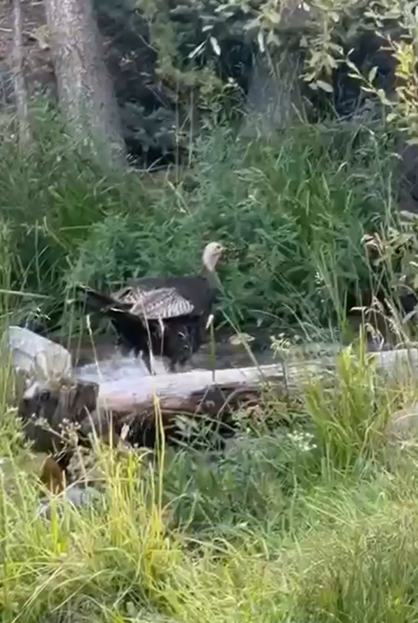
Wild Turkey Near Lehman Creek Near Baker, NV Monitoring Location 10251259
Wild Turkey Near Lehman Creek Near Baker, NV Monitoring Location 10251259Photograph of a turkey crossing Lehman Creek near the monitoring location 10243260.
Wild Turkey Near Lehman Creek Near Baker, NV Monitoring Location 10251259
Wild Turkey Near Lehman Creek Near Baker, NV Monitoring Location 10251259Photograph of a turkey crossing Lehman Creek near the monitoring location 10243260.
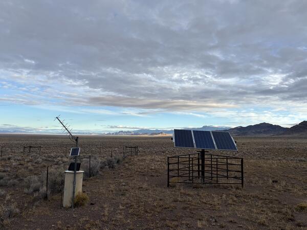
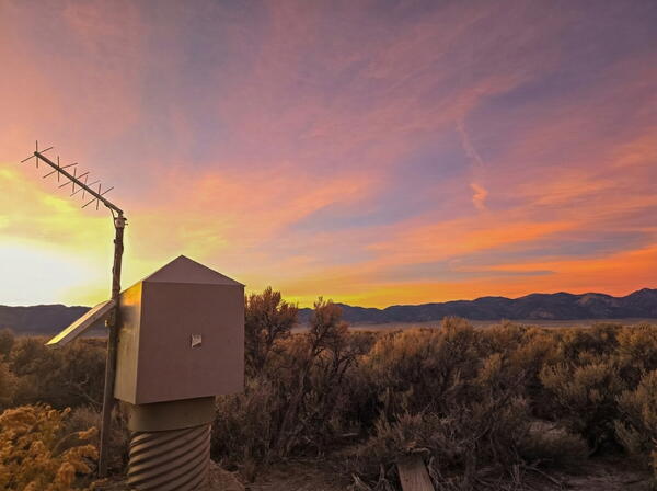
1000-Foot-Deep Well Monitoring Location 374215114453101
1000-Foot-Deep Well Monitoring Location 374215114453101Photograph of the USGS deep well monitoring location 374215114453101 and solar panel equipment.
1000-Foot-Deep Well Monitoring Location 374215114453101
1000-Foot-Deep Well Monitoring Location 374215114453101Photograph of the USGS deep well monitoring location 374215114453101 and solar panel equipment.
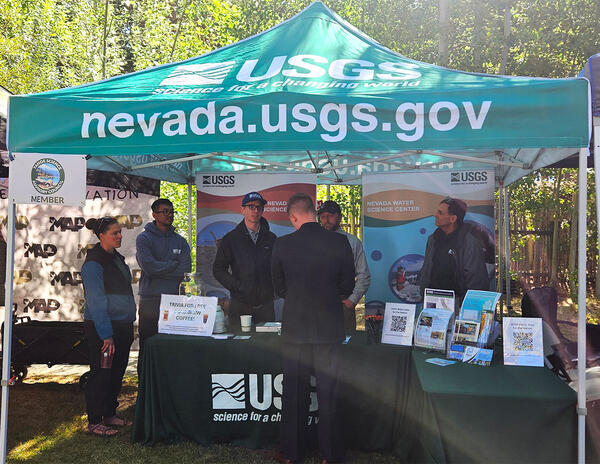
USGS booth at 2025 Tahoe Summit.
USGS booth at 2025 Tahoe Summit. Pictured from left, Sara Doyle (NV WSC), Zach Hood (NV WSC), David Smith (NV WSC), Ed Parvin (CAWSC) and Mark Dickman (CAWSC). Photograph by Ramon Naranjo (NV WSC) on 8/6/25.
USGS booth at 2025 Tahoe Summit. Pictured from left, Sara Doyle (NV WSC), Zach Hood (NV WSC), David Smith (NV WSC), Ed Parvin (CAWSC) and Mark Dickman (CAWSC). Photograph by Ramon Naranjo (NV WSC) on 8/6/25.
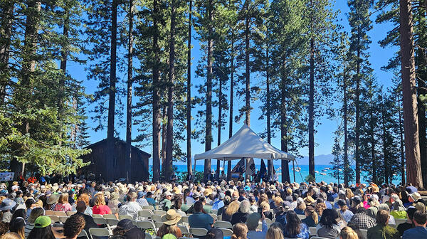
Crowd gathered at 2025 Tahoe Summit
Crown gathered at 2025 Tahoe Summit. The Lake Tahoe Summit is an annual event that brings local, federal, and state leaders together to discuss ways to protect Lake Tahoe and strengthen the partnership underlying the Lake Tahoe Environmental Improvement Program.
Crown gathered at 2025 Tahoe Summit. The Lake Tahoe Summit is an annual event that brings local, federal, and state leaders together to discuss ways to protect Lake Tahoe and strengthen the partnership underlying the Lake Tahoe Environmental Improvement Program.
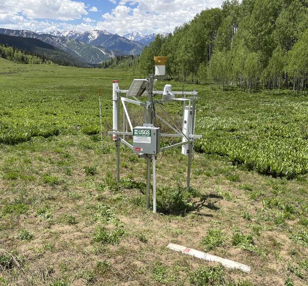
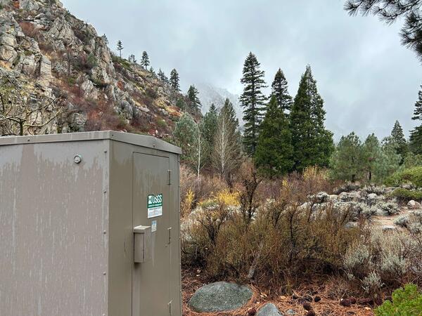
Van Horn CRNS soil moisture monitoring station
This image shows the Van Horn CRNS soil moisture monitoring station in the Roaring Fork Basin, CO (USGS-391336106455801).
This image shows the Van Horn CRNS soil moisture monitoring station in the Roaring Fork Basin, CO (USGS-391336106455801).

ER-8-1 Well
Photograph of electric cable measurement at well ER-8-1 as part of the U.S. Geological Survey-U.S. Department of Energy Cooperative Studies Program.
Photograph of electric cable measurement at well ER-8-1 as part of the U.S. Geological Survey-U.S. Department of Energy Cooperative Studies Program.

Cinnamon teal wearing a tracking backpack
Cinnamon teal with a GPS tracking backpack that weighs 10 grams, making it much more successful in staying on longer than heavier tracking devices.
Cinnamon teal with a GPS tracking backpack that weighs 10 grams, making it much more successful in staying on longer than heavier tracking devices.

2024 Lake Tahoe Summit
Distance shot of crown gathered for the 2024 Lake Tahoe Summit. Lake Tahoe Summit attendees listen to opening remarks from U.S. Senator Catherine Cortez Masto from Nevada.
Distance shot of crown gathered for the 2024 Lake Tahoe Summit. Lake Tahoe Summit attendees listen to opening remarks from U.S. Senator Catherine Cortez Masto from Nevada.
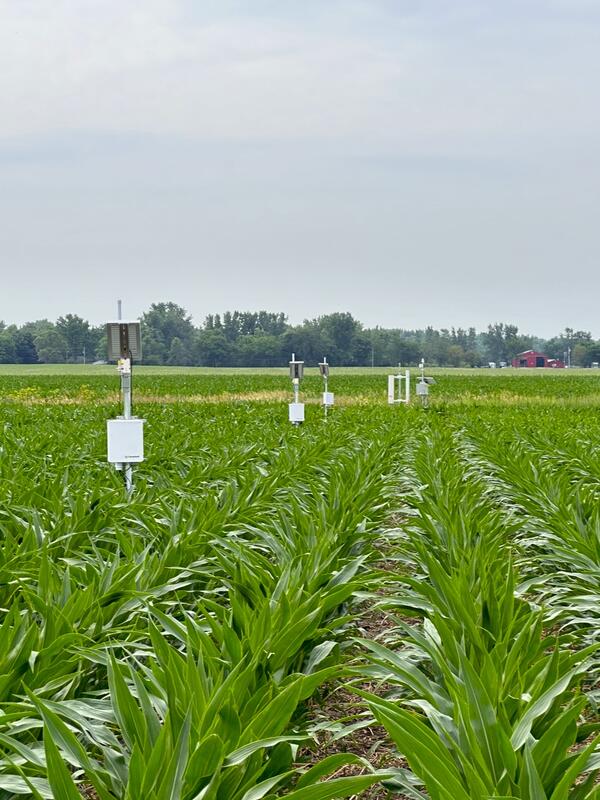
Hanna CRNS soil moisture monitoring station
This image shows the Hanna CRNS soil moisture monitoring station in a corn field in Indiana (USGS-412349086423701). This image is useful to see the station structure and layout of installed sensors.
This image shows the Hanna CRNS soil moisture monitoring station in a corn field in Indiana (USGS-412349086423701). This image is useful to see the station structure and layout of installed sensors.

Shore of Lake Abert, Oregon
Lake Abert, Oregon is one of the 20 terminal lakes identified by USGS partners as priority ecosystems for study by the Saline Lakes Ecosystems IWAA.
By
Ecosystems Mission Area, Water Resources Mission Area, Forest and Rangeland Ecosystem Science Center, Fort Collins Science Center, Nevada Water Science Center, Oregon Water Science Center, Utah Water Science Center, Western Ecological Research Center (WERC), Saline Lake Ecosystems Integrated Water Availability Assessment

Goose Lake, Oregon-California
Goose Lake, on the Oregon-California border, is one of the 20 terminal lakes identified by USGS partners as priority ecosystems for study by the Saline Lakes Ecosystems IWAA.
By
Ecosystems Mission Area, Water Resources Mission Area, Species Management Research Program, Water Resources Research Act Program, Forest and Rangeland Ecosystem Science Center, Fort Collins Science Center, Nevada Water Science Center, Oregon Water Science Center, Utah Water Science Center, Western Ecological Research Center (WERC), Saline Lake Ecosystems Integrated Water Availability Assessment

Carson River Basin Hydro Mapper
The Carson River Basin Hydro Mapper web application provides a modern and easy-to-use interface with the USGS National Water Information System (NWIS). It is also a one-stop location for visually descriptive summaries of USGS, SNOTEL, National Weather Service, Advanced Hydrologic Prediction Service, and other local and regional hydrologic data with access
The Carson River Basin Hydro Mapper web application provides a modern and easy-to-use interface with the USGS National Water Information System (NWIS). It is also a one-stop location for visually descriptive summaries of USGS, SNOTEL, National Weather Service, Advanced Hydrologic Prediction Service, and other local and regional hydrologic data with access