



Developing Riverine and Pluvial Flood Hazard Tools for Planning and Mitigation in Massachusetts
The U.S. Geological Survey (USGS), in cooperation with the Massachusetts Executive Office of Energy and Environmental Affairs (EOEEA), is developing a web-based tool to visualize flood data in Massachusetts. Climate projections, including those derived from the Climate and Hydrologic Risk Project, are being incorporated into new and existing flood models in pilot areas distributed across the Commonwealth.
In Massachusetts, there is a critical need for information on current and future flood hazards from overflowing rivers (riverine) or pooling water on the land from intense rainfall (pluvial). A pluvial flood is a precipitation-driven flood that occurs when the rainfall rate exceeds the rate of both absorption into the ground (infiltration) and conveyance by natural and engineered drainage systems.

Visualizing Flood Data for Planners, Practitioners, and the Public
The objectives of this project are to:
- Provide climate-informed riverine flood hazard data by leveraging existing models
- Provide climate-informed pluvial flood hazard data by developing new models
- Develop a web-based viewer and mapping tool that supports riverine and pluvial flood planning and exposure analysis
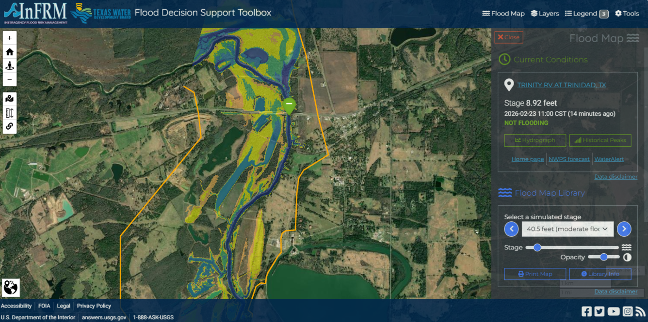
USGS is producing riverine flood-inundation maps for a range of flood flows using 1D HEC-RAS models. Pluvial flooding is being modeled using 2D surface flow models coupled with 1D subsurface models when applicable. The resulting flood maps are visualized using the Flood Decision Support Toolbox (FDST) mapping application developed by the Oklahoma-Texas Water Science Center.

Characterizing Future Climate and Hydrology in Massachusetts using Stochastic Modeling Methods
The U.S. Geological Survey (USGS), in cooperation with the Massachusetts Executive Office of Energy and Environmental Affairs (EOEEA), is developing a web-based tool to visualize flood data in Massachusetts. Climate projections, including those derived from the Climate and Hydrologic Risk Project, are being incorporated into new and existing flood models in pilot areas distributed across the Commonwealth.
In Massachusetts, there is a critical need for information on current and future flood hazards from overflowing rivers (riverine) or pooling water on the land from intense rainfall (pluvial). A pluvial flood is a precipitation-driven flood that occurs when the rainfall rate exceeds the rate of both absorption into the ground (infiltration) and conveyance by natural and engineered drainage systems.
Visualizing Flood Data for Planners, Practitioners, and the Public
The objectives of this project are to:
- Provide climate-informed riverine flood hazard data by leveraging existing models
- Provide climate-informed pluvial flood hazard data by developing new models
- Develop a web-based viewer and mapping tool that supports riverine and pluvial flood planning and exposure analysis
USGS is producing riverine flood-inundation maps for a range of flood flows using 1D HEC-RAS models. Pluvial flooding is being modeled using 2D surface flow models coupled with 1D subsurface models when applicable. The resulting flood maps are visualized using the Flood Decision Support Toolbox (FDST) mapping application developed by the Oklahoma-Texas Water Science Center.