
The peripheral fence of Hanscom Air Force base that is located downstream from the USGS streamgage on Shawsheen River at Hanscom Field in Bedford, Massachusetts.
Gregory J Stewart, P.E.
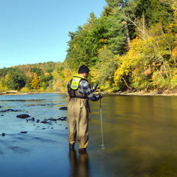
Greg Stewart is a Chief of the Applied Hydrology Branch in the New England Water Science Center.
My work with the USGS started in 1990. During my time with the USGS I held a number of different positions and worked on a variety of projects. I started my career as a student working on any tasks from data entry to field construction. After college graduation I started as an entry level hydraulic engineer position working in the data and studies program. I have worked on many different projects focused on surface water hydrologic, hydraulic, and statistical studies. Starting in 1995 I worked on Flood Insurance Studies, authored many Flood Insurance Studies and several Flood recovery reports. In 2012 I became newly revitalized FEMA program coordinator for New England. As a manager, I became the Maine data section chief in 2002 and added the role of Maine study section chief in 2005. In 2015 to 2021 I had the role as chief, surface water hydrologic instigations section, for New England. 2021 to 2024 I was the chief, hydrologic monitoring branch and in 2024 took the role as chief, applied hydrology branch. I am a licensed professional engineer in the State of Maine.
Science and Products
Filter Total Items: 13
Assessing Sustainable Water Use in Connecticut
The U.S. Geological Survey (USGS) New England Water Science Center, in cooperation with the Connecticut Department of Energy and Environmental Protection (CT DEEP), is updating a planning-level support tool to help decision makers estimate daily mean streamflows and selected streamflow statistics to assess sustainable water use across the state of Connecticut.

Applied Hydrology Branch
The Applied Hydrology Branch provides hydrologic data, research, and tools to water resource managers, stakeholders and policy makers that inform critical water management decisions throughout New England. This branch is divided into the Hydrology and Hydraulics Section, Water Quality Networks Section, Connecticut Water Quality Monitoring Section, and Massachusetts/Rhode Island Water Quality...

December 2023 Flood in Maine
The U.S. Geological Survey (USGS) New England Water Science Center, in cooperation with the Federal Emergency Management Agency (FEMA), is conducting a study to characterize the magnitude and extent of the December 18-21, 2023 Flood in various portions of the State of Maine.

July 2023 Flood in Vermont
From July 9 through July 12, 2023, 3 to 9 inches of rain fell within 48 hours across the state of Vermont, causing catastrophic flooding and millions of dollars in damage. The high amount of rain caused several rivers to peak at record levels, in some cases exceeding records set during Tropical Storm Irene in 2011.

USGS Assessment of Water Resources near Hanscom Air Force Base
The United States Geological Survey (USGS) New England Water Science Center is expanding its scientific investigation to better understand the water resources at, and in the vicinity of, Hanscom Air Force Base (AFB) and the potential impacts from historical base operations and other sources.

Characterizing Future Climate and Hydrology in Massachusetts using Stochastic Modeling Methods
Communities across Massachusetts may face potential consequences of climate change, ranging from more extreme rainfall to more pronounced and frequent droughts. Climate change could alter the state’s hydrology in potentially complex and unanticipated ways. Typical approaches for projecting hydrologic risk under climate change can misrepresent and underestimate the variability of climate and...

Remembering Tropical Storm Irene in New England
On August 28, 2011 Tropical Storm Irene made landfall in New England, leading to coastal storm surge, significant riverine flooding, sediment transport to Long Island Sound, and major infrastructure damage and destruction. Ten years later, the USGS New England Water Science Center looks back at Irene, the data collected by our Center during the event, the response by our employees before, during...

New England Flood Information
The USGS delivers continuous streamflow, stage (water-level), and tide data to help emergency managers and other decision makers protect life and property caused by floods and other water-related hazards.

Development of Flood Insurance Maps in New England
FEMA has requested USGS expertise in hydraulics, hydrology, and mapping to generate flood insurance maps for New England.

Development of Streamflow Record Extension Equations in New Hampshire
Currently, there are 16 designated rivers in New Hampshire in need of daily mean streamflow estimates for managing instream flows. Many of New Hampshire’s Designated Rivers have current and/or historical streamflow data that may be used to extend an existing streamgages streamflow record in time through record extension techniques. Evaluating the feasibility of record extension techniques to...

Flow Modeling at Dam Removal Sites Associated with Hurricane Sandy Resiliency Efforts
The purpose of this work is to better understand the effects of dam removal on local hydraulics, fish passage, and flooding. This study is part of a larger effort to monitor ecological resilience changes at nine Hurricane Sandy coastal resiliency aquatic connectivity restoration projects. It will contribute crucial knowledge that will be used to improve aquatic connectivity system cost...

Development of Regional Regression Equations to Estimate the Magnitude of Peak Flows for Selected Annual-Exceedance Probabilities in Maine
The flood-frequency characteristics for streamgages and regression equations for estimating flood magnitudes have been published.

Hanscom Air Force Base
The peripheral fence of Hanscom Air Force base that is located downstream from the USGS streamgage on Shawsheen River at Hanscom Field in Bedford, Massachusetts.

Groundwater Well at Hanscom Air Force Base
A groundwater well in a grassy field near Hanscom Air Force Base in Bedford, Massachusetts.
A groundwater well in a grassy field near Hanscom Air Force Base in Bedford, Massachusetts.

Scenic photo of the North River in Shattuckville, Massachusetts
Scenic photo of the North River in Shattuckville, MassachusettsScenic photo of the North River in Shattuckville, Massachusetts taken during a cloudy day.
Scenic photo of the North River in Shattuckville, Massachusetts
Scenic photo of the North River in Shattuckville, MassachusettsScenic photo of the North River in Shattuckville, Massachusetts taken during a cloudy day.
Science and Products
Filter Total Items: 13
Assessing Sustainable Water Use in Connecticut
The U.S. Geological Survey (USGS) New England Water Science Center, in cooperation with the Connecticut Department of Energy and Environmental Protection (CT DEEP), is updating a planning-level support tool to help decision makers estimate daily mean streamflows and selected streamflow statistics to assess sustainable water use across the state of Connecticut.
Applied Hydrology Branch
The Applied Hydrology Branch provides hydrologic data, research, and tools to water resource managers, stakeholders and policy makers that inform critical water management decisions throughout New England. This branch is divided into the Hydrology and Hydraulics Section, Water Quality Networks Section, Connecticut Water Quality Monitoring Section, and Massachusetts/Rhode Island Water Quality...
December 2023 Flood in Maine
The U.S. Geological Survey (USGS) New England Water Science Center, in cooperation with the Federal Emergency Management Agency (FEMA), is conducting a study to characterize the magnitude and extent of the December 18-21, 2023 Flood in various portions of the State of Maine.
July 2023 Flood in Vermont
From July 9 through July 12, 2023, 3 to 9 inches of rain fell within 48 hours across the state of Vermont, causing catastrophic flooding and millions of dollars in damage. The high amount of rain caused several rivers to peak at record levels, in some cases exceeding records set during Tropical Storm Irene in 2011.
USGS Assessment of Water Resources near Hanscom Air Force Base
The United States Geological Survey (USGS) New England Water Science Center is expanding its scientific investigation to better understand the water resources at, and in the vicinity of, Hanscom Air Force Base (AFB) and the potential impacts from historical base operations and other sources.
Characterizing Future Climate and Hydrology in Massachusetts using Stochastic Modeling Methods
Communities across Massachusetts may face potential consequences of climate change, ranging from more extreme rainfall to more pronounced and frequent droughts. Climate change could alter the state’s hydrology in potentially complex and unanticipated ways. Typical approaches for projecting hydrologic risk under climate change can misrepresent and underestimate the variability of climate and...
Remembering Tropical Storm Irene in New England
On August 28, 2011 Tropical Storm Irene made landfall in New England, leading to coastal storm surge, significant riverine flooding, sediment transport to Long Island Sound, and major infrastructure damage and destruction. Ten years later, the USGS New England Water Science Center looks back at Irene, the data collected by our Center during the event, the response by our employees before, during...
New England Flood Information
The USGS delivers continuous streamflow, stage (water-level), and tide data to help emergency managers and other decision makers protect life and property caused by floods and other water-related hazards.
Development of Flood Insurance Maps in New England
FEMA has requested USGS expertise in hydraulics, hydrology, and mapping to generate flood insurance maps for New England.
Development of Streamflow Record Extension Equations in New Hampshire
Currently, there are 16 designated rivers in New Hampshire in need of daily mean streamflow estimates for managing instream flows. Many of New Hampshire’s Designated Rivers have current and/or historical streamflow data that may be used to extend an existing streamgages streamflow record in time through record extension techniques. Evaluating the feasibility of record extension techniques to...
Flow Modeling at Dam Removal Sites Associated with Hurricane Sandy Resiliency Efforts
The purpose of this work is to better understand the effects of dam removal on local hydraulics, fish passage, and flooding. This study is part of a larger effort to monitor ecological resilience changes at nine Hurricane Sandy coastal resiliency aquatic connectivity restoration projects. It will contribute crucial knowledge that will be used to improve aquatic connectivity system cost...
Development of Regional Regression Equations to Estimate the Magnitude of Peak Flows for Selected Annual-Exceedance Probabilities in Maine
The flood-frequency characteristics for streamgages and regression equations for estimating flood magnitudes have been published.
Hanscom Air Force Base
The peripheral fence of Hanscom Air Force base that is located downstream from the USGS streamgage on Shawsheen River at Hanscom Field in Bedford, Massachusetts.
The peripheral fence of Hanscom Air Force base that is located downstream from the USGS streamgage on Shawsheen River at Hanscom Field in Bedford, Massachusetts.
Groundwater Well at Hanscom Air Force Base
A groundwater well in a grassy field near Hanscom Air Force Base in Bedford, Massachusetts.
A groundwater well in a grassy field near Hanscom Air Force Base in Bedford, Massachusetts.
Scenic photo of the North River in Shattuckville, Massachusetts
Scenic photo of the North River in Shattuckville, MassachusettsScenic photo of the North River in Shattuckville, Massachusetts taken during a cloudy day.
Scenic photo of the North River in Shattuckville, Massachusetts
Scenic photo of the North River in Shattuckville, MassachusettsScenic photo of the North River in Shattuckville, Massachusetts taken during a cloudy day.