
Andrew Collins
Andrew Collins is a Physical Scientist in the New England Water Science Center.
Andrew uses numerical models, remote sensing, and geophysical data to support a wide variety of water resource investigations. He is particularly interested in using modeling to understand how anthropogenic constituents like per- and polyfluoroalkyl substances (PFAS) travel through the hydrologic system and impact water quality. His experience with environmental assessments and contaminant hydrology studies as an environmental consultant informs his current work. Other recent projects include inland flood modeling, hydrographic mapping automation, and integrating geophysical analyses with hydrologic studies.
Andrew is also a member of the USGS Geographic Information Response Team, which disseminates geospatial data and information during disaster events.
Before coming to the New England Water Science Center, Andrew worked as a geologist in the Geologic Hazards Science Center.
Science and Products
Collaborations with EPA on Contaminated Site Hydrology

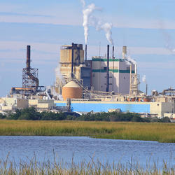
Augmented Site Characterization of PFAS Manufacturing and Processing Facilities

Communication of Complex Contaminant Transport Processes in Groundwater

Detailed Characterization of the Savage Superfund Site, New Hampshire

The Aqueous Flow Concentration Estimator (AFCE): Software for Estimation of Ambient Groundwater Flow in Bedrock Open Boreholes

Geochemical Fingerprinting of Anthropogenic and Geologically Sourced Uranium at the Homestake Superfund Site, New Mexico

The Purge Analyzer Tool (PAT) to Assess Optimal Pumping Parameters in the Collection of Representative Groundwater Samples from Wells
Science and Products
Collaborations with EPA on Contaminated Site Hydrology
Augmented Site Characterization of PFAS Manufacturing and Processing Facilities
Communication of Complex Contaminant Transport Processes in Groundwater
Detailed Characterization of the Savage Superfund Site, New Hampshire
The Aqueous Flow Concentration Estimator (AFCE): Software for Estimation of Ambient Groundwater Flow in Bedrock Open Boreholes
Geochemical Fingerprinting of Anthropogenic and Geologically Sourced Uranium at the Homestake Superfund Site, New Mexico
The Purge Analyzer Tool (PAT) to Assess Optimal Pumping Parameters in the Collection of Representative Groundwater Samples from Wells
*Disclaimer: Listing outside positions with professional scientific organizations on this Staff Profile are for informational purposes only and do not constitute an endorsement of those professional scientific organizations or their activities by the USGS, Department of the Interior, or U.S. Government