Bandelier National Monument Postwildfire Flood Support
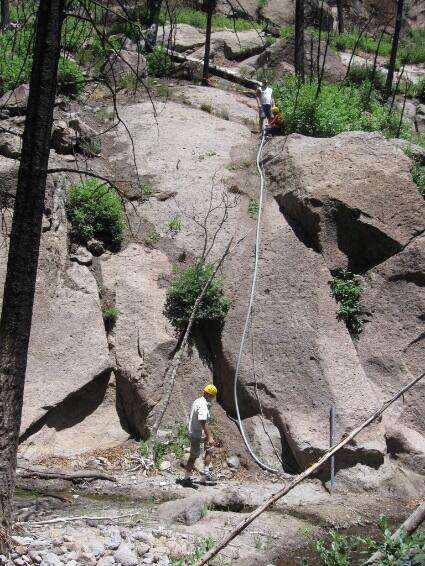
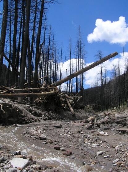
In the summer of 2011, the Las Conchas Fire burned 156,593 acres in the Jemez Mountains in northern NM including the upper watersheds of Frijoles and Capulin Canyons in Bandelier National Monument. The drastic removal of vegetation in the upper watersheds of these popular tourist destinations left them susceptible to dangerous and record breaking floods. As long as the threat of large post-wildfire floods exists, property and infrastructure in, and visitors to, Frijoles Canyon could be at risk of damage, injury, or loss of life from flooding. Park administration requested that the USGS provide information on the streamflow/flood behavior of the Rito de los Frijoles, assistance in implementing a flood warning system, and availability to survey and document future floods.

Approach
- Install, operate, and maintain two real-time precipitation gages upstream from the most used area of the park
- Install, operate, and maintain a real-time stage-only streamgage with back-up float switch 6 miles upstream of the park headquarters
- Provide technical assistance to park administrators for issues related to streamflow and flood risks in the park, and hydrologic analysis of major flood events
Objectives
- Construct and maintain real-time precipitation gages and streamgages as part of an early flood-warning system
- Provide hydrologic expertise to Park decision makers during the crucial year following the fire

Below are partners associated with this project.
In the summer of 2011, the Las Conchas Fire burned 156,593 acres in the Jemez Mountains in northern NM including the upper watersheds of Frijoles and Capulin Canyons in Bandelier National Monument. The drastic removal of vegetation in the upper watersheds of these popular tourist destinations left them susceptible to dangerous and record breaking floods. As long as the threat of large post-wildfire floods exists, property and infrastructure in, and visitors to, Frijoles Canyon could be at risk of damage, injury, or loss of life from flooding. Park administration requested that the USGS provide information on the streamflow/flood behavior of the Rito de los Frijoles, assistance in implementing a flood warning system, and availability to survey and document future floods.

Approach
- Install, operate, and maintain two real-time precipitation gages upstream from the most used area of the park
- Install, operate, and maintain a real-time stage-only streamgage with back-up float switch 6 miles upstream of the park headquarters
- Provide technical assistance to park administrators for issues related to streamflow and flood risks in the park, and hydrologic analysis of major flood events
Objectives
- Construct and maintain real-time precipitation gages and streamgages as part of an early flood-warning system
- Provide hydrologic expertise to Park decision makers during the crucial year following the fire

Below are partners associated with this project.

