
Great Lakes Restoration Initiative (GLRI)
Great Lakes Restoration Initiative (GLRI)
Filter Total Items: 9

Assessing stormwater reduction through green infrastructure: RecoveryPark (Detroit, Mich.)
The effectiveness of green infrastructure (including urban land conversion and bioswales) at reducing stormwater runoff is being assessed at RecoveryPark, a redeveloped urban farm in Detroit, Michigan. This study will monitor pre- and post-construction storm-sewer flow, groundwater levels, precipitation, and potential evapotranspiration (ET) to evaluate stormwater-volume reduction in response to...
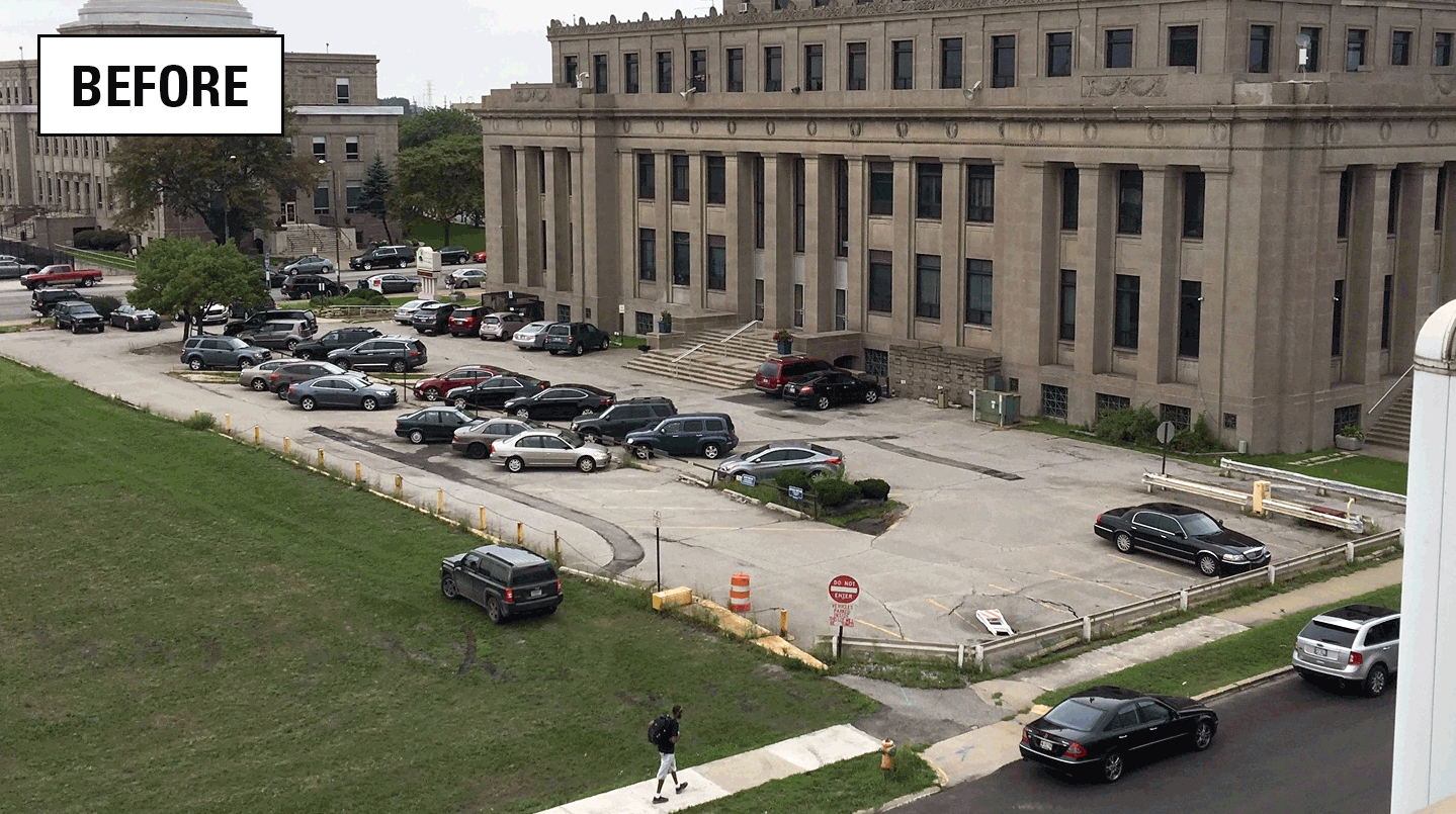
Assessing stormwater reduction using green infrastructure: Gary City Hall (Gary, Ind.)
The effectiveness of green infrastructure (rain gardens and decreased impervious surface) at reducing stormwater runoff and capturing dissolved chloride is being assessed at a redevelopment project at Gary City Hall (Gary, Indiana). This study will evaluate pre- and post-construction hydrologic conditions using data collected by monitoring storm-sewer flow, groundwater levels, soil moisture, and...

Water Quality Monitoring and Algal Community Composition Analysis in Support of Eutrophication Beneficial Use Impairment Evaluation in the Grand Calumet River Area of Concern, Northwest Indiana
In cooperation with the Indiana Department of Environmental Management and the U.S. Environmental Protection Agency

Grand River near Painesville, OH
Water-quality “super” gages (also known as “sentry” gages) provide real-time, continuous measurements of the physical and chemical characteristics of stream water at or near selected U.S. Geological Survey (USGS) streamgages in Ohio, Kentucky, and Indiana. A super gage includes streamflow and water-quality instrumentation and representative stream sample collection for laboratory analysis. USGS...

Huron River near Milan, OH
Water-quality “super” gages (also known as “sentry” gages) provide real-time, continuous measurements of the physical and chemical characteristics of stream water at or near selected U.S. Geological Survey (USGS) streamgages in Ohio, Kentucky, and Indiana. A super gage includes streamflow and water-quality instrumentation and representative stream sample collection for laboratory analysis. USGS...

Indiana Harbor Canal at East Chicago, IN
Water-quality “super” gages (also known as “sentry” gages) provide real-time, continuous measurements of the physical and chemical characteristics of stream water at or near selected U.S. Geological Survey (USGS) streamgages in Ohio, Kentucky, and Indiana. A super gage includes streamflow and water-quality instrumentation and representative stream sample collection for laboratory analysis. USGS...

GLRI Urban Stormwater Monitoring
The GLRI Urban Stormwater Monitoring effort brings together the expertise of the USGS with local and national partners to assess the ability of green infrastructure to reduce stormwater runoff in Great Lakes urban areas.

Edge of Field Monitoring - Black Creek Watershed
Ohio, Kentucky, and Indiana Water Science Center is monitoring the effects of best management practices (BMP's) on baseflow and storm runoff in the Black Creek watershed near Harlan, IN. We will be sampling water-quality intensively for 5 years from overland field, subsurface tile, and in-stream runoff events. Results will be used to model the effectiveness of BMP’s in reducing nutrient and...

Edge Of Field And Priority Watershed (Waterville) Monitoring
The Great Lakes Restoration Initiative (GLRI) is an interagency effort that seeks to accelerate ecosystem restoration in the Great Lakes by confronting threats to the region, such as nonpoint source pollution. Three Priority Watersheds have been targeted (Fox/Green Bay, Saginaw, and Maumee) and are characterized by having a high density of agricultural land use and have ecosystem impairments...