
Alluvial reach identification and hydrogeomorphic characterization of Oregon rivers
The USGS, in partnership with the Environmental Protection Agency (EPA), is developing an objective mapping framework to systematically identify alluvial reaches in 13 river basins across Oregon to support EPA and Oregon’s Department of Environmental Quality (DEQ) in their implementation of the Clean Water Act’s water temperature Total Maximum Daily Loads (TMDLs), as well as to support the Columbia River Basin Initiative and other restoration programs throughout Oregon.
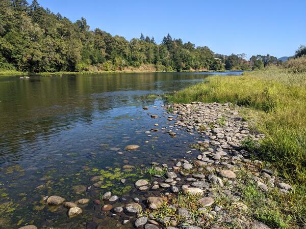
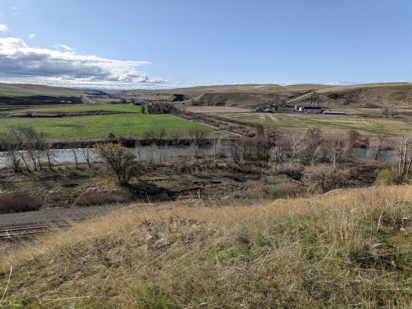
Stream hydrologic connectivity has long been recognized as important for supporting hydrologic function, aquatic resources and habitat, and water quality. Because when streams are connected with the landscape, water naturally moves nutrients, chemicals, sediments, and biota around the environment. Alluvial corridors, composed of unconsolidated sediment as opposed to mixed-bed or bedrock reaches, are typically more likely to support local water exchange through multiple connections within the stream network. For example, hyporheic flow, shallow groundwater exchange through the channel bed and banks, and floodplain connectivity through overbank inundation and recharge. These connections between the stream network and its surroundings affect stream temperature by mixing water sources with varying temperatures. Identifying alluvial reaches and hydrogeomorphic characteristics within river basins will help develop guidelines for appropriate scales of analysis and restoration actions across time and space.
The overarching goal of this study is to develop an objective mapping framework to facilitate efficient and systematic hydrogeomorphic classification of river reaches across Oregon. The mapping framework will be applied to several river basins across Oregon. This mapping framework will ultimately assist EPA and other management agencies as they assess hydrogeomorphic differences along and between river corridors where water temperature Total Maximum Daily Loads (TMDLs) are being updated.
How can this tool be used?
The results of this study will aid the EPA in identifying valley segments and stream reaches that have hydrogeomorphic characteristics useful for informing river studies or restoration projects. In the future, this framework could also be used to target high priority reaches where the EPA might more intensely monitor, evaluate, and model stream and floodplain conditions. The intent of the mapping is to provide high-level hydrogeomorphic characterization that could be used as a screening tool by the EPA or other river managers or restoration practitioners. If alluvial valley segmentation and the overall multi-layered analysis framework is successfully incorporated into the TMDL process in Oregon, similar approaches could be applied in Washington and Idaho where TMDLs are also being updated. In addition to supporting the EPA and DEQ TMDL processes, mapping approaches and results can be used to support the Columbia River Basin Initiative, as well as other restoration programs throughout Oregon.
- Develop a mapping framework that relies on publicly available datasets and is repeatable, consistent, and objective.
- Apply the mapping framework to an initial set of test basins to delineate valley and reach-scale hydrogeomorphic conditions at the basin-scale, then apply to a wider set of basins across Oregon.
River basins in this study:
- Umpqua River (test basin)
- Umatilla River (test basin)
- Rogue River
- John Day River
- Deschutes River
- Lower Grande Ronde River
- Imnaha River
- Wallowa River
- Middle Columbia – Hood River
- Snake River – Hells Canyon
- Malheur River
- Walla Walla River
- Willow Creek
The USGS, in partnership with the Environmental Protection Agency (EPA), is developing an objective mapping framework to systematically identify alluvial reaches in 13 river basins across Oregon to support EPA and Oregon’s Department of Environmental Quality (DEQ) in their implementation of the Clean Water Act’s water temperature Total Maximum Daily Loads (TMDLs), as well as to support the Columbia River Basin Initiative and other restoration programs throughout Oregon.
Stream hydrologic connectivity has long been recognized as important for supporting hydrologic function, aquatic resources and habitat, and water quality. Because when streams are connected with the landscape, water naturally moves nutrients, chemicals, sediments, and biota around the environment. Alluvial corridors, composed of unconsolidated sediment as opposed to mixed-bed or bedrock reaches, are typically more likely to support local water exchange through multiple connections within the stream network. For example, hyporheic flow, shallow groundwater exchange through the channel bed and banks, and floodplain connectivity through overbank inundation and recharge. These connections between the stream network and its surroundings affect stream temperature by mixing water sources with varying temperatures. Identifying alluvial reaches and hydrogeomorphic characteristics within river basins will help develop guidelines for appropriate scales of analysis and restoration actions across time and space.
The overarching goal of this study is to develop an objective mapping framework to facilitate efficient and systematic hydrogeomorphic classification of river reaches across Oregon. The mapping framework will be applied to several river basins across Oregon. This mapping framework will ultimately assist EPA and other management agencies as they assess hydrogeomorphic differences along and between river corridors where water temperature Total Maximum Daily Loads (TMDLs) are being updated.
How can this tool be used?
The results of this study will aid the EPA in identifying valley segments and stream reaches that have hydrogeomorphic characteristics useful for informing river studies or restoration projects. In the future, this framework could also be used to target high priority reaches where the EPA might more intensely monitor, evaluate, and model stream and floodplain conditions. The intent of the mapping is to provide high-level hydrogeomorphic characterization that could be used as a screening tool by the EPA or other river managers or restoration practitioners. If alluvial valley segmentation and the overall multi-layered analysis framework is successfully incorporated into the TMDL process in Oregon, similar approaches could be applied in Washington and Idaho where TMDLs are also being updated. In addition to supporting the EPA and DEQ TMDL processes, mapping approaches and results can be used to support the Columbia River Basin Initiative, as well as other restoration programs throughout Oregon.
- Develop a mapping framework that relies on publicly available datasets and is repeatable, consistent, and objective.
- Apply the mapping framework to an initial set of test basins to delineate valley and reach-scale hydrogeomorphic conditions at the basin-scale, then apply to a wider set of basins across Oregon.
River basins in this study:
- Umpqua River (test basin)
- Umatilla River (test basin)
- Rogue River
- John Day River
- Deschutes River
- Lower Grande Ronde River
- Imnaha River
- Wallowa River
- Middle Columbia – Hood River
- Snake River – Hells Canyon
- Malheur River
- Walla Walla River
- Willow Creek