
Using Video Imagery to Study Coastal Change: Whidbey Island
From May of 2018 through November of 2019, USGS scientists collected imagery from video cameras overlooking the coast along a beach on Whidbey Island, Island County at the northern boundary of Puget Sound in western Washington.

The study area has some of the highest rates of coastal bluff retreat in Puget Sound. In fact, towards the end of 2019, the cliff area where the cameras were installed showed signs of failure, so the cameras were removed.
An interagency team led by the USGS is researching how extreme-storm water levels and waves affect bluff erosion and the movement of sediment along beaches. The video-based remote-sensing tools measured storm water levels, waves, currents, and beach, and bluff changes to property, infrastructure, and habitats. The data enabled scientists to examine sediment transport that affects habitats for valued juvenile salmon, forage fish, and shellfish. In particular, the research is evaluating the extent that waves and sediment modify habitat complexity and its role in wave runup as well as shellfish biomass and diversity. Ultimately, the research will help guide and improve numerical model predictions of coastal and habitat change associated with sea-level rise, storms, and waves to inform resilience planning.
USGS projects that will benefit from this study include:
- Puget Sound Coastal Storm Modeling System (PS-CoSMoS)
- Estuaries and large river deltas in the Pacific Northwest
- Coastal Habitats in Puget Sound
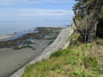
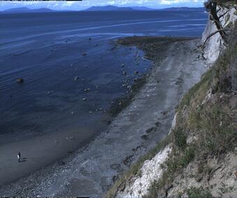
Every half hour during daylight hours, from May of 2018 through November of 2019, video cameras installed on the high coastal bluff collected snapshots and video for 10 minutes. Some examples of the imagery are shown here.


Below are the projects that use the data collected by the video cameras.

Remote Sensing Coastal Change

Coastal Habitats in Puget Sound

PS-CoSMoS: Puget Sound Coastal Storm Modeling System

Estuaries and large river deltas in the Pacific Northwest
From May of 2018 through November of 2019, USGS scientists collected imagery from video cameras overlooking the coast along a beach on Whidbey Island, Island County at the northern boundary of Puget Sound in western Washington.
The study area has some of the highest rates of coastal bluff retreat in Puget Sound. In fact, towards the end of 2019, the cliff area where the cameras were installed showed signs of failure, so the cameras were removed.
An interagency team led by the USGS is researching how extreme-storm water levels and waves affect bluff erosion and the movement of sediment along beaches. The video-based remote-sensing tools measured storm water levels, waves, currents, and beach, and bluff changes to property, infrastructure, and habitats. The data enabled scientists to examine sediment transport that affects habitats for valued juvenile salmon, forage fish, and shellfish. In particular, the research is evaluating the extent that waves and sediment modify habitat complexity and its role in wave runup as well as shellfish biomass and diversity. Ultimately, the research will help guide and improve numerical model predictions of coastal and habitat change associated with sea-level rise, storms, and waves to inform resilience planning.
USGS projects that will benefit from this study include:
- Puget Sound Coastal Storm Modeling System (PS-CoSMoS)
- Estuaries and large river deltas in the Pacific Northwest
- Coastal Habitats in Puget Sound
Every half hour during daylight hours, from May of 2018 through November of 2019, video cameras installed on the high coastal bluff collected snapshots and video for 10 minutes. Some examples of the imagery are shown here.
Below are the projects that use the data collected by the video cameras.
Remote Sensing Coastal Change
Coastal Habitats in Puget Sound
PS-CoSMoS: Puget Sound Coastal Storm Modeling System