
Water Balance
Water Balance
Filter Total Items: 15

Assessing stormwater reduction through green infrastructure: RecoveryPark (Detroit, Mich.)
The effectiveness of green infrastructure (including urban land conversion and bioswales) at reducing stormwater runoff is being assessed at RecoveryPark, a redeveloped urban farm in Detroit, Michigan. This study will monitor pre- and post-construction storm-sewer flow, groundwater levels, precipitation, and potential evapotranspiration (ET) to evaluate stormwater-volume reduction in response to...
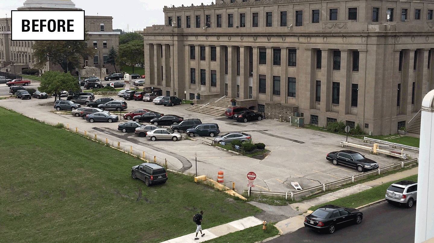
Assessing stormwater reduction using green infrastructure: Gary City Hall (Gary, Ind.)
The effectiveness of green infrastructure (rain gardens and decreased impervious surface) at reducing stormwater runoff and capturing dissolved chloride is being assessed at a redevelopment project at Gary City Hall (Gary, Indiana). This study will evaluate pre- and post-construction hydrologic conditions using data collected by monitoring storm-sewer flow, groundwater levels, soil moisture, and...

Monitoring and predicting the impacts of trees on urban stormwater volume reduction
Much has been learned about how effectively individual green infrastructure practices can reduce stormwater volume, however, the role of urban trees in stormwater detention is poorly understood. This study quantified the impact that trees have on stormwater runoff volume.

Groundwater monitoring and research
Groundwater is an important water resource. The USGS collects information on the quality and quantity of groundwater and conducts advanced modeling of groundwater flow and groundwater/surface-water systems. The USGS also evaluates the effects of water-use, land-use, and climate change on groundwater, surface-water, and the ecosystems that rely on them.

GLRI Urban Stormwater Monitoring
The GLRI Urban Stormwater Monitoring effort brings together the expertise of the USGS with local and national partners to assess the ability of green infrastructure to reduce stormwater runoff in Great Lakes urban areas.

Impacts of agricultural drainage on groundwater recharge
Artificial subsurface drainage is being increasingly utilized on agricultural land in southeast Minnesota. This region is underlain by thinner glacial deposits than are found in the historically drained areas of the State. Due to these thinner deposits, drainage in this area may have a greater impact on recharge to the underlying bedrock aquifers, a critical resource to the region.

Assessing Hydrologic Changes in the St. Louis River Basin from Past Land Uses
Resource managers can use assessments of past and future land use to make science-based decisions. This project characterizes how changes in land use can change groundwater and surface-water flows in the St. Louis River Basin, MN. The USGS is constructing a set of groundwater models to simulate groundwater/surface-water interactions and evaluate how water flows have changed.

Assessing stormwater reduction using green infrastructure: Niagara River Greenway Project (Buffalo, NY)
The U.S. Geological Survey is assessing the effectiveness of green infrastructure at attenuating and reducing stormflow along a 2.26 mile corridor of Niagara Street in Buffalo, NY. This research is being conducted in collaboration with the Environmental Protection Agency, the Buffalo Sewer Authority and University at Buffalo.

Dane County water-quality monitoring program
Many Dane County, Wis., streams and lakes have been degraded due to excessive nutrients and sediment contributed primarily by agriculture and urbanization. The goal is to build a long-term base of streamflow, lake stage, and water-quality data essential for water-resource planning and assessment purposes for streams and lakes in Dane County, with a focus on the Yahara River Basin.

Connecting Channels
In response to decreasing water levels in the Great Lakes, especially Lake Michigan and Lake Huron, the International Upper Great Lakes Study (IUGLS) asked USGS to continuously measure flows in the connecting channels of St. Marys, St. Clair, and Detroit Rivers, and Water Survey Canada (WSC) to measure flows of Niagara River. To accommodate the effects of variable backwater and the unsteadiness of...

Continuous Groundwater Monitoring Network - Minnesota
This project monitors groundwater level, groundwater temperature and precipitation at hourly intervals at a long-term network of sites throughout Minnesota. These data are collected from surficial and buried aquifers and can be used to estimate groundwater recharge and assist water-availability assessments. Data are corrected to manual measurements at least twice per year and are available through...

Silver Lake Nutrient Study
Recently, elevated chlorophyll-a concentrations were found related to persistent algal blooms on Silver Lake in Oceana County, MI. Elevated chlorophyll-a concentrations, high phosphorus concentrations during summer months, as well as a decrease in water clarity indicated potential accelerated eutrophication processes during the last two years, and underscore a need to characterize water and...