
Surface Water Monitoring
Surface Water Monitoring
Filter Total Items: 19

Effects of Abandoned Coal Mine Drainage in the New River Gorge
Many abandoned historic mines surround the New River Gorge. Untreated water draining from these mines has the potential to alter the temperature and water quality of nearby creeks and rivers. Remediation and restoration has been proposed for many of these abandoned mines. However, the cold water seeping out of these mines may also create wetland areas along the flat mine benches which were cut...
Henrico County Hydrologic Monitoring Network
The USGS Virginia and West Virginia Water Science Center has established a comprehensive network of hydrologic monitoring stations throughout Henrico County. Precipitation and water-level data collected from these stations are used to inform floodplain management, reduce the risk of flooding, and inform emergency management. On this page, you can access our data and learn more about the Henrico...

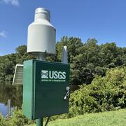
Source Water Monitoring on the Roanoke River in Salem, Virginia
The Roanoke River is the primary source of the City of Salem's drinking water. Threats to water quality in rivers like the Roanoke have increased in recent years, and water authorities as well as residents are concerned about preventing source water contamination. Realtime water quality monitoring is a valuable tool in alerting water authorities such as Salem Water when there are anomalous...

Investigation of Drivers of Harmful Algal Blooms on Lake Anna, Virginia
The U.S. Geological Survey (USGS), in cooperation with the Viriginia Department of Environmental Quality (DEQ) is monitoring harmful algal blooms (HABs) on Lake Anna in Virginia. The hydrology, water-quality, and weather conditions are evaluated both continuously and discretely to analyze the causes, persistence, and decline of HABs in two tributaries and along Lake Anna. Synoptic monitoring of...

Investigation of Drivers of Harmful Algal Blooms on the Shenandoah River, Virginia
The U.S. Geological Survey (USGS), in cooperation with the Viriginia Department of Environmental Quality (DEQ) and collaboration with the Interstate Commission on the Potomac River Basin (ICPRB) is monitoring harmful algal blooms (HABs) on the two forks of the Shenandoah River in Virginia. Continuous and discrete water-quality and hydrology data is conducted to understand the drivers, persistence...

Harmful Algal Blooms Investigations at the Virginia and West Virginia Water Science Center
Excessive accumulations of algae that impair waterbodies, called harmful algal blooms (HABs), can have detrimental effects on aquatic ecosystems, reduce the quality of water resources, and can pose significant risks to human and animal health. The Virginia and West Virginia Water Science Center works with state, regional, and local partners to evaluate the drivers and distribution of harmful algal...

Hydrologic Monitoring and Analysis to Support Water Resource Management in the City of Roanoke
The U.S. Geological Survey, partnering with the City of Roanoke and Virginia Tech, are working to monitor the water volume and quality in streams throughout the City of Roanoke. There are currently six monitoring stations within the city. Water-quality data are collected at five stations through real-time monitors. The overall objective of the study is to quantify the amount of sediment delivered...

Climate Change in the Chesapeake Bay Watershed: Effects on Riverine Discharge, Ecosystems, and Water Quality
The 64,000-square mile watershed that drains to the Chesapeake Bay is highly populated and has diverse land use, including forested, agricultural, and urbanized areas. Increased precipitation in the eastern United States over the last 100 years has affected stream flow and thus the loading of pollutants delivered to the bay. Such pollutants as suspended sediment and dissolved phosphorus and...

Fairfax County Water Resources Monitoring Network
In recent years, hundreds of millions of dollars have been invested into the implementation of Best Management Practices in Fairfax County, Virginia, with the goal of improving water quality. Research has demonstrated that best management practices are effective at smaller scales, but less information is available to document the effectiveness of these best management practices at the watershed...

Hampton Roads Regional Water Quality Monitoring Program
In 2015, the U.S. Geological Survey partnered with the Hampton Roads Sanitation District (HRSD) in cooperation with the Hampton Roads Planning District Commission to implement a water-quality monitoring program in six major cities across the Hampton Roads region. This long-term monitoring program consists of a network of 12 water-quality monitoring stations, 2 per jurisdiction, across the cities...

Clinch River Water Quality and Mussel Health
The Clinch and Powell Rivers flowing from southwestern Virginia through parts of East Tennessee support unique and nationally significant endemic and endangered populations of fresh-water mussels and other aquatic fauna. Surveys of mussel and fish community structure over past decades have shown a pattern of decline throughout the Powell River and on parts of the upper Clinch that have suggested a...

Chesapeake Bay Water-Quality Loads and Trends
Access the most recent data gathered from the Chesapeake Bay Nontidal Monitoring Network, learn about the techniques used to collect this data, and read about the history of the Chesapeake Bay Nontidal Monitoring Program. Nontidal Network (NTN) data refers to data from the 123 monitoring stations where nutrients and sediment are collected monthly and during storms. River Input Monitoring (RIM)...