
Land Use Change and Water Resources
Land Use Change and Water Resources
As with climate change, consideration of possible land-use change effects on water resources is regularly integrated into many of our investigations, particularly those focused on water availability and use and hydrologic hazards. We often use our hydrology computer models to simulate the potential effects of land-use change, and integrate those effects with those from other stressors such as climate change to help our partners plan resilient water supply and hazard reduction strategies.
Filter Total Items: 9
Watersheds and Fluvial Systems Team
The Watersheds and Fluvial Systems Team at the Washington Water Science Center provides reliable science to understand how watersheds, rivers, and streams function—and how they respond to a changing world. We aim to build partnerships that foster informed decision-making and effective resource management throughout the Pacific Northwest region and across the U.S.
Bear Gulch Fire Water Quality Monitoring
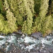
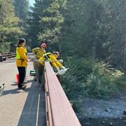
The USGS is monitoring water quality in the North Fork Skokomish River following the Bear Gulch Fire that burned in summer 2025. USGS has over 100 years of data from this river. Streamflow data support water supply management and flood prediction. Post-fire data provides an important window into how watersheds are shaped by fire.
Carbon in Urban River Biogeochemistry Project
The Issue: In aquatic ecosystems, dissolved organic carbon represents the largest flux of carbon in streams and it is a primary energy source in aquatic food webs. There is limited understanding of how human activities related to urban development influence the timing and scale of carbon cycling in aquatic ecosystems. How USGS will help: The USGS is working with university partners to assess how...

Integration of Urban Stormwater Infrastructure in Modeling Water Quality Patterns in Small Urban Streams
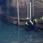
The Issue: Stormwater can quickly run off impervious surfaces delivering potentially polluted water to streams and rivers in the Puget Sound region. Runoff from impervious surfaces can either be directly connected to streams through stormwater pipes or indirectly connected if runoff is routed to some other surface such as grass or a feature like a stormwater management structure. It is currently...

Post-wildfire sedimentation and release of metals to Conconully Reservoir, Washington
Wildfires can negatively impact reservoirs and water supply. In 2021, a wildfire in Okanagan County, Washington, engulfed a large area around Conconully Reservoir. USGS scientists are assessing sediment and water quality in the reservoir and surrounding streams.

Analysis of USGS Surface Water Monitoring Networks
The issue: National interests in water information are important but challenging to incorporate into planning and operation of a monitoring network driven by local information needs. These interests include an understanding of the spatial variability in water availability across the United States, anthro-physical factors including climate and land use that affect water availability, and federal...

Regional Stormwater Monitoring Program Sampling
The Issue: The State of Washington issues Municipal Stormwater Permits to local governments in the Puget Sound region that require them to develop and implement a stormwater management program that reduces the discharge of pollutants and protects the quality of water in rivers, streams, lakes and Puget Sound. The permitees in partnership with the State need to measure whether water quality and...

Potholes Reservoir
Managed by the U.S. Bureau of Reclamation (USBR), water is diverted from the Columbia River into Potholes Reservoir and the canal system for delivery to irrigators. Through the USGS/USBR collaborative Watershed and River Systems Management Program (WARSMP), the USBR will be developing a river-management model to improve the efficiency of water distribution. An important input needed for the model...

Hydrologic Urban Indicators
Storm water, the rainfall that runs off urban surfaces such as rooftops, pavement, and lawns, can affect streams in a number of ways. As urban development increases, storm water can run quickly into streams, increasing the volume and peak flows and reducing summer flows. Sediment and other contaminants can also be carried into the streams. The Washington Department of Ecology (WDOE), the state...