
Exploring Critical Minerals and Volcanic Processes in Aleutian Rocks
A USGS-led expedition in the Aleutian Arc off Alaska will provide critical information on energy resources, underwater earthquakes and other hazards, seafloor habitats, and biological resources, including key fisheries, as well as potential seabed minerals.
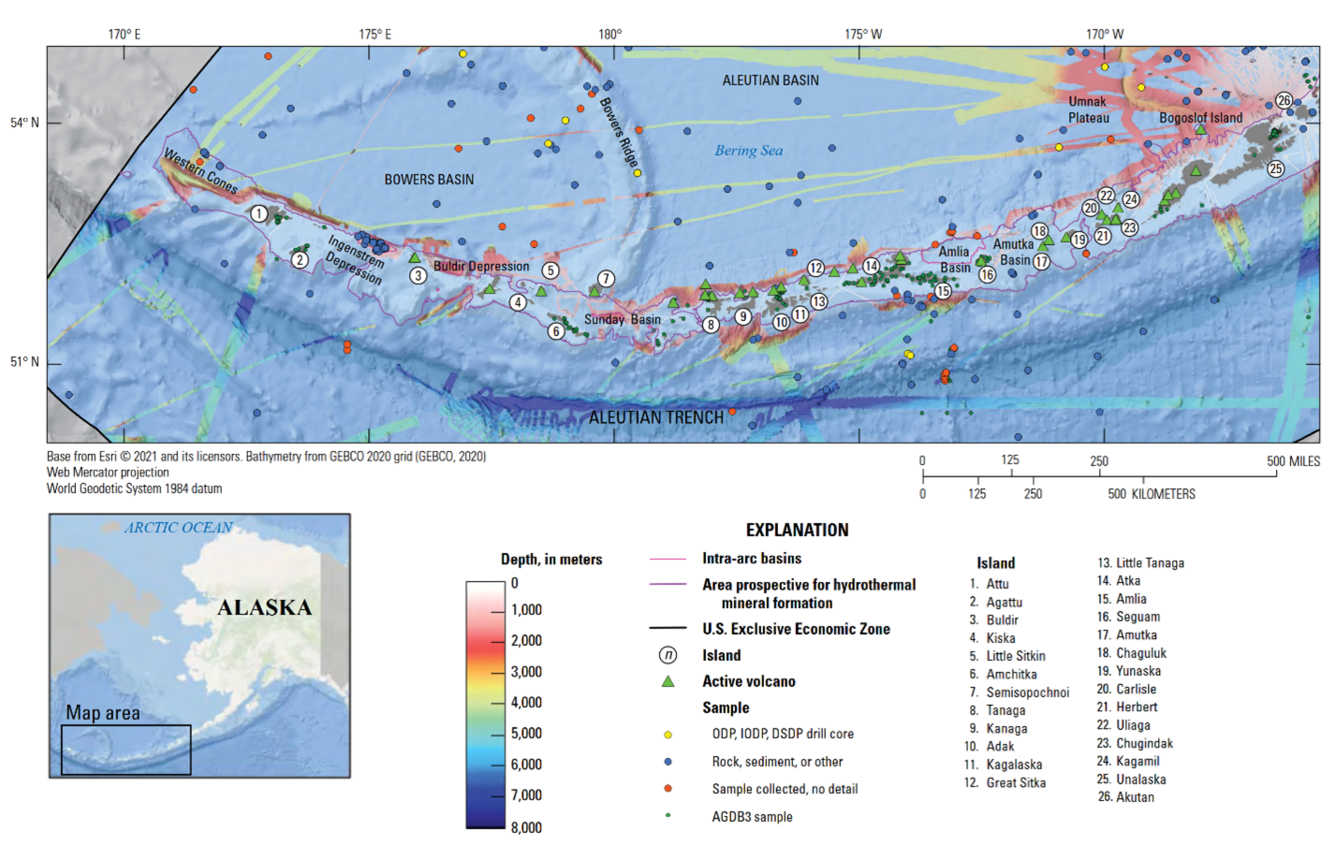
One of the motivations of this expedition along the Aleutian Arc is centered on collecting and characterizing submarine volcanic and seafloor rocks to support two complementary objectives: improving assessments of volcanic hazards and identifying environments favorable for critical mineral formation. This region, marked by a tectonic complexity of volcanic arcs offers valuable insight into both eruptive history and the potential of hydrothermal systems.
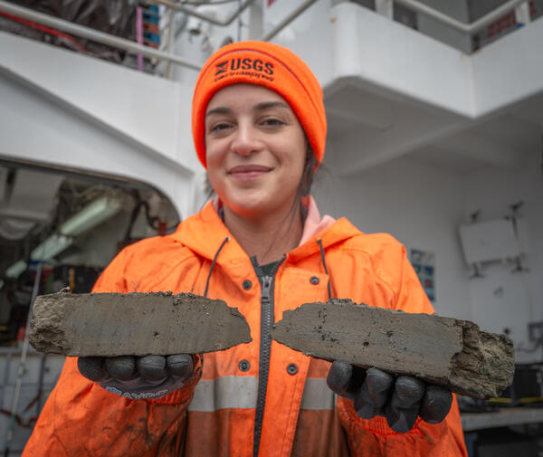
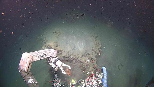
Some of the recovered samples so far include basalts, altered volcanic rocks, volcaniclastics rocks and mudstones. These volcanic samples are essential for reconstructing eruption histories, evaluating seafloor geohazards, and constraining the timing of volcanic activity in this subduction-dominated arc. Many of the basalts display textures consistent with submarine eruption, including glassy rims and radial jointing. Some exhibit alteration features such as clay replacement and oxidation halos, which may reflect interaction with hydrothermal fluids. However, further analysis is required to confirm the extent and origin of these alterations.
In parallel, the Global Seabed Mineral Resources team—namely Maria Figueroa and Katlin Adamczyk—from the USGS Pacific Coastal and Marine Science Center (PCMSC) is actively surveying for hydrothermal vents. These vents are key targets as they form where metal-rich hydrothermal fluids meet colder seawater, precipitating sulfide-rich minerals as they cool. Hydrothermal vents can be important sources of metals such as zinc, copper, gold, cobalt, and antimony, many of which are identified as critical minerals by the USGS and the U.S. Department of the Interior.
By combining geological, geochemical, and geophysical observations, this expedition contributes to the broader USGS, BOEM, and NOAA missions to improve national understanding of domestic critical mineral resources, particularly in underexplored areas of the U.S. Exclusive Economic Zone. Ongoing work will further refine the mineralogical and geochemical characterization of recovered samples and guide continued hydrothermal prospecting throughout the cruise.
