
Mesophotic and Deep Benthic Communities: Habitat Assessment and Evaluation
Through a collaborative effort with other federal agencies and academic and research institutions, USGS is working to fill data gaps, determine baseline conditions, and characterize key community conditions at mesophotic and deep benthic sites impacted by the Deepwater Horizon oil spill.

The Science Issue and Relevance: The life histories, diversity, and population structures of the species that make up mesophotic and deep benthic communities (MDBC) in the Gulf are not well understood. However, these factors play a critical role in these communities’ potential for recovery from damage, such as oil spills and other human activities. A better understanding of the mesophotic and deep-sea communities is needed to inform planning for active management and restoration. The goal of this project is to fill data gaps, determine baseline conditions, and characterize key community conditions at injured sites from the Deepwater Horizon (DWH) oil spill, as well as reference sites.
While some areas of injured resources are known, this project will locate other sites and determine areas where resource restoration or other complementary management measures may be needed and are most likely to succeed. This project will determine the distribution, genetic diversity, and connectivity of MDBCs within the DWH-impacted zone and provide insight to fundamental aspects of injured resources, such as their biology and ecology. Community ecology and temporal variability will be evaluated in impacted, potentially impacted, and reference zones, providing data to inform the effectiveness of restoration actions. This will help fill critical gaps in our understanding of the health, biodiversity, recovery, and resilience of MDBCs following the DWH spill and support the restoration and recovery of these species and habitats.
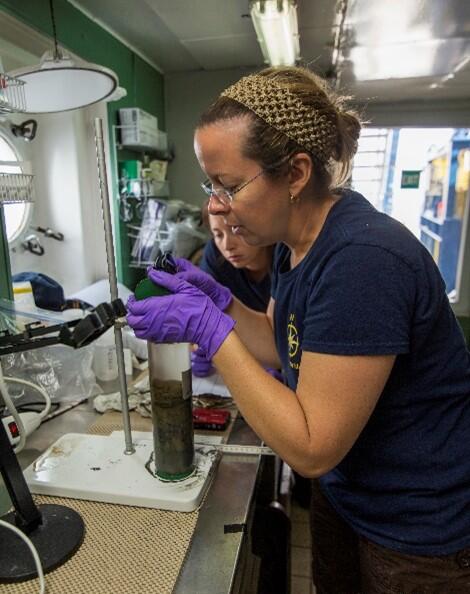
Methodology for Addressing the Issue: Specimens from mesophotic and deep benthic areas will be collected on multiple research expeditions in the Gulf. Sampling will focus on known locations of target species populations and previously studied soft-sediment habitats. In addition to multibeam bathymetric maps, extensive remotely operated vehicle (ROV) image surveys of coral communities in the northwestern Gulf are available from previous projects performed by USGS and various partners. These expeditions will allow documentation of living marine resources and assess the status of benthic communities in mesophotic and deep-sea areas. Samples for genetic and isotope analyses will be taken from collected specimens. Statistical methods that integrate independent datasets (isotopic, genetic, and habitat suitability) will be applied to provide greater resolution than any dataset alone. All results will be integrated and displayed via geonarratives, which allow different data layers, including dispersal pathways, sources and sinks of populations, and suitable habitats for mesophotic and shallow-water species, to be overlain onto a map to visualize the potentially complex patterns of connectivity among shallow and mesophotic areas in the Gulf.
Future Steps: Deep-water benthic information in the Gulf is urgently needed to guide potential management decisions associated with conventional energy, renewable energy, and marine minerals in response to the 2019 Presidential Memorandum’s (PM) Section 2 National Strategy on Ocean Mapping, Exploring and Characterizing the U.S. Exclusive Economic Zone (NOMEC). The findings from this project will contribute to our understanding of ecosystem status and connectivity in the Gulf since the DWH oil spill, the processes that shape these environments, and the long-term impacts of disturbances on these habitats.

Mesophotic and Deep Benthic Communities: Coral Propagation Technique (CPT) Development Project

USGS DISCOVRE: Benthic Ecology, Trophodynamics, and Ecosystem Connectivity – Lophelia II: Continuing Ecological Research on Deep-Sea Corals and Deep Reef Habitats in the Gulf

Connectivity of Coral Ecosystems in the Northwestern Gulf
Through a collaborative effort with other federal agencies and academic and research institutions, USGS is working to fill data gaps, determine baseline conditions, and characterize key community conditions at mesophotic and deep benthic sites impacted by the Deepwater Horizon oil spill.
The Science Issue and Relevance: The life histories, diversity, and population structures of the species that make up mesophotic and deep benthic communities (MDBC) in the Gulf are not well understood. However, these factors play a critical role in these communities’ potential for recovery from damage, such as oil spills and other human activities. A better understanding of the mesophotic and deep-sea communities is needed to inform planning for active management and restoration. The goal of this project is to fill data gaps, determine baseline conditions, and characterize key community conditions at injured sites from the Deepwater Horizon (DWH) oil spill, as well as reference sites.
While some areas of injured resources are known, this project will locate other sites and determine areas where resource restoration or other complementary management measures may be needed and are most likely to succeed. This project will determine the distribution, genetic diversity, and connectivity of MDBCs within the DWH-impacted zone and provide insight to fundamental aspects of injured resources, such as their biology and ecology. Community ecology and temporal variability will be evaluated in impacted, potentially impacted, and reference zones, providing data to inform the effectiveness of restoration actions. This will help fill critical gaps in our understanding of the health, biodiversity, recovery, and resilience of MDBCs following the DWH spill and support the restoration and recovery of these species and habitats.
Methodology for Addressing the Issue: Specimens from mesophotic and deep benthic areas will be collected on multiple research expeditions in the Gulf. Sampling will focus on known locations of target species populations and previously studied soft-sediment habitats. In addition to multibeam bathymetric maps, extensive remotely operated vehicle (ROV) image surveys of coral communities in the northwestern Gulf are available from previous projects performed by USGS and various partners. These expeditions will allow documentation of living marine resources and assess the status of benthic communities in mesophotic and deep-sea areas. Samples for genetic and isotope analyses will be taken from collected specimens. Statistical methods that integrate independent datasets (isotopic, genetic, and habitat suitability) will be applied to provide greater resolution than any dataset alone. All results will be integrated and displayed via geonarratives, which allow different data layers, including dispersal pathways, sources and sinks of populations, and suitable habitats for mesophotic and shallow-water species, to be overlain onto a map to visualize the potentially complex patterns of connectivity among shallow and mesophotic areas in the Gulf.
Future Steps: Deep-water benthic information in the Gulf is urgently needed to guide potential management decisions associated with conventional energy, renewable energy, and marine minerals in response to the 2019 Presidential Memorandum’s (PM) Section 2 National Strategy on Ocean Mapping, Exploring and Characterizing the U.S. Exclusive Economic Zone (NOMEC). The findings from this project will contribute to our understanding of ecosystem status and connectivity in the Gulf since the DWH oil spill, the processes that shape these environments, and the long-term impacts of disturbances on these habitats.
Mesophotic and Deep Benthic Communities: Coral Propagation Technique (CPT) Development Project
USGS DISCOVRE: Benthic Ecology, Trophodynamics, and Ecosystem Connectivity – Lophelia II: Continuing Ecological Research on Deep-Sea Corals and Deep Reef Habitats in the Gulf