
Arch Cave in Zion National Park. Although not yet a full arch, the processes by which arches form can be seen here.
Images
Images
Filter Total Items: 9454

Arch Cave in Zion National Park
Arch Cave in Zion National Park. Although not yet a full arch, the processes by which arches form can be seen here.
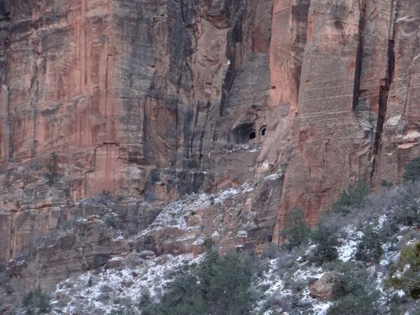
Zion-Mt. Carmel Tunnel Window
A window for the Zion-Mt. Carmel Tunnel, which was built during the late 1920s.
A window for the Zion-Mt. Carmel Tunnel, which was built during the late 1920s.
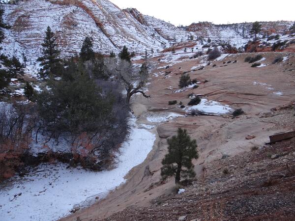
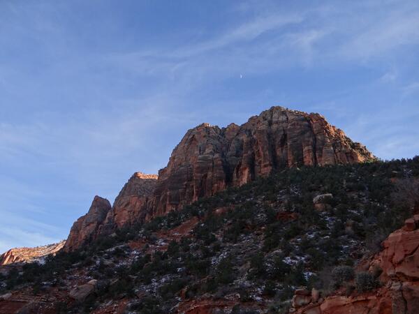
Snow-covered Sandstone in Zion
Snow-covered sandstone in Zion National Park.
Snow-covered sandstone in Zion National Park.
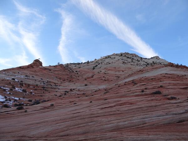
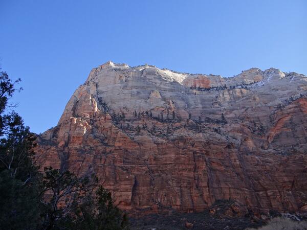
Sandstone Peak in Zion National Park
One of Zion National Park's most distinguishing features is its sandstone peaks.
One of Zion National Park's most distinguishing features is its sandstone peaks.

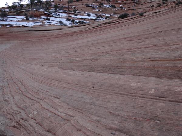
Sandstone Erosion Patterns in Zion
Wind and water combine to create unique patterns in the sandstone.
Wind and water combine to create unique patterns in the sandstone.

Sandstone Peaks in Zion National Park
Zion Canyon is characterized by its dramatic sandstone peaks.
Zion Canyon is characterized by its dramatic sandstone peaks.
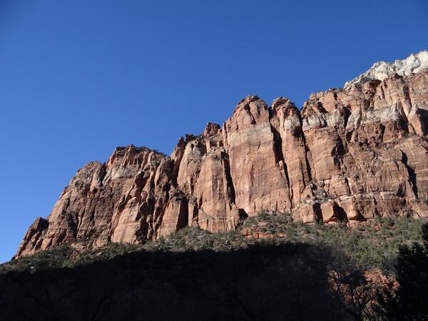
Zion National Park
A sandstone cliff in Zion National Park.
A sandstone cliff in Zion National Park.
Zion National Park
A sandstone monolith in Zion National Park.
A sandstone monolith in Zion National Park.

Trickling Water in Zion National Park
Trickling water from the Emerald Pools in Zion National Park.
Trickling water from the Emerald Pools in Zion National Park.

Angel's Landing
Angel's Landing, one of the more popular hiking destinations in Zion National Park.
Angel's Landing, one of the more popular hiking destinations in Zion National Park.
Sandstone Erosion Patterns in Zion
Wind and water combine to create unique patterns in the sandstone.
Wind and water combine to create unique patterns in the sandstone.
Sandstone Peak in Zion National Park
One of Zion National Park's most defining features is its sandstone peaks.
One of Zion National Park's most defining features is its sandstone peaks.

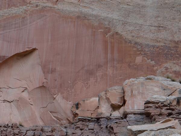
Petroglyphs in Captiol Reef
From about 300-1300 CE, ancestors of the Hopi Tribe, Pueblo of Zuni, and Paiute Tribe lived in Capitol Reef. They are known by various names-archeologists call them the Fremont Culture; the Hopi Tribe calls them the Hisatsinom, or the "People of Long Ago;" and the Paiute Tribe calls them the Wee Noonts, or the "People Who Lived the Old Ways."
From about 300-1300 CE, ancestors of the Hopi Tribe, Pueblo of Zuni, and Paiute Tribe lived in Capitol Reef. They are known by various names-archeologists call them the Fremont Culture; the Hopi Tribe calls them the Hisatsinom, or the "People of Long Ago;" and the Paiute Tribe calls them the Wee Noonts, or the "People Who Lived the Old Ways."
Capitol Reef Petroglyphs
From about 300-1300 CE, ancestors of the Hopi Tribe, Pueblo of Zuni, and Paiute Tribe lived in Capitol Reef. They are known by various names-archeologists call them the Fremont Culture; the Hopi Tribe calls them the Hisatsinom, or the "People of Long Ago;" and the Paiute Tribe calls them the Wee Noonts, or the "People Who Lived the Old Ways."
From about 300-1300 CE, ancestors of the Hopi Tribe, Pueblo of Zuni, and Paiute Tribe lived in Capitol Reef. They are known by various names-archeologists call them the Fremont Culture; the Hopi Tribe calls them the Hisatsinom, or the "People of Long Ago;" and the Paiute Tribe calls them the Wee Noonts, or the "People Who Lived the Old Ways."

Navajo Dome
Navajo Dome, one of the more notable features within Capitol Reef National Park. Capitol Reef is primarily made up of sandstone formations within the Waterpocket Fold, monocline that extends nearly 100 miles. A monocline is a step-like fold in rock strata that can resemble an enormous wrinkle in the earth.
Navajo Dome, one of the more notable features within Capitol Reef National Park. Capitol Reef is primarily made up of sandstone formations within the Waterpocket Fold, monocline that extends nearly 100 miles. A monocline is a step-like fold in rock strata that can resemble an enormous wrinkle in the earth.
The Fruita of Capitol Reef
This area, known as the Fruita, is made up of three primary layers. The bottom sandstone layer is known as the Moenkopi Formation and is about 245 million years old. The middle gray-green layer is known as the Chinle Formation and was laid down as volcanic ash about 225 million years ago.
This area, known as the Fruita, is made up of three primary layers. The bottom sandstone layer is known as the Moenkopi Formation and is about 245 million years old. The middle gray-green layer is known as the Chinle Formation and was laid down as volcanic ash about 225 million years ago.
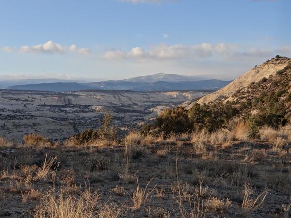
Grand Staircase-Escalante
A landscape view from State Route 12 through the Grand Staircase-Escalante National Monument. Grand Staircase-Escalante encompasses the largest land area of all U.S. National Monuments.
A landscape view from State Route 12 through the Grand Staircase-Escalante National Monument. Grand Staircase-Escalante encompasses the largest land area of all U.S. National Monuments.

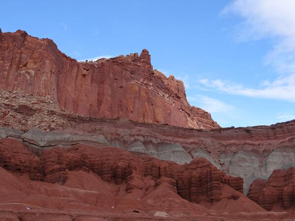
Capitol Reef Cliff
A sandstone cliff near the entrance of Capitol Reef National Park. Capitol Reef is primarily made up of sandstone formations within the Waterpocket Fold, monocline that extends nearly 100 miles. A monocline is a step-like fold in rock strata that can resemble an enormous wrinkle in the earth. This land is managed by the Bureau of Land Management.
A sandstone cliff near the entrance of Capitol Reef National Park. Capitol Reef is primarily made up of sandstone formations within the Waterpocket Fold, monocline that extends nearly 100 miles. A monocline is a step-like fold in rock strata that can resemble an enormous wrinkle in the earth. This land is managed by the Bureau of Land Management.

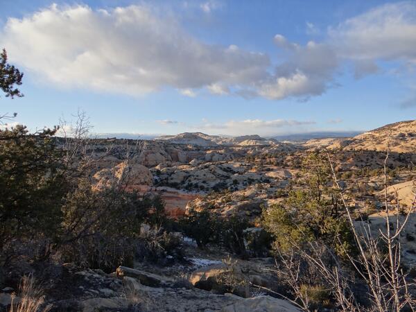
Grand Staircase-Escalante
A landscape view from State Route 12 through the Grand Staircase-Escalante National Monument. Grand Staircase-Escalante encompasses the largest land area of all U.S. National Monuments.
A landscape view from State Route 12 through the Grand Staircase-Escalante National Monument. Grand Staircase-Escalante encompasses the largest land area of all U.S. National Monuments.