
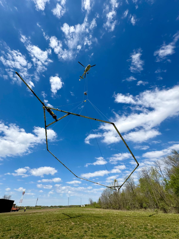
A helicopter with a “boom” containing sensors that measure the magnetic field to map geologic features. Photo courtesy of Precision GeoSurveys
Images
Images
Filter Total Items: 9454

Helicopter with boom
A helicopter with a “boom” containing sensors that measure the magnetic field to map geologic features. Photo courtesy of Precision GeoSurveys

Low level flight helicopter
A low-flying helicopter towing a geophysical device collects scientific data on groundwater and geology. (Credit: SkyTEM Surveys)
A low-flying helicopter towing a geophysical device collects scientific data on groundwater and geology. (Credit: SkyTEM Surveys)
Low level flight helicopter 2
A low-flying helicopter towing a geophysical device collects scientific data on groundwater and geology. (Credit: SkyTEM Surveys)
A low-flying helicopter towing a geophysical device collects scientific data on groundwater and geology. (Credit: SkyTEM Surveys)
Colorado helicopter survey map
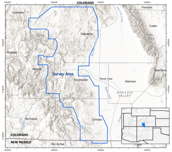
The helicopter survey will take place within the polygon on the map in southern Colorado.
The helicopter survey will take place within the polygon on the map in southern Colorado.
Aerial survey map for Michigan, Wisconsin and Minnesota
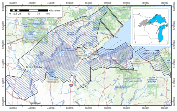
Aerial survey map for Michigan, Wisconsin and MinnesotaMap showing the location of the survey over Michigan, Wisconsin, and Minnesota. The survey will cover parts of Gogebic and Ontonagon counties in Michigan, Ashland, Bayfield, Douglas, Iron, and Vilas counties in Wisconsin, and Benton, Carlton, Cass, Crow Wing, Douglas, Itasca, Kanabec, Lake, Mille Lacs, Morrison, Otter Tail, Pi
Aerial survey map for Michigan, Wisconsin and Minnesota
Aerial survey map for Michigan, Wisconsin and MinnesotaMap showing the location of the survey over Michigan, Wisconsin, and Minnesota. The survey will cover parts of Gogebic and Ontonagon counties in Michigan, Ashland, Bayfield, Douglas, Iron, and Vilas counties in Wisconsin, and Benton, Carlton, Cass, Crow Wing, Douglas, Itasca, Kanabec, Lake, Mille Lacs, Morrison, Otter Tail, Pi
NASA’s ER‑2 high‑altitude research aircraft touches down in Colorado Springs May 11, 2026
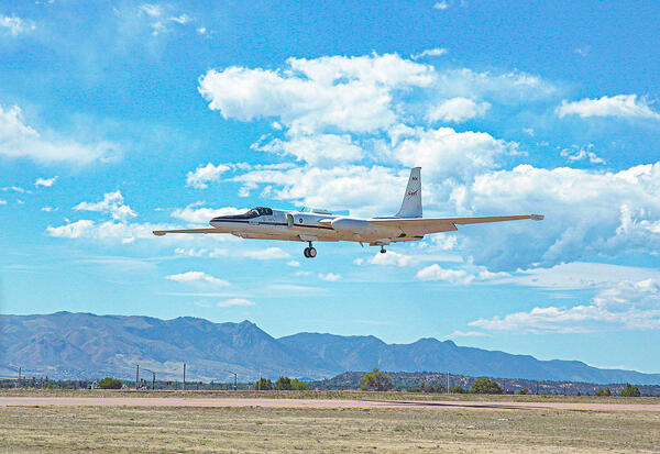
NASA’s ER‑2 high‑altitude research aircraft touches down in Colorado Springs May 11, 2026NASA’s ER‑2 high‑altitude research aircraft touches down in Colorado Springs May 11, 2026, after completing a hyperspectral survey flight for the joint USGS–NASA effort to map critical minerals across the western United States.
NASA’s ER‑2 high‑altitude research aircraft touches down in Colorado Springs May 11, 2026
NASA’s ER‑2 high‑altitude research aircraft touches down in Colorado Springs May 11, 2026NASA’s ER‑2 high‑altitude research aircraft touches down in Colorado Springs May 11, 2026, after completing a hyperspectral survey flight for the joint USGS–NASA effort to map critical minerals across the western United States.

Monitoring hyperspectral data while NASA’s high‑altitude ER‑2 aircraft conducts mineral‑mapping flights
Monitoring hyperspectral data while NASA’s high‑altitude ER‑2 aircraft conducts mineral‑mapping flightsU.S. Geological Survey geophysicists Ray Kokaly (left) and Todd Hoefen (right) monitor incoming hyperspectral data in the hangar as NASA’s high‑altitude ER‑2 aircraft conducts mineral‑mapping flights over the western United States.
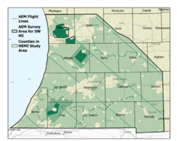
Map of survey area and planned flight lines in Southwest Michigan
Map of survey area and planned flight lines in Southwest MichiganMap of survey area and planned flight lines in Southwest Michigan.
Map of survey area and planned flight lines in Southwest Michigan
Map of survey area and planned flight lines in Southwest MichiganMap of survey area and planned flight lines in Southwest Michigan.
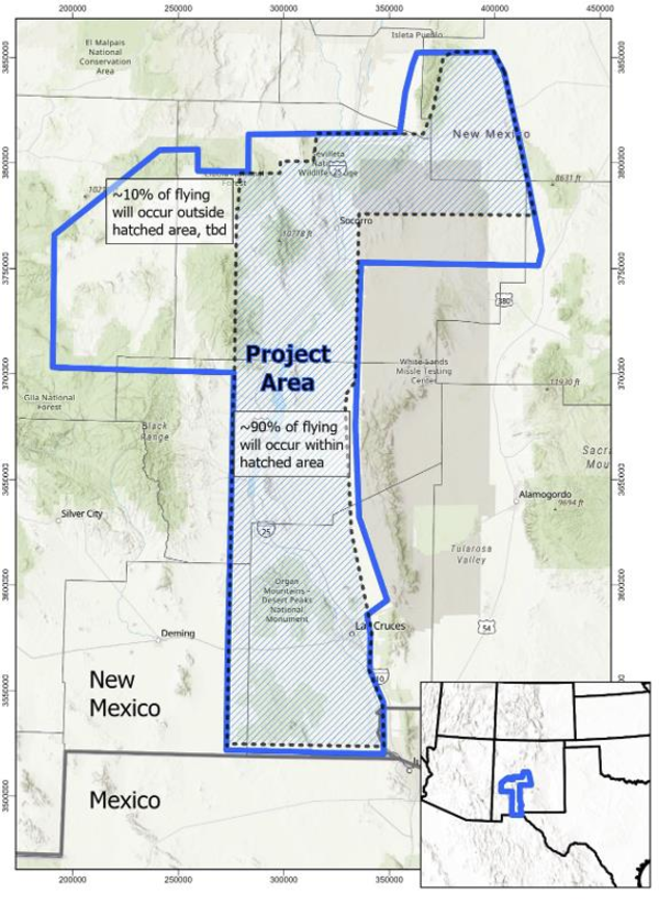
NM Earth MRI Map
Map showing the location of the survey over New Mexico. The vast majority -- 90 % -- of aircraft flights will occur within the hatched area, while the remaining flights will be located in the northwestern portion of the project area. Flights will cover areas within the New Mexico counties of Doña Ana, Lincoln, Luna, Sierra, Socorro, Torrance, and Valenci
Map showing the location of the survey over New Mexico. The vast majority -- 90 % -- of aircraft flights will occur within the hatched area, while the remaining flights will be located in the northwestern portion of the project area. Flights will cover areas within the New Mexico counties of Doña Ana, Lincoln, Luna, Sierra, Socorro, Torrance, and Valenci

NM Earth MRI aircraft
The Cessna 208 Grand Caravan aircraft, Eurocopter AStar-350 B3e helicopter, and Cessna Turbo 206 aircraft used by NV5, Precision GeoSurveys, and Edcon-PRJ, respectively, for surveying.
The Cessna 208 Grand Caravan aircraft, Eurocopter AStar-350 B3e helicopter, and Cessna Turbo 206 aircraft used by NV5, Precision GeoSurveys, and Edcon-PRJ, respectively, for surveying.

Top ten states by value of nonfuel minerals produced in 2025
Top ten states by value of nonfuel minerals produced in 2025Top ten states by value of nonfuel minerals produced in 2025. USGS graph.
Top ten states by value of nonfuel minerals produced in 2025
Top ten states by value of nonfuel minerals produced in 2025Top ten states by value of nonfuel minerals produced in 2025. USGS graph.
Beryllium Sample
Isolated beryllium specimen from the USGS mineral collection. High-definition image showing metallic luster and fine-grained texture.
Isolated beryllium specimen from the USGS mineral collection. High-definition image showing metallic luster and fine-grained texture.
Blue Calcite 2
High-definition image of blue calcite specimen with layered crystal structure and pale blue hue.
High-definition image of blue calcite specimen with layered crystal structure and pale blue hue.
Calcite with Sphalerite
USGS mineral specimen of calcite with sphalerite inclusions. High-definition image showing crystal structure and metallic highlights.
USGS mineral specimen of calcite with sphalerite inclusions. High-definition image showing crystal structure and metallic highlights.
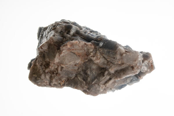
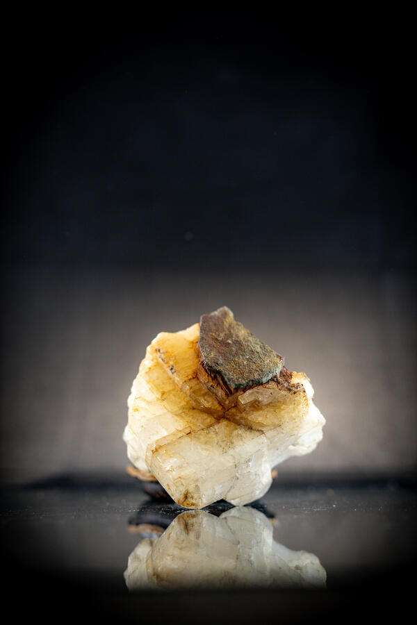
Chalcopyrite Specimen
Isolated chalcopyrite specimen from the USGS mineral collection. High-definition image showing metallic luster and granular texture.
Isolated chalcopyrite specimen from the USGS mineral collection. High-definition image showing metallic luster and granular texture.
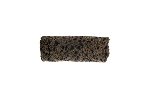
Vesicular Basalt – Side View
Isolated USGS mineral specimen of vesicular basalt. High-definition image showing porous side texture and dark volcanic color.
Isolated USGS mineral specimen of vesicular basalt. High-definition image showing porous side texture and dark volcanic color.
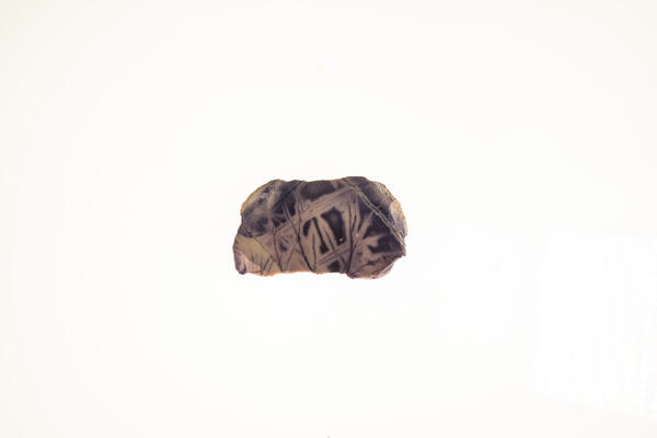
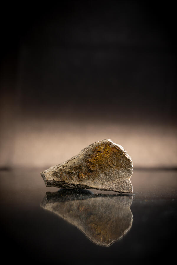
Gold Ore – 0.5 oz/ton
USGS mineral specimen of gold ore with 0.5 oz per short ton. High-definition image showing granular texture and metallic flecks.
USGS mineral specimen of gold ore with 0.5 oz per short ton. High-definition image showing granular texture and metallic flecks.
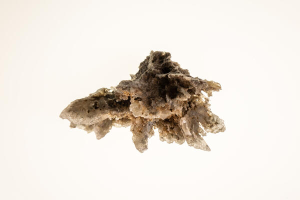
Skeletal Gypsum 1
Isolated skeletal gypsum specimen from the USGS mineral collection. High-definition image showing intricate crystal structure.
Isolated skeletal gypsum specimen from the USGS mineral collection. High-definition image showing intricate crystal structure.
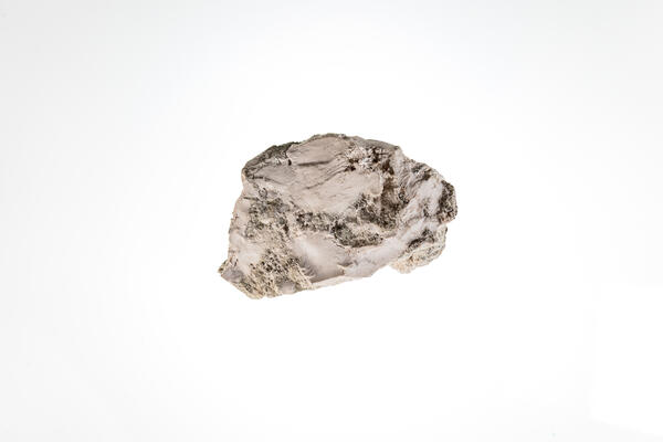
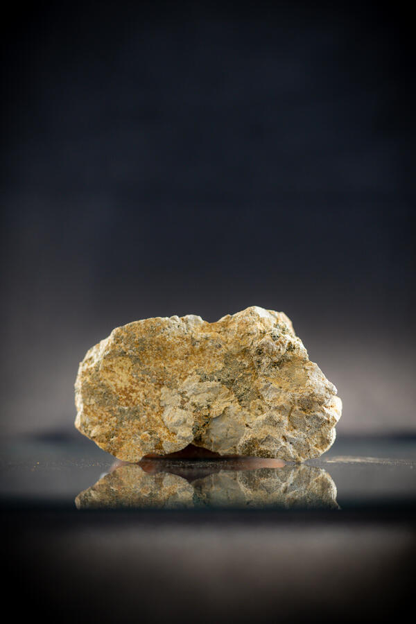
Magnesite (Magnesium Ore)
Isolated magnesite specimen from the USGS mineral collection. High-definition image showing granular texture and pale coloration.
Isolated magnesite specimen from the USGS mineral collection. High-definition image showing granular texture and pale coloration.
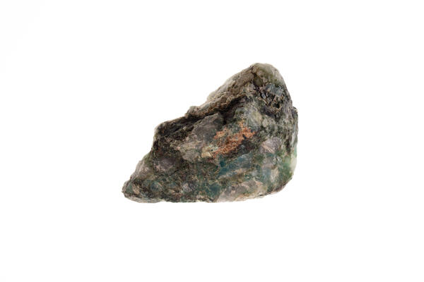
Malachite Specimen
Isolated malachite specimen from the USGS mineral collection. High-definition image showing banded green texture and fibrous structure.
Isolated malachite specimen from the USGS mineral collection. High-definition image showing banded green texture and fibrous structure.
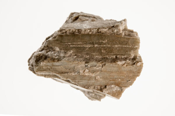
Spodumene Specimen 2
High-definition image of spodumene specimen with fibrous texture and light coloration.
High-definition image of spodumene specimen with fibrous texture and light coloration.