
Amistad National Recreation Area includes the Amistad Reservoir, a man-made lake along the border of Texas and Mexico. This view is of the cliffs of Diablo East. Prickly pear cacti are common around the reservoir.
Images
Images
Filter Total Items: 9448

Prickly Pears at Amistad Reservoir
Amistad National Recreation Area includes the Amistad Reservoir, a man-made lake along the border of Texas and Mexico. This view is of the cliffs of Diablo East. Prickly pear cacti are common around the reservoir.
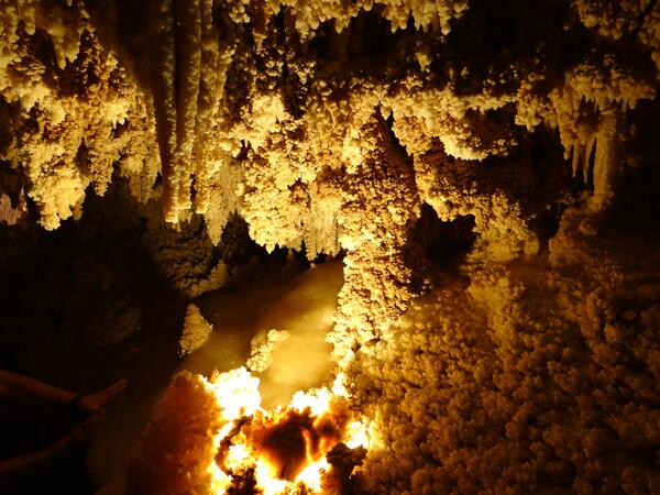
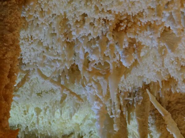
Various Speleothems in the Caverns of Sonora
The Caverns of Sonora have numerous types of speleothems, or cave formations. In this image, stalactites can be seen hanging from the ceiling; stalagmites can be seen rising from the floor; and all along the walls are small formations known as "cave popcorn."
The Caverns of Sonora have numerous types of speleothems, or cave formations. In this image, stalactites can be seen hanging from the ceiling; stalagmites can be seen rising from the floor; and all along the walls are small formations known as "cave popcorn."
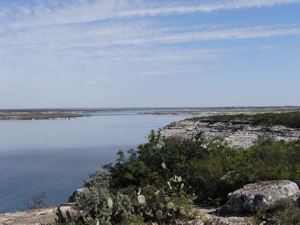
Cliffs of Diablo East
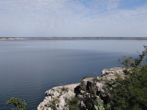
Amistad National Recreation Area includes the Amistad Reservoir, a man-made lake along the Texas and Mexico border. It is fed by the Rio Grande, Devils River, and the Pecos River, among others.
Amistad National Recreation Area includes the Amistad Reservoir, a man-made lake along the Texas and Mexico border. It is fed by the Rio Grande, Devils River, and the Pecos River, among others.
Amistad Reservoir
Amistad National Recreation Area includes the Amistad Reservoir, a man-made lake along the Texas and Mexico border. It is fed by the Rio Grande, Devils River, and the Pecos River, among others.
Amistad National Recreation Area includes the Amistad Reservoir, a man-made lake along the Texas and Mexico border. It is fed by the Rio Grande, Devils River, and the Pecos River, among others.

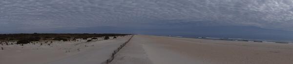
Panorama of Amistad Reservoir
Amistad National Recreation Area includes the Amistad Reservoir, a man-made lake along the Texas and Mexico border. It is fed by the Rio Grande, Devils River, and the Pecos River, among others.
Amistad National Recreation Area includes the Amistad Reservoir, a man-made lake along the Texas and Mexico border. It is fed by the Rio Grande, Devils River, and the Pecos River, among others.

Exit to the Caverns of Sonora
An image of the exit to the Caverns of Sonora. Unlike the rest of the cave, which had been weathered by water, this portion of the cave had been weathered by air moving through the limestone.
An image of the exit to the Caverns of Sonora. Unlike the rest of the cave, which had been weathered by water, this portion of the cave had been weathered by air moving through the limestone.
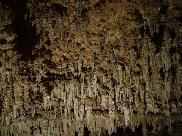
Stalactites and Cave Popcorn
The Caverns of Sonora have numerous types of speleothems, or cave formations. In this image, stalactites can be seen hanging from the ceiling and all along the walls are small formations known as "cave popcorn."
The Caverns of Sonora have numerous types of speleothems, or cave formations. In this image, stalactites can be seen hanging from the ceiling and all along the walls are small formations known as "cave popcorn."
Helictites
A unique speleothem, or cave, formation can be seen here: helictites. Helictites are undulating dripstone formations that, due to differential pressures in the water, grow in unusual directions. These helictites are in the Caverns of Sonora.
A unique speleothem, or cave, formation can be seen here: helictites. Helictites are undulating dripstone formations that, due to differential pressures in the water, grow in unusual directions. These helictites are in the Caverns of Sonora.
Helictites and Stalactites
A small chamber of speleothems, otherwise known as cave formations. The ones that descend vertically are known as stalactites, whereas the ones that extend horizontally or diagonally are known as helictites.
A small chamber of speleothems, otherwise known as cave formations. The ones that descend vertically are known as stalactites, whereas the ones that extend horizontally or diagonally are known as helictites.

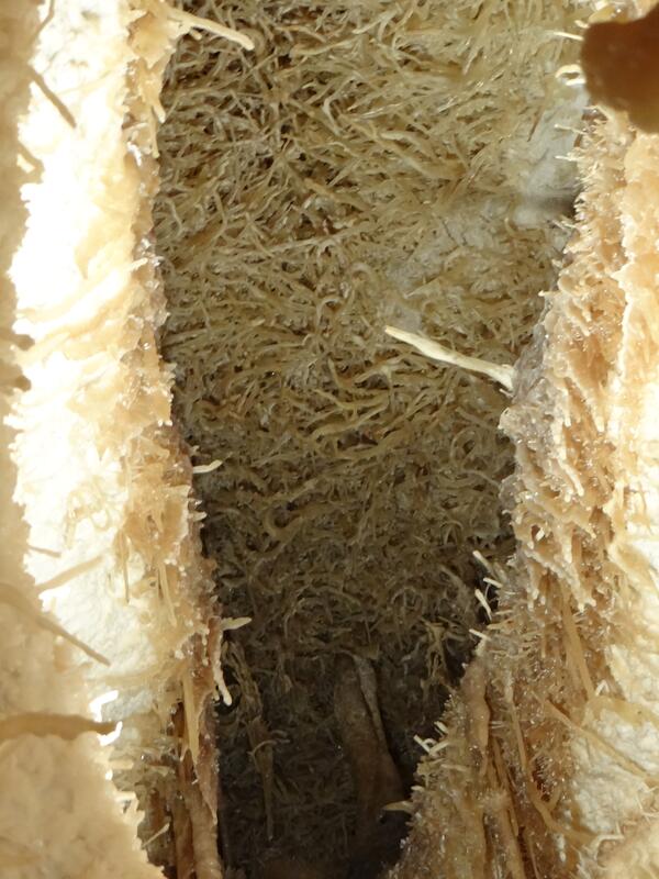
Wind-blown Cave
These sections of the Caverns of Sonora were carved by the wind, rather than by water. As such, they have smooth walls.
These sections of the Caverns of Sonora were carved by the wind, rather than by water. As such, they have smooth walls.
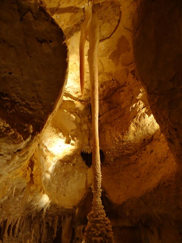
Cave Column
A prominent cave column in the Caverns of Sonora. Cave columns occur when stalactites and stalagmites fuse together. This column then grew a series of cave formations, or speleothems, known as "cave popcorn."
A prominent cave column in the Caverns of Sonora. Cave columns occur when stalactites and stalagmites fuse together. This column then grew a series of cave formations, or speleothems, known as "cave popcorn."
Panorama of Assateague Island
A panorama of Assateague Island looking north toward Ocean City, MD.
A panorama of Assateague Island looking north toward Ocean City, MD.

Panorama of Chincoteague Channel Marshes
A panorama of seagrass marshes in Chincoteague Channel. Saltwater and barrier marshes are important ecosystems that protect inland habitat and communities from ocean storms.
A panorama of seagrass marshes in Chincoteague Channel. Saltwater and barrier marshes are important ecosystems that protect inland habitat and communities from ocean storms.

NASA Wallops Island Facilities
A view of the NASA Wallops Island launch and testing facilities. Chincoteague Channel runs in the foreground.
A view of the NASA Wallops Island launch and testing facilities. Chincoteague Channel runs in the foreground.

Salt Marshes at Chincoteague Island
Salt marshes at Chincoteague Island. The salt marshes that make up Chincoteague Island are important habitat for migrating waterfowl. In addition, they serve an important role in protecting inland ecosystems and communities from oceanic storms. Mosquito point can be seen in the background where the trees are.
Salt marshes at Chincoteague Island. The salt marshes that make up Chincoteague Island are important habitat for migrating waterfowl. In addition, they serve an important role in protecting inland ecosystems and communities from oceanic storms. Mosquito point can be seen in the background where the trees are.

Mosquito Point at Chincoteague Island
Salt marshes at Mosquito Point of Chincoteague Island. The salt marshes that make up Chincoteague Island are important habitat for migrating waterfowl. In addition, they serve an important role in protecting inland ecosystems and communities from oceanic storms.
Salt marshes at Mosquito Point of Chincoteague Island. The salt marshes that make up Chincoteague Island are important habitat for migrating waterfowl. In addition, they serve an important role in protecting inland ecosystems and communities from oceanic storms.

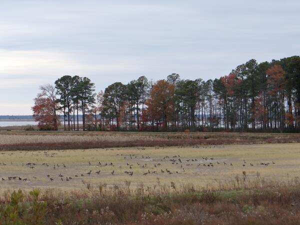
Marsh Management at Blackwater National Wildlife Refuge
Marsh Management at Blackwater National Wildlife RefugeMarsh management projects on-going at Blackwater National Wildlife Refuge. Wetlands are planted and flooded during the Spring and Summer, then drained during the Fall and Winter. This provides sediment stabilization and habitat for migrating waterfowl.

Engorged Female Deer Tick
Ticks spread the widest variety of diseases that are harmful to humans, including Lyme disease. This image shows a large, engorged female blacklegged tick, or deer tick (species Ixodes scapularis).
Ticks spread the widest variety of diseases that are harmful to humans, including Lyme disease. This image shows a large, engorged female blacklegged tick, or deer tick (species Ixodes scapularis).

NASA Wallops Island Launch Site
A view of the NASA Wallops Island launch and testing facilities. Chincoteague Channel runs in the foreground.
A view of the NASA Wallops Island launch and testing facilities. Chincoteague Channel runs in the foreground.