



The STATEMAP component of the NCGMP funds state partner contributions to the national geologic framework as guided by their economic, social, and scientific needs. STATEMAP mapping priorities are determined by individual states through a multi-representational State Mapping Advisory Committee in concert with their State Geological Survey.
State mapping priorities are based on multiple factors including a) state requirements for geologic-map information in areas of multiple-issue need or areas of compelling single-issue need, and b) state requirements for geologic map information in areas where mapping is required to solve critical earth science problems.
Geologic maps and data produced under STATEMAP provide insight into wide-sweeping earth science issues and resources across the nation including energy, water, aggregates, minerals, natural hazards, and land-use.
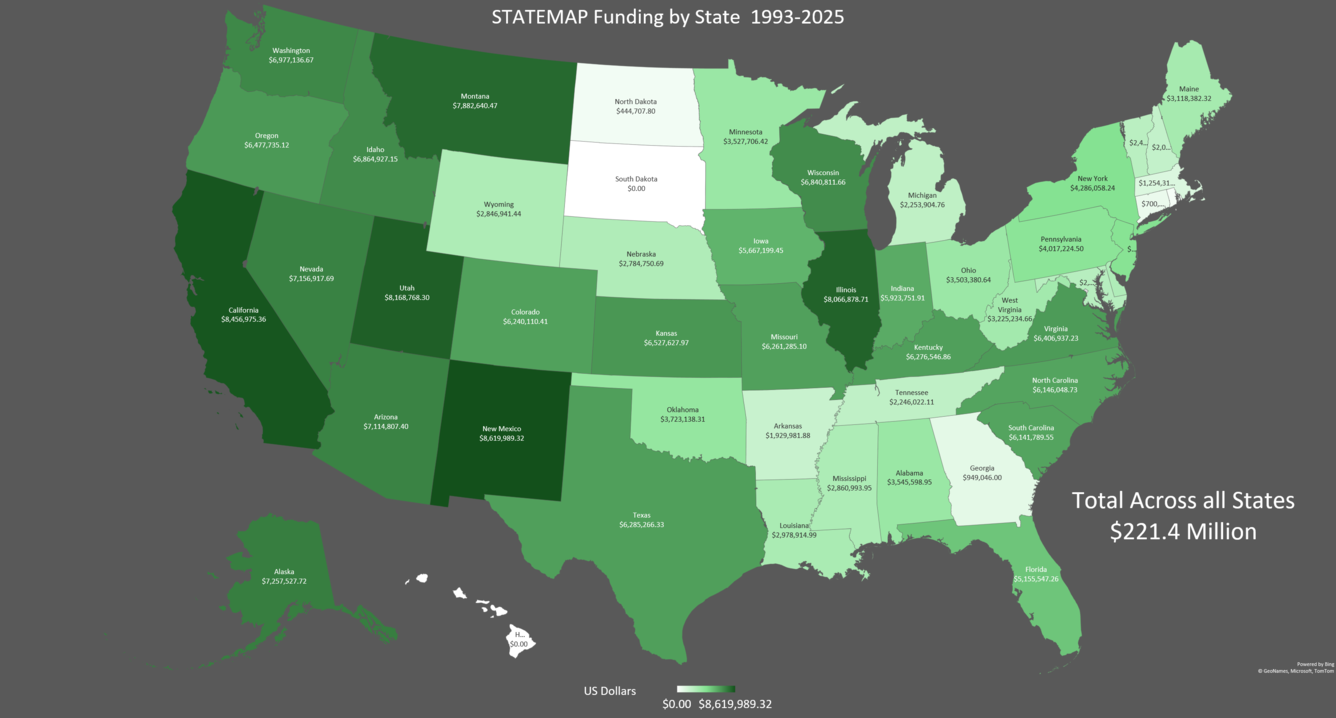
STATEMAP cooperative agreements are funded through an annual competitive grant process in response to STATEMAP Notice of Funding Opportunities. Each federal dollar awarded to a State Geological Survey is matched by a state dollar. Geologists at the State Geological Surveys conduct geologic mapping and frequently work closely with EDMAP students and their professors, as well as with FEDMAP geologists mapping within the state. Detailed STATEMAP funding data for fiscal years 1993 through 2025 can be seen by clicking here: 1993-2025 STATEMAP Awards.
STATEMAP Frequently Asked Questions (FAQ)
Below are other science projects associated with this project.
Great Lakes Geologic Mapping Coalition (GLGMC)

FEDMAP
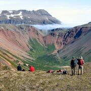
EDMAP

The National Geologic Map Database (NGMDB)
The STATEMAP component of the NCGMP funds state partner contributions to the national geologic framework as guided by their economic, social, and scientific needs. STATEMAP mapping priorities are determined by individual states through a multi-representational State Mapping Advisory Committee in concert with their State Geological Survey.
State mapping priorities are based on multiple factors including a) state requirements for geologic-map information in areas of multiple-issue need or areas of compelling single-issue need, and b) state requirements for geologic map information in areas where mapping is required to solve critical earth science problems.
Geologic maps and data produced under STATEMAP provide insight into wide-sweeping earth science issues and resources across the nation including energy, water, aggregates, minerals, natural hazards, and land-use.
STATEMAP cooperative agreements are funded through an annual competitive grant process in response to STATEMAP Notice of Funding Opportunities. Each federal dollar awarded to a State Geological Survey is matched by a state dollar. Geologists at the State Geological Surveys conduct geologic mapping and frequently work closely with EDMAP students and their professors, as well as with FEDMAP geologists mapping within the state. Detailed STATEMAP funding data for fiscal years 1993 through 2025 can be seen by clicking here: 1993-2025 STATEMAP Awards.
STATEMAP Frequently Asked Questions (FAQ)
Below are other science projects associated with this project.
Great Lakes Geologic Mapping Coalition (GLGMC)
FEDMAP
EDMAP