Maps and Mapping
How do I find, download, or order topographic maps?
What types of elevation datasets are available, what formats do they come in, and where can I download them?
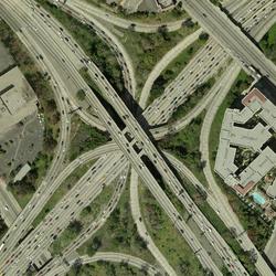
What is a Digital Orthophoto Quadrangle (DOQ) or an orthoimage?
The USGS provides the mapping and digital geospatial foundation for the Nation.
How do US Topo maps differ from historical USGS topographic maps?
Historically, USGS topographic maps were made using data from primary sources including direct field observations. Those maps were compiled, drawn, and edited by hand. By today's standards, those traditional methods are very expensive and time-consuming, and the USGS no longer has funding to make maps that way. A new USGS topographic map series was launched in 2009 and branded " US Topo ." Though...
Can I get a bulk order of USGS topographic maps in PDF format for a state or the entire country?
Bulk delivery is available for US Topo maps (produced 2009-present) and the Historical Topographic Map Collection (produced 1884-2006). Only current US Topo maps (not superseded maps) are available for bulk distribution (use topoView to download individual superseded maps). Bulk delivery options are currently only available for maps in GeoPDF file format. Options for bulk delivery: 1. Batch...
How often is orthoimagery in The National Map updated and what are the acquisition dates?
Orthoimagery (georectified aerial photography) available through The National Map Downloader and The National Map Services is from the USDA Farm Service Agency's National Agricultural Imagery Program (NAIP), which is 1-meter resolution. Generally, NAIP imagery is refreshed on a 3-year cycle with approximately one third of the continental U.S. flown each year. The month and year of imagery...
What projection are the imagery services in The National Map viewer?
Imagery services in The National Map (TNM) use WGS 1984 Web Mercator (Auxiliary Sphere) . The USGS ImageryOnly Service (under Base Maps) is cached (pre-generated) at this projection. Imagery services can be easily reprojected to many other popular projections for use in GIS desktop applications as background services. Learn more: Training videos for using The National Map Products and Services
What are the URLs for imagery services in The National Map, and are they cached or dynamic?
There are several imagery services for The National Map . Some imagery services are cached and some are dynamic: USGSImageryOnly (under Base Maps), for example, is a tile cache base map service of orthoimagery. It has different imagery data sources depending on view scale. The USGSImageryOnly service uses cache tiles of 256x256 pixels in size and 96 dots per inch (dpi) resolution with 75%...
What sources were used for imagery in The National Map services?
Sources for orthoimagery in The National Map services : World view to 1:2,300,000 - NASA Blue Marble Next Generation (BMNG) 1:1,150,000 to 1:289,000 - A subset of the Global Land Survey 2000 (Landsat) Scales larger than 1:289,000 - primarily the National Agriculture Imagery Program (NAIP). The data is 1-meter pixel resolution flown during "leaf-on" conditions. Collection of NAIP imagery is...
How can I download orthoimagery in bulk?
Download orthoimagery in bulk through a Bulk Download Application (BDA). Free registration is required. Start by clicking on the Help link in EarthExplorer and selecting the Bulk Download Tutorial . To receive bulk data via external hard drive, you must supply the hard drive(s) within our specifications, pay for shipping the drive(s), and provide a paid return label or a carrier account number...
Why does my orthoimagery search on The National Map return multiple tiles for downloading?
Orthoimagery is usually very large in file size, so we stage the data in "tiles" that can be reasonably transported over the Internet. Orthoimagery from the National Agriculture Imagery Program (NAIP) that is distributed via The National Map Data Download is in compressed 10:1, JPEG2000 format in 3.75 minute x 3.75 minute tile extents. A larger catalog of orthoimagery can also be downloaded using...
How do I download orthoimagery products and what are the available formats?
Download orthoimagery (georectified aerial photographs) using EarthExplorer , which has the full catalog of USGS orthoimagery and aerial photography, or The National Map downloader, which has NAIP orthoimagery only. EarthExplorer : Products Overview Format varies by type of orthoimagery: Native format, Georeferenced Tagged Image File Format (GeoTIFF), or compressed 10:1 JPEG2000 The National Map...
Do US Topos and The National Map have a layer that shows the Public Land Survey System (PLSS)?
The Public Land Survey System (PLSS) is a way of subdividing and describing land in the United States. PLSS surveys, which are available for portions of land in 30 southern and western states , are made by the Bureau of Land Management (BLM). The PLSS typically divides land into 6-mile-square townships. Townships are subdivided into 36 one-mile-square sections. Sections can be further subdivided...
How can I find original field notes made by USGS geologists and geographers?
The USGS Field Records Collection is an archive of unpublished field notes, maps, correspondence, manuscripts, analysis reports, and other data created or collected by USGS Geology Discipline scientists during field studies and other project work. The collection is located in the USGS Library in Denver, Colorado, and is available for on-premises examination during normal library hours. See the...
How often are boundaries, structures, and transportation products and services updated in the National Map?
Since the USGS obtains most boundaries, structures, and transportation data from external sources, the frequency of updates depends on the release schedule of the source products. Boundaries - updates are variable. Structures - data content for map services is targeted for quarterly refresh cycles, while updated products are immediately available for download. Transportation - updates range from...


