
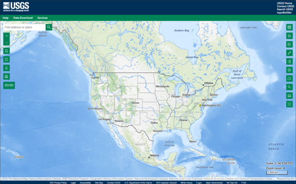
This is a screen shot of the National Map (TNM) 3D Viewer Application. This new application will replace the existing TNM Viewer on or around April 7th 2025
What is the difference between tiled and dynamic services?
A tiled service contains cached tiles that render the map in small tile images. This allows the map to perform much faster when panning and zooming, compared to a dynamic service.
Dynamic is considered an "older" way of displaying web maps, where each feature is called from the source data and drawn separately for every pan and zoom. Tiled base maps are cached from global scale to a scale of 1:9,000.
Related

Where can I find a list of URLs for The National Map services? Where can I find a list of URLs for The National Map services?
See The National Map Services for a complete list of map service URLs. That includes available REST, WMS, WMTS (cached base maps only), WFS, WCS, and other service links. Learn more: Training videos for The National Map Products and Services The National Map Applications

What map projections are used in The National Map tiled base map services and dynamic overlay services? What map projections are used in The National Map tiled base map services and dynamic overlay services?
The projection used for all tiled base map services in The National Map is the World Geodetic System 1984 (WGS 84) Web Mercator (Auxiliary Sphere) so that base map services can be used in combination with other common viewers. See Spatial Reference SR-ORG:6928 and Spatial Reference SR-ORG:7483. Dynamic overlay services are in WGS84 (see Spatial Reference EPSG:4326) but can be reprojected as needed...

How can I submit a question or report issues regarding The National Map products and services? How can I submit a question or report issues regarding The National Map products and services?
Submit questions about The National Map products or report issues to The National Map service desk at: tnm_help@usgs.gov

What sources were used for imagery in The National Map services? What sources were used for imagery in The National Map services?
Sources for orthoimagery in The National Map services: World view to 1:2,300,000 - NASA Blue Marble Next Generation (BMNG) 1:1,150,000 to 1:289,000 - A subset of the Global Land Survey 2000 (Landsat) Scales larger than 1:289,000 - primarily the National Agriculture Imagery Program (NAIP). The data is 1-meter pixel resolution flown during "leaf-on" conditions. Collection of NAIP imagery is...
The National Map 3D Viewer
This is a screen shot of the National Map (TNM) 3D Viewer Application. This new application will replace the existing TNM Viewer on or around April 7th 2025

National Map Service Endpoints
The image shows the National Map Service Endpoints website with Theme Overlays and Web Feature Services highlighted.
The image shows the National Map Service Endpoints website with Theme Overlays and Web Feature Services highlighted.

Using US Topo and Historic Topo Maps on your Mobile Device
Using US Topo and Historic Topo Maps on your Mobile DeviceLesson 6a: Using USGS US Topo and Historic Topographic Maps on your Mobile Device - This video demonstrates how to download and use US Topo and Historic Topographic maps on a mobile device.

PubTalk 11/2010 — Silicon, Software, and Science
Monitoring the Earth's Landscape with Low-Cost High-Tech
by Rian Bogle, Remote Sensing Specialist
Monitoring the Earth's Landscape with Low-Cost High-Tech
by Rian Bogle, Remote Sensing Specialist
Related
Where can I find a list of URLs for The National Map services? Where can I find a list of URLs for The National Map services?
See The National Map Services for a complete list of map service URLs. That includes available REST, WMS, WMTS (cached base maps only), WFS, WCS, and other service links. Learn more: Training videos for The National Map Products and Services The National Map Applications
What map projections are used in The National Map tiled base map services and dynamic overlay services? What map projections are used in The National Map tiled base map services and dynamic overlay services?
The projection used for all tiled base map services in The National Map is the World Geodetic System 1984 (WGS 84) Web Mercator (Auxiliary Sphere) so that base map services can be used in combination with other common viewers. See Spatial Reference SR-ORG:6928 and Spatial Reference SR-ORG:7483. Dynamic overlay services are in WGS84 (see Spatial Reference EPSG:4326) but can be reprojected as needed...
How can I submit a question or report issues regarding The National Map products and services? How can I submit a question or report issues regarding The National Map products and services?
Submit questions about The National Map products or report issues to The National Map service desk at: tnm_help@usgs.gov
What sources were used for imagery in The National Map services? What sources were used for imagery in The National Map services?
Sources for orthoimagery in The National Map services: World view to 1:2,300,000 - NASA Blue Marble Next Generation (BMNG) 1:1,150,000 to 1:289,000 - A subset of the Global Land Survey 2000 (Landsat) Scales larger than 1:289,000 - primarily the National Agriculture Imagery Program (NAIP). The data is 1-meter pixel resolution flown during "leaf-on" conditions. Collection of NAIP imagery is...
The National Map 3D Viewer
This is a screen shot of the National Map (TNM) 3D Viewer Application. This new application will replace the existing TNM Viewer on or around April 7th 2025
This is a screen shot of the National Map (TNM) 3D Viewer Application. This new application will replace the existing TNM Viewer on or around April 7th 2025
National Map Service Endpoints
The image shows the National Map Service Endpoints website with Theme Overlays and Web Feature Services highlighted.
The image shows the National Map Service Endpoints website with Theme Overlays and Web Feature Services highlighted.
Using US Topo and Historic Topo Maps on your Mobile Device
Using US Topo and Historic Topo Maps on your Mobile DeviceLesson 6a: Using USGS US Topo and Historic Topographic Maps on your Mobile Device - This video demonstrates how to download and use US Topo and Historic Topographic maps on a mobile device.
PubTalk 11/2010 — Silicon, Software, and Science
Monitoring the Earth's Landscape with Low-Cost High-Tech
by Rian Bogle, Remote Sensing Specialist
Monitoring the Earth's Landscape with Low-Cost High-Tech
by Rian Bogle, Remote Sensing Specialist
Updated Date: June 26, 2025