
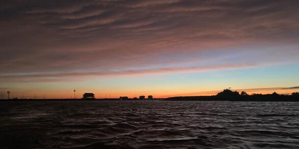
The map overview highlights the three basins involved in the monitoring project across southern New Jersey. The USGS gages listed are the nearest telemetry stations recording tidal elevation, specific conductance, and water temperature.
Saltwater Intrusion and Sea Level Rise Monitoring in New Jersey
Active
By New Jersey Water Science Center
January 8, 2026
Frequently, water withdrawals for public supply are made from the freshwater reaches of rivers and streams across new Jersey. Overall, there is a lack of scientific information describing the movement of saltwater upstream into the tributaries discharging into Delaware Bay. This project is beginning to collect water quality data along three selected tributaries in New Jersey to Delaware Bay in an effort to develop methods to relate specific conductance of the tributary waters to the upstream location of saltwater in the tributary. The location of the saltwater and freshwater interface is termed the saltfront. Estimating the location and movement of the saltfront in these tributaries will help the scientific community understand the water quality conditions in these areas. This project is funded by the Next Generation Water Observing System (NGWOS).
Next Generation Water Observing System (NGWOS)
Next Generation Water Observing System (NGWOS)

Substantial advances in water science, together with emerging breakthroughs in technical and computational capabilities, have led the USGS to develop a Next Generation Water Observing System (NGWOS). The USGS NGWOS will provide real-time data on water quantity and quality in more affordable and rapid ways than previously possible, and in more locations.
New Jersey Tide Network
New Jersey Tide Network
The New Jersey Water Science Center monitors data for estuary and back-bay areas all along the New Jersey coast and links to related projects with more information about coastal flood hazards, water quality, and other topics.
Overview
The Delaware River Basin provides drinking water to 15 million people in the surrounding area. Water is frequently withdrawn from the freshwater reaches of streams, above head of tide, in the Delaware River Basin for use as public drinking water. During extended periods of low flow, saltwater can move upstream, which can threaten drinking-water supplies in the basin. Due to spatial patterns in bathymetry, tidal influences within the Delaware River Basin, and varying weather conditions, it can be hard to predict the movement and upstream extent of the freshwater-saltwater interface, often defined as the salt-front. Although there is a relationship that predicts this location in the main stem of the Delaware River, there lacks a relationship for its tributaries, such as the Maurice and Cohansey Rivers in southwestern New Jersey. In this study, a relationship was developed between daily specific conductance (SC) at gage locations along the tidal river reaches of the Maurice and Cohansey Rivers to the daily upstream location of the salt-front. The study augmented existing real-time tide gage data with the collection of water temperature and specific conductance data to develop the relationship. Additionally, longitudinal profiles upstream of the selected tide gages were conducted during a range of high tide conditions to define the location of the salt-front. Equations were then developed that related the daily SC measured at the tide gage to the upstream location of the salt-front. The equations were used to estimate the daily upstream location of the salt-front for the period of July 15, 2021, to July 15, 2024. This work can aid in understanding the propagation of saltwater upstream, which can affect local communities and crop farmers along these tidal reaches of the Delaware River Basin.
The Study Area
The study area included the tidally influenced reaches of the Maurice and Cohansey Rivers, which are both tributaries to the Delaware Bay and located on the southwestern portion of the New Jersey coastline. Two tide gages along these rivers, the Maurice River at Bivalve, New Jersey (NJ) (USGS site no. 01412150) and the Cohansey River at Greenwich, NJ (USGS site no. 01413038), both located in Cumberland County, were preexisting as part of the USGS New Jersey Tide Network. This study leveraged the existing tide gage infrastructure to expand data collection to include SC with water temperature for the purpose of developing methods to estimate the location of the salt-front using the daily-average value of SC. The existing tide gage at the Maurice River at Bivalve, NJ, is located about 2.3 RMs above the mouth of the Maurice River whereas the Cohansey River at Greenwich, NJ tide gage is located about 3.9 RMs above the mouth of the Cohansey River. Both of these tide gages are located close enough to the confluence (the area where bodies of water join) with the Delaware Bay that the daily concentrations of SC are high, ranging from 3,000–37,000 µS/cm. The Maurice and Cohansey Rivers are tributaries to the Delaware Bay that allow saltwater fluctuations from the Bay to encroach upstream from the mouth during normal tidal cycles. The variability of salinity concentrations in these tributaries is linked to saltwater conditions in the bay.
A new gage was installed—Maurice River at Mauricetown, NJ (USGS site no. 01412130), approximately 10.8 RMs above the mouth of the Maurice River, to collect SC data further upstream where the SC was lower (200–29,000 µS/cm) than Bivalve which contains the defined salt-front, as well as to provide higher spatial resolution of SC data for developing a relationship between gage daily-average SC values with the salt-front location. A suitable location for an additional gage along the Cohansey River could not be determined, so the study relies on the SC data collected at the Greenwich tide gage to develop methods for estimating the location of the salt-front in the Cohansey River.
Real-time tide elevation, water temperature, and water conductivity data are available on National Water Information System (NWIS) and Current Condition Streamflow pages:
USGS 01412150 Maurice River at Bivalve NJ
USGS 01413038 Cohansey River at Greenwich NJ
USGS 01412130 Maurice River at Mauricetown NJ
Media

Sources/Usage: Public Domain. View Media Details
USGS Current Conditions for New Jersey: Streamflow
The salt-front was recorded at the location where the average SC concentration of three depths in the thalweg (a line connecting the deepest points along the stream channel) of the river was equal to 1,100 µS/cm. To determine this location, in situ measurements of SC were required. Data collection was done at or near high-slack tide using a power boat and a calibrated multiparameter sonde to measure SC and water temperature at three depths at specific locations along the river until the salt-front location was found. The depths used to compute the average SC and water temperature reading were 80 percent, 50 percent, and 20 percent of the total depth of the water column at each cross-section. A total of 14 boat surveys were completed between October 2021–April 2024 on the Maurice River, and 12 boat surveys were completed between December 2021–January 2024 on the Cohansey River, targeting a field-survey schedule of every 8 weeks per tributary. A relationship was then developed by fitting a curve to the daily average SC at the gage and the upstream location of the salt-front.
This research provides scientific information that describes the potential risk to drink-water intakes from saltwater. Understanding the movement of saltwater in tributaries also provides a tool to help protect freshwater habitats from saltwater intrusion and helps local communities and crop farmers build resiliency against sea level rise and storm surge.
Media

The multiparameter sonde is housed in a gray PVC pipe and co-located at a Tide Telemetry Gage at USGS 01413038 -Cohansey River at Greenwich NJ. Similarly, the Bivalve and Maureicetown Telemetry Gages are installed the same way.
Sources/Usage: Public Domain. View Media Details
Media

Multiparameter sonde used to measure water temperature and specific conductance at each Telemetry Gage location. The sonde is hard-wired into the gage and provides real-time timeseries data.
Sources/Usage: Public Domain. View Media Details

Next Generation Water Observing System (NGWOS)
The Next Generation Water Observing System (NGWOS) supports water availability assessments, management, and prediction by enhancing water observations in basins that represent major U.S. hydrologic regions. NGWOS provides high-resolution, real-time data on water quantity, quality, and use, as well as advance the development and application of new sensor technologies and remote sensing methods.

Study Basin Map
The map overview highlights the three basins involved in the monitoring project across southern New Jersey. The USGS gages listed are the nearest telemetry stations recording tidal elevation, specific conductance, and water temperature.

Maurice River Cross Sections
An example of a Maurice River longitudinal profile survey on 6/30/2022. The average specific conductivity is shown at each cross-section. The transects help demonstrate the relationship between specific conductivity and distance upstream from the mouth of the Maurice River.
An example of a Maurice River longitudinal profile survey on 6/30/2022. The average specific conductivity is shown at each cross-section. The transects help demonstrate the relationship between specific conductivity and distance upstream from the mouth of the Maurice River.

Sonde Sensor
Multiparameter sonde used to measure water temperature and specific conductance at each Telemetry Gage location. The sonde is hard-wired into the gage and provides real-time timeseries data.
Multiparameter sonde used to measure water temperature and specific conductance at each Telemetry Gage location. The sonde is hard-wired into the gage and provides real-time timeseries data.

Greenwich Housing
The multiparameter sonde is housed in a gray PVC pipe and co-located at a Tide Telemetry Gage at USGS 01413038 -Cohansey River at Greenwich NJ.
The multiparameter sonde is housed in a gray PVC pipe and co-located at a Tide Telemetry Gage at USGS 01413038 -Cohansey River at Greenwich NJ.
Frequently, water withdrawals for public supply are made from the freshwater reaches of rivers and streams across new Jersey. Overall, there is a lack of scientific information describing the movement of saltwater upstream into the tributaries discharging into Delaware Bay. This project is beginning to collect water quality data along three selected tributaries in New Jersey to Delaware Bay in an effort to develop methods to relate specific conductance of the tributary waters to the upstream location of saltwater in the tributary. The location of the saltwater and freshwater interface is termed the saltfront. Estimating the location and movement of the saltfront in these tributaries will help the scientific community understand the water quality conditions in these areas. This project is funded by the Next Generation Water Observing System (NGWOS).
Next Generation Water Observing System (NGWOS)
Next Generation Water Observing System (NGWOS)
Substantial advances in water science, together with emerging breakthroughs in technical and computational capabilities, have led the USGS to develop a Next Generation Water Observing System (NGWOS). The USGS NGWOS will provide real-time data on water quantity and quality in more affordable and rapid ways than previously possible, and in more locations.
New Jersey Tide Network
New Jersey Tide Network
The New Jersey Water Science Center monitors data for estuary and back-bay areas all along the New Jersey coast and links to related projects with more information about coastal flood hazards, water quality, and other topics.
Overview
The Delaware River Basin provides drinking water to 15 million people in the surrounding area. Water is frequently withdrawn from the freshwater reaches of streams, above head of tide, in the Delaware River Basin for use as public drinking water. During extended periods of low flow, saltwater can move upstream, which can threaten drinking-water supplies in the basin. Due to spatial patterns in bathymetry, tidal influences within the Delaware River Basin, and varying weather conditions, it can be hard to predict the movement and upstream extent of the freshwater-saltwater interface, often defined as the salt-front. Although there is a relationship that predicts this location in the main stem of the Delaware River, there lacks a relationship for its tributaries, such as the Maurice and Cohansey Rivers in southwestern New Jersey. In this study, a relationship was developed between daily specific conductance (SC) at gage locations along the tidal river reaches of the Maurice and Cohansey Rivers to the daily upstream location of the salt-front. The study augmented existing real-time tide gage data with the collection of water temperature and specific conductance data to develop the relationship. Additionally, longitudinal profiles upstream of the selected tide gages were conducted during a range of high tide conditions to define the location of the salt-front. Equations were then developed that related the daily SC measured at the tide gage to the upstream location of the salt-front. The equations were used to estimate the daily upstream location of the salt-front for the period of July 15, 2021, to July 15, 2024. This work can aid in understanding the propagation of saltwater upstream, which can affect local communities and crop farmers along these tidal reaches of the Delaware River Basin.
The Study Area
The study area included the tidally influenced reaches of the Maurice and Cohansey Rivers, which are both tributaries to the Delaware Bay and located on the southwestern portion of the New Jersey coastline. Two tide gages along these rivers, the Maurice River at Bivalve, New Jersey (NJ) (USGS site no. 01412150) and the Cohansey River at Greenwich, NJ (USGS site no. 01413038), both located in Cumberland County, were preexisting as part of the USGS New Jersey Tide Network. This study leveraged the existing tide gage infrastructure to expand data collection to include SC with water temperature for the purpose of developing methods to estimate the location of the salt-front using the daily-average value of SC. The existing tide gage at the Maurice River at Bivalve, NJ, is located about 2.3 RMs above the mouth of the Maurice River whereas the Cohansey River at Greenwich, NJ tide gage is located about 3.9 RMs above the mouth of the Cohansey River. Both of these tide gages are located close enough to the confluence (the area where bodies of water join) with the Delaware Bay that the daily concentrations of SC are high, ranging from 3,000–37,000 µS/cm. The Maurice and Cohansey Rivers are tributaries to the Delaware Bay that allow saltwater fluctuations from the Bay to encroach upstream from the mouth during normal tidal cycles. The variability of salinity concentrations in these tributaries is linked to saltwater conditions in the bay.
A new gage was installed—Maurice River at Mauricetown, NJ (USGS site no. 01412130), approximately 10.8 RMs above the mouth of the Maurice River, to collect SC data further upstream where the SC was lower (200–29,000 µS/cm) than Bivalve which contains the defined salt-front, as well as to provide higher spatial resolution of SC data for developing a relationship between gage daily-average SC values with the salt-front location. A suitable location for an additional gage along the Cohansey River could not be determined, so the study relies on the SC data collected at the Greenwich tide gage to develop methods for estimating the location of the salt-front in the Cohansey River.
Real-time tide elevation, water temperature, and water conductivity data are available on National Water Information System (NWIS) and Current Condition Streamflow pages:
USGS 01412150 Maurice River at Bivalve NJ
USGS 01413038 Cohansey River at Greenwich NJ
USGS 01412130 Maurice River at Mauricetown NJ
Media
Sources/Usage: Public Domain. View Media Details
USGS Current Conditions for New Jersey: Streamflow
The salt-front was recorded at the location where the average SC concentration of three depths in the thalweg (a line connecting the deepest points along the stream channel) of the river was equal to 1,100 µS/cm. To determine this location, in situ measurements of SC were required. Data collection was done at or near high-slack tide using a power boat and a calibrated multiparameter sonde to measure SC and water temperature at three depths at specific locations along the river until the salt-front location was found. The depths used to compute the average SC and water temperature reading were 80 percent, 50 percent, and 20 percent of the total depth of the water column at each cross-section. A total of 14 boat surveys were completed between October 2021–April 2024 on the Maurice River, and 12 boat surveys were completed between December 2021–January 2024 on the Cohansey River, targeting a field-survey schedule of every 8 weeks per tributary. A relationship was then developed by fitting a curve to the daily average SC at the gage and the upstream location of the salt-front.
This research provides scientific information that describes the potential risk to drink-water intakes from saltwater. Understanding the movement of saltwater in tributaries also provides a tool to help protect freshwater habitats from saltwater intrusion and helps local communities and crop farmers build resiliency against sea level rise and storm surge.
Media
The multiparameter sonde is housed in a gray PVC pipe and co-located at a Tide Telemetry Gage at USGS 01413038 -Cohansey River at Greenwich NJ. Similarly, the Bivalve and Maureicetown Telemetry Gages are installed the same way.
Sources/Usage: Public Domain. View Media Details
Media
Multiparameter sonde used to measure water temperature and specific conductance at each Telemetry Gage location. The sonde is hard-wired into the gage and provides real-time timeseries data.
Sources/Usage: Public Domain. View Media Details
Next Generation Water Observing System (NGWOS)
The Next Generation Water Observing System (NGWOS) supports water availability assessments, management, and prediction by enhancing water observations in basins that represent major U.S. hydrologic regions. NGWOS provides high-resolution, real-time data on water quantity, quality, and use, as well as advance the development and application of new sensor technologies and remote sensing methods.
Study Basin Map
The map overview highlights the three basins involved in the monitoring project across southern New Jersey. The USGS gages listed are the nearest telemetry stations recording tidal elevation, specific conductance, and water temperature.
The map overview highlights the three basins involved in the monitoring project across southern New Jersey. The USGS gages listed are the nearest telemetry stations recording tidal elevation, specific conductance, and water temperature.
Maurice River Cross Sections
An example of a Maurice River longitudinal profile survey on 6/30/2022. The average specific conductivity is shown at each cross-section. The transects help demonstrate the relationship between specific conductivity and distance upstream from the mouth of the Maurice River.
An example of a Maurice River longitudinal profile survey on 6/30/2022. The average specific conductivity is shown at each cross-section. The transects help demonstrate the relationship between specific conductivity and distance upstream from the mouth of the Maurice River.
Sonde Sensor
Multiparameter sonde used to measure water temperature and specific conductance at each Telemetry Gage location. The sonde is hard-wired into the gage and provides real-time timeseries data.
Multiparameter sonde used to measure water temperature and specific conductance at each Telemetry Gage location. The sonde is hard-wired into the gage and provides real-time timeseries data.
Greenwich Housing
The multiparameter sonde is housed in a gray PVC pipe and co-located at a Tide Telemetry Gage at USGS 01413038 -Cohansey River at Greenwich NJ.
The multiparameter sonde is housed in a gray PVC pipe and co-located at a Tide Telemetry Gage at USGS 01413038 -Cohansey River at Greenwich NJ.