
The “Super Monitor”: Tracking Willamette River water quality in Portland
Nicknamed the ‘Super Monitor,’ this site has measured key water-quality values every 15 minutes since 2009.
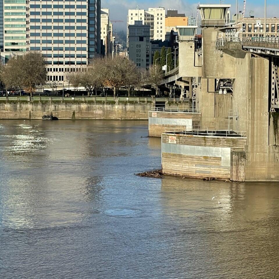
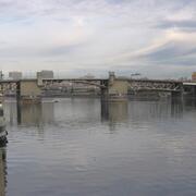
For more than a decade, the U.S. Geological Survey (USGS) has tracked water quality in the Willamette River at the Morrison Bridge. Installed in 2009, the site is nicknamed the “Super Monitor” because every 15 minutes it measures several water-quality values: water temperature, nitrate, calculated suspended sediment from turbidity data, and more. Initial funding came from a collaboration between the USGS, Portland State University, and the Center for Coastal Margin Observation & Prediction to monitor conditions in the Portland Harbor and Columbia Estuary.
Today this location is one of 110 stream and river sites in the USGS’s National Water Quality Network (NWQN). The NWQN collects long-term, consistent data on streamflow and water quality to track changes in the Nation’s rivers and streams. This information supports studies at local, regional, and national scales on issues such as drinking-water quality, chemical movement in the environment, and harmful algal blooms.
View the long-term trends from water-samples in the Willamette at Portland from.
The Importance of Long-Term Data
Long-term streamflow and water-quality data provide a baseline for understanding natural conditions, detecting trends, and evaluating the effects of human activities and climate. By tracking changes over years and decades, scientists can distinguish short-term fluctuations from meaningful patterns, inform resource management, guide policy decisions, and help protect aquatic ecosystems and public health.
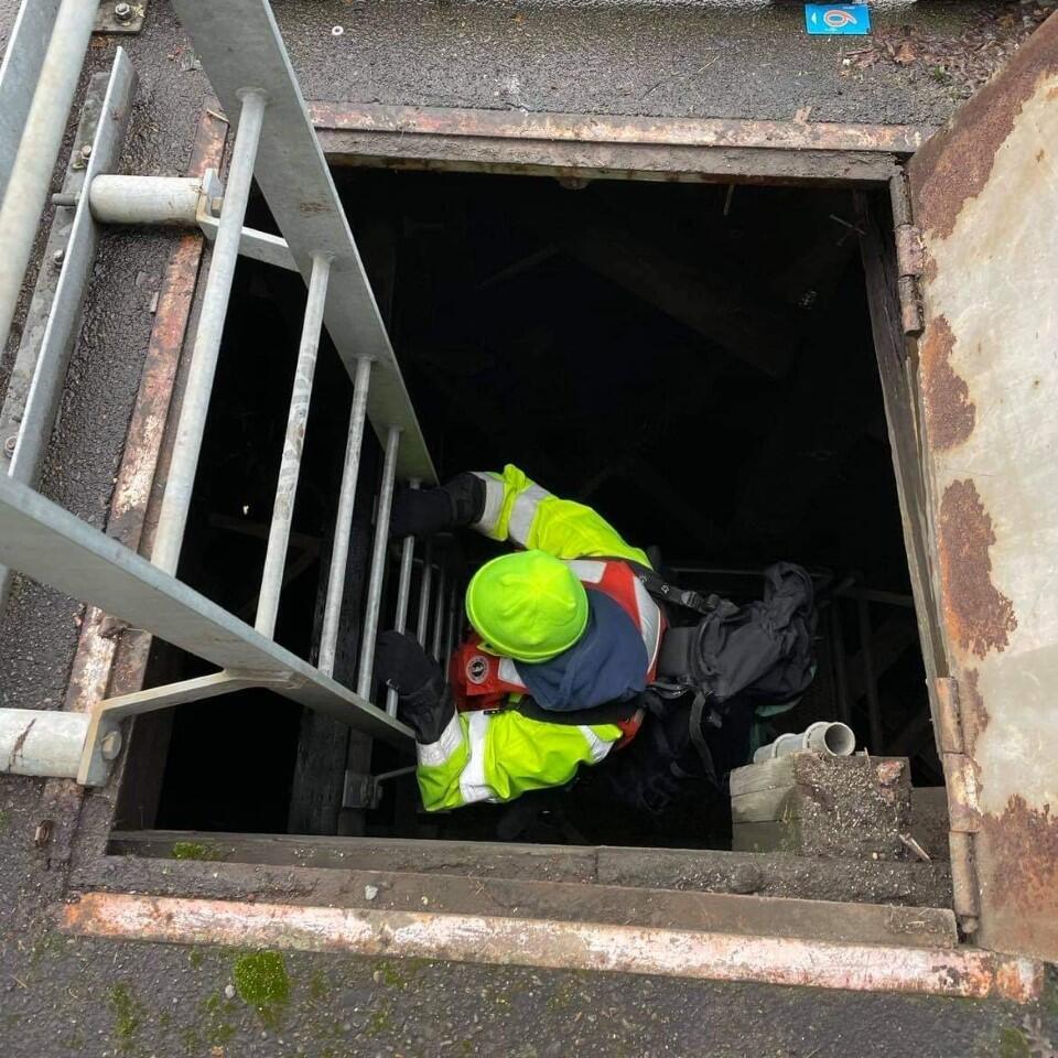
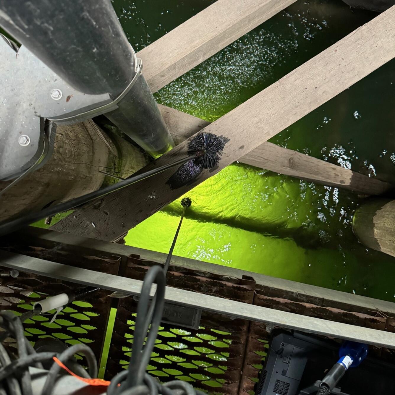
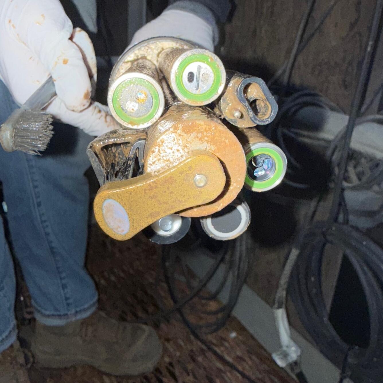
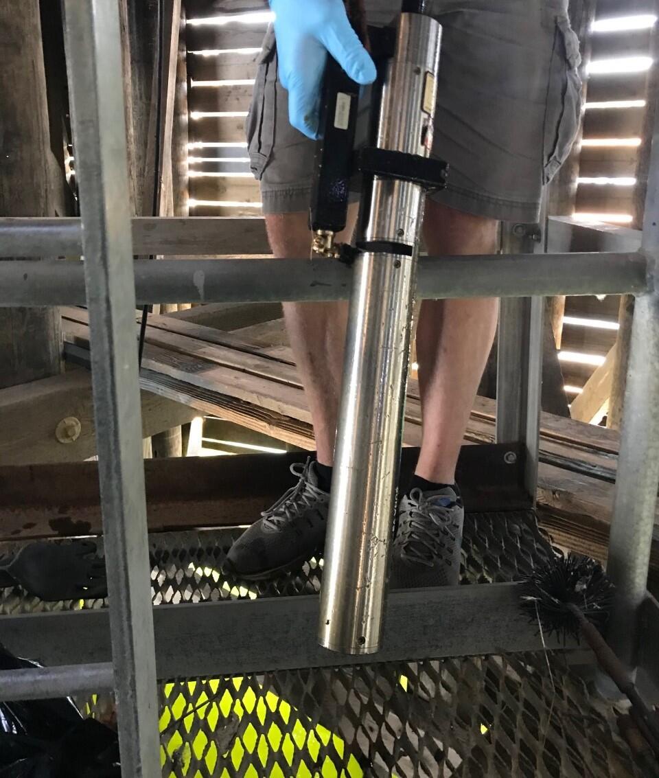
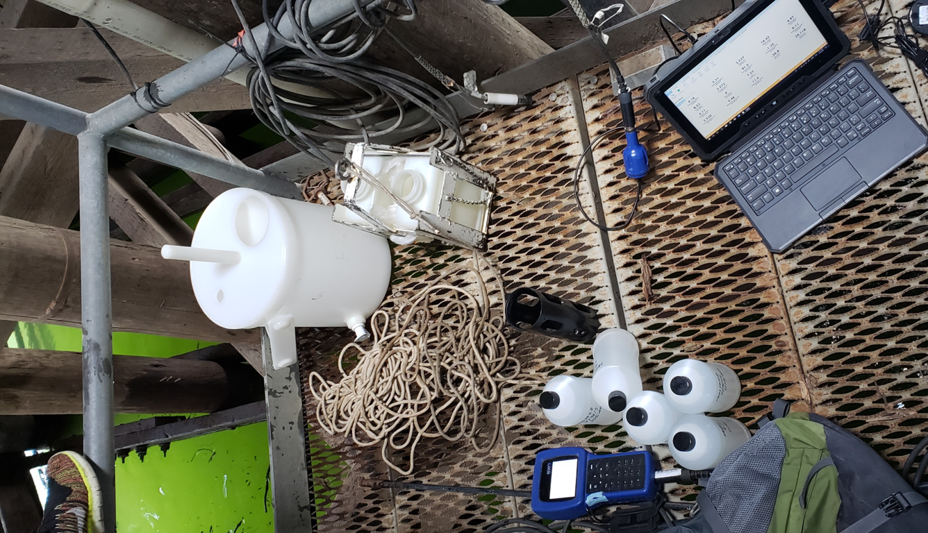
Behind the scenes of a water-quality monitor cleaning inspection
Why does each water-quality measurement matter?
Water temperature shapes aquatic life and water chemistry. Each fish, insect, and plant species thrive within a specific temperature range; too far outside it, they decline or disappear. Warmer water holds less dissolved oxygen, which can stress or kill sensitive species, and can make certain pollutants more toxic. Temperature also affects chemical reactions—speeding them up—and influences how minerals and gases dissolve, altering water quality.
Turbidity measures how clear or cloudy water is, caused by suspended particles such as silt, clay, algae, and organic matter. High turbidity reduces light penetration, affecting aquatic plant growth, habitat quality, and recreational use. It can also indicate increased sediment or pollutant loads. Monitoring turbidity helps track water-quality changes, understand sediment transport, and supports management of healthy aquatic ecosystems.
Suspended sediment refers to fine particles of soil, sand, and organic material carried in the water column. High concentrations can affect water clarity and habitat quality. The USGS estimates suspended sediment by relating turbidity measurements to sediment sample concentrations. Tracking suspended sediment helps assess erosion, sediment transport, and impacts on aquatic ecosystems and water supplies.
Specific conductance a measure of how well water conducts electrical current, reflects the amounts of dissolved ions – such as salts, minerals, and other charged particles in the water. High or low values can signal shifts in geology, land use, pollution, or mixing of different water sources like groundwater or surface runoff. Monitoring it helps scientists detect contamination, understand natural conditions, and interpret other water-quality measurements.
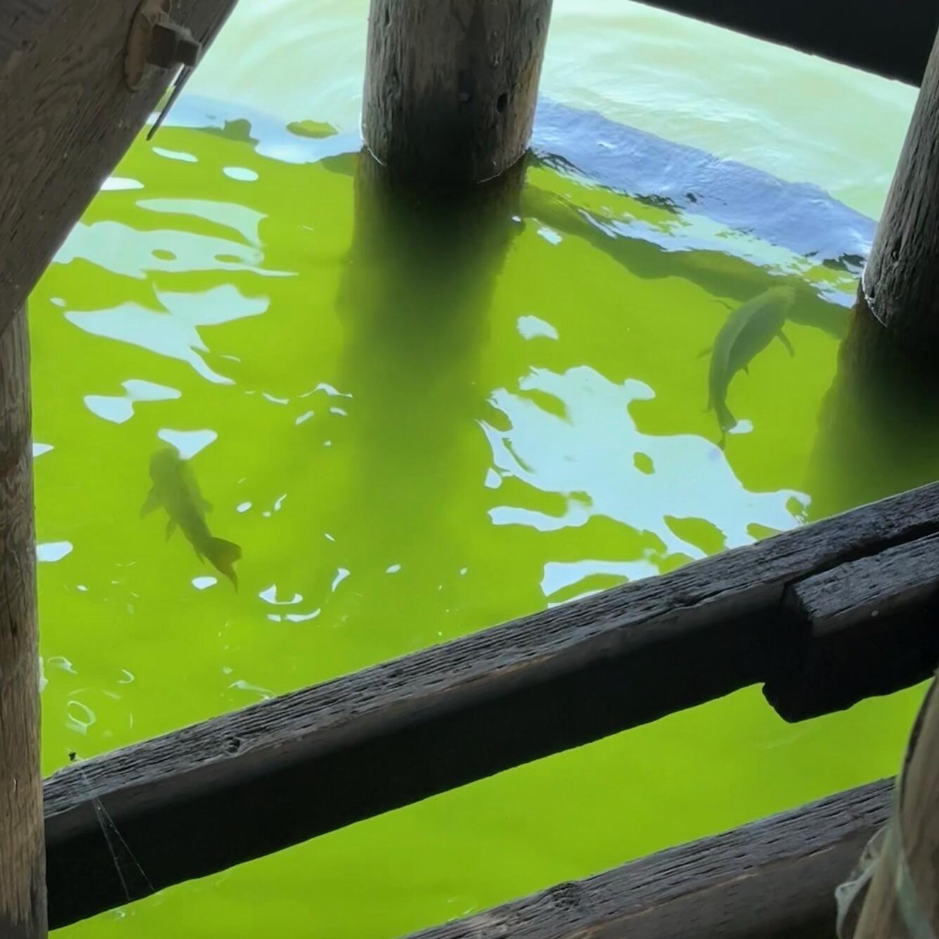
Chlorophyll is a green pigment found in algae and plants growing in the water. Chlorophyll is associated with beneficial phytoplankton, small organisms that photosynthesize and provide energy for aquatic food webs. Measuring chlorophyll helps scientists estimate the amounts of algae in the water, which is a key indicator of ecosystem productivity and nutrient levels. Elevated chlorophyll can signal excessive nutrient inputs that may lead to harmful algal blooms, while low levels may reflect limited food supply for aquatic life. Monitoring chlorophyll tracks water-quality changes, supports nutrient management, and protects aquatic habitats and drinking-water sources.
Phycocyanin is a pigment found in certain cyanobacteria (blue-green algae). Measuring phycocyanin helps scientists estimate the amount of cyanobacteria present, which is important because some species can produce toxins harmful to people, pets, and wildlife. Phycocyanin levels can change quickly with shifts in temperature, light, nutrient availability, or flow conditions. Monitoring phycocyanin can serve as an early warning for potential harmful algal blooms, and support water managers in protecting drinking-water supplies, recreation, and aquatic ecosystems.
pH is a measure of how acidic or basic water is, on a scale from 0 to 14, with 7 being neutral. It influences the health of aquatic life and the chemistry of many substances in water, including nutrients and metals. In rivers and lakes, pH can be affected by geology, precipitation, pollution, and biological activity. Values outside the natural range can stress or harm fish, invertebrates, and plants. Monitoring pH detects changes in water chemistry, helps assess ecosystem health, and supports water-quality standards that protect people and the environment.
Nitrate is a form of nitrogen that plants and algae use for growth. In rivers and lakes, nitrate comes from natural sources such as soil and decomposing plants, as well as human activities like agriculture, wastewater, and stormwater runoff. Elevated nitrate can fuel excessive algal growth, reduce oxygen levels, and harm aquatic life. In drinking water, high nitrate can pose health risks, especially for infants. Monitoring nitrate tracks nutrient pollution, supports water-quality standards, and helps manage healthy aquatic ecosystems.
Dissolved oxygen is the amount of oxygen available in water for fish, invertebrates, and other aquatic life. It comes from the atmosphere and from photosynthesis by aquatic plants and algae. Levels can change with water temperature, flow, time of day, and the amount of organic matter in the water. Too little dissolved oxygen can stress or kill aquatic organisms, while healthy levels are essential for a balanced ecosystem. Monitoring dissolved oxygen helps assess habitat quality, detect pollution impacts, and supports water-resource management.
Dissolved organic matter (DOM) consists of carbon-containing compounds from decaying plants, soils, and organic materials in water. It influences water chemistry, nutrient availability, and the growth of microorganisms. DOM can also affect drinking-water treatment by interacting with disinfectants and forming byproducts. Monitoring dissolved organic matter helps understand water-quality dynamics, tracks nutrient cycling, and supports management of healthy aquatic ecosystems.
Water-quality parameters collected at the USGS Willamette at Morrison (14211702) streamgage are primarily supported by appropriated funds from Congress. Continued collection of this long-term water-quality record depends upon availability of funding and program priorities. Users of this data are encouraged to stay informed about its availability and share how they use it to support scientific or management decisions.
Science web pages related to this data collection effort.
Measuring Willamette River streamflow in Portland

Willamette River Data Comes to Life Through Bridge Lighting
Nicknamed the ‘Super Monitor,’ this site has measured key water-quality values every 15 minutes since 2009.
For more than a decade, the U.S. Geological Survey (USGS) has tracked water quality in the Willamette River at the Morrison Bridge. Installed in 2009, the site is nicknamed the “Super Monitor” because every 15 minutes it measures several water-quality values: water temperature, nitrate, calculated suspended sediment from turbidity data, and more. Initial funding came from a collaboration between the USGS, Portland State University, and the Center for Coastal Margin Observation & Prediction to monitor conditions in the Portland Harbor and Columbia Estuary.
Today this location is one of 110 stream and river sites in the USGS’s National Water Quality Network (NWQN). The NWQN collects long-term, consistent data on streamflow and water quality to track changes in the Nation’s rivers and streams. This information supports studies at local, regional, and national scales on issues such as drinking-water quality, chemical movement in the environment, and harmful algal blooms.
View the long-term trends from water-samples in the Willamette at Portland from.
The Importance of Long-Term Data
Long-term streamflow and water-quality data provide a baseline for understanding natural conditions, detecting trends, and evaluating the effects of human activities and climate. By tracking changes over years and decades, scientists can distinguish short-term fluctuations from meaningful patterns, inform resource management, guide policy decisions, and help protect aquatic ecosystems and public health.
Behind the scenes of a water-quality monitor cleaning inspection
Why does each water-quality measurement matter?
Water temperature shapes aquatic life and water chemistry. Each fish, insect, and plant species thrive within a specific temperature range; too far outside it, they decline or disappear. Warmer water holds less dissolved oxygen, which can stress or kill sensitive species, and can make certain pollutants more toxic. Temperature also affects chemical reactions—speeding them up—and influences how minerals and gases dissolve, altering water quality.
Turbidity measures how clear or cloudy water is, caused by suspended particles such as silt, clay, algae, and organic matter. High turbidity reduces light penetration, affecting aquatic plant growth, habitat quality, and recreational use. It can also indicate increased sediment or pollutant loads. Monitoring turbidity helps track water-quality changes, understand sediment transport, and supports management of healthy aquatic ecosystems.
Suspended sediment refers to fine particles of soil, sand, and organic material carried in the water column. High concentrations can affect water clarity and habitat quality. The USGS estimates suspended sediment by relating turbidity measurements to sediment sample concentrations. Tracking suspended sediment helps assess erosion, sediment transport, and impacts on aquatic ecosystems and water supplies.
Specific conductance a measure of how well water conducts electrical current, reflects the amounts of dissolved ions – such as salts, minerals, and other charged particles in the water. High or low values can signal shifts in geology, land use, pollution, or mixing of different water sources like groundwater or surface runoff. Monitoring it helps scientists detect contamination, understand natural conditions, and interpret other water-quality measurements.
Chlorophyll is a green pigment found in algae and plants growing in the water. Chlorophyll is associated with beneficial phytoplankton, small organisms that photosynthesize and provide energy for aquatic food webs. Measuring chlorophyll helps scientists estimate the amounts of algae in the water, which is a key indicator of ecosystem productivity and nutrient levels. Elevated chlorophyll can signal excessive nutrient inputs that may lead to harmful algal blooms, while low levels may reflect limited food supply for aquatic life. Monitoring chlorophyll tracks water-quality changes, supports nutrient management, and protects aquatic habitats and drinking-water sources.
Phycocyanin is a pigment found in certain cyanobacteria (blue-green algae). Measuring phycocyanin helps scientists estimate the amount of cyanobacteria present, which is important because some species can produce toxins harmful to people, pets, and wildlife. Phycocyanin levels can change quickly with shifts in temperature, light, nutrient availability, or flow conditions. Monitoring phycocyanin can serve as an early warning for potential harmful algal blooms, and support water managers in protecting drinking-water supplies, recreation, and aquatic ecosystems.
pH is a measure of how acidic or basic water is, on a scale from 0 to 14, with 7 being neutral. It influences the health of aquatic life and the chemistry of many substances in water, including nutrients and metals. In rivers and lakes, pH can be affected by geology, precipitation, pollution, and biological activity. Values outside the natural range can stress or harm fish, invertebrates, and plants. Monitoring pH detects changes in water chemistry, helps assess ecosystem health, and supports water-quality standards that protect people and the environment.
Nitrate is a form of nitrogen that plants and algae use for growth. In rivers and lakes, nitrate comes from natural sources such as soil and decomposing plants, as well as human activities like agriculture, wastewater, and stormwater runoff. Elevated nitrate can fuel excessive algal growth, reduce oxygen levels, and harm aquatic life. In drinking water, high nitrate can pose health risks, especially for infants. Monitoring nitrate tracks nutrient pollution, supports water-quality standards, and helps manage healthy aquatic ecosystems.
Dissolved oxygen is the amount of oxygen available in water for fish, invertebrates, and other aquatic life. It comes from the atmosphere and from photosynthesis by aquatic plants and algae. Levels can change with water temperature, flow, time of day, and the amount of organic matter in the water. Too little dissolved oxygen can stress or kill aquatic organisms, while healthy levels are essential for a balanced ecosystem. Monitoring dissolved oxygen helps assess habitat quality, detect pollution impacts, and supports water-resource management.
Dissolved organic matter (DOM) consists of carbon-containing compounds from decaying plants, soils, and organic materials in water. It influences water chemistry, nutrient availability, and the growth of microorganisms. DOM can also affect drinking-water treatment by interacting with disinfectants and forming byproducts. Monitoring dissolved organic matter helps understand water-quality dynamics, tracks nutrient cycling, and supports management of healthy aquatic ecosystems.
Water-quality parameters collected at the USGS Willamette at Morrison (14211702) streamgage are primarily supported by appropriated funds from Congress. Continued collection of this long-term water-quality record depends upon availability of funding and program priorities. Users of this data are encouraged to stay informed about its availability and share how they use it to support scientific or management decisions.
Science web pages related to this data collection effort.
Measuring Willamette River streamflow in Portland