
Great Lakes Water Authority Detroit Regional Water Quality Monitoring Program
The Great Lakes Water Authority Detroit Regional Water Quality Monitoring Program provides current and accurate water quality data to track progress toward water quality standard milestones and document long-term trends.
Background
The Great Lakes Water Authority (GLWA) is a regional water authority that provides drinking water and sewer services for southeast Michigan communities. Lake Huron and the Detroit River serve as the primary sources of municipal drinking water provided by the GLWA. The GLWA services around 3.9 million customers located in Wayne, Oakland, and Macomb counties. In 2020, the GLWA developed a Wastewater Master Plan, in which they proposed developing a Regional Water Quality Monitoring Program (RWQMP) in cooperation with the USGS to collect both discrete and continuous real-time water quality data at a total of 23 sites in the Rouge, Clinton, and Detroit Rivers and Lake St Clair. Data collected in this study will benefit the GLWA by providing information needed to evaluate water quality, streamflow, and loading of nutrients, chloride, and sediment, and help support best management decisions for the source waters, rivers, and municipal water systems in southeast Michigan.
Continuous Water Quality Monitoring
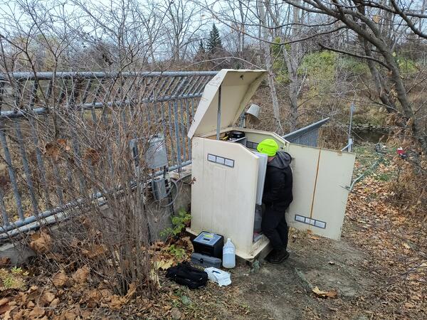
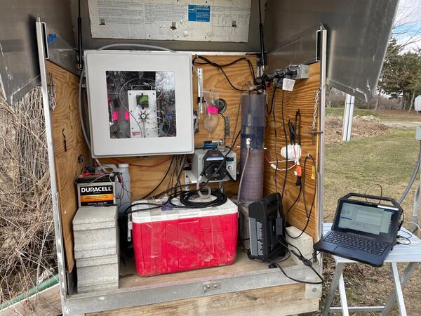
Current and accurate data on water quality in the Rouge River, Clinton River, This project utilizes deployed water quality sondes to collect temperature, dissolved oxygen, specific conductance, turbidity, and pH data every 15 minutes and in-situ nitrate and phosphate sensors to analyze samples every one to two hours. This data is available to the public in real time on our USGS Water Data For the Nation (WDFN) web page and is used in comparison with discrete water quality samples.
Monthly Sampling
Monthly, discrete water samples are analyzed at our lab (National Water Quality Lab (NWQL)) for nitrogen, phosphorus, chloride, and suspended sediment. Additionally, E. coli samples are collected and analyzed at our lab – Michigan Bacteriological Research Laboratory (MI-BaRL).
Discharge
The USGS has a long history of providing essential streamflow data at gages across the nation. This study utilizes both continuous discharge measurements every 15 minutes and monthly instantaneous discharge measurements. Discharge directly influences environmental characteristics, including sediment and chemical concentrations.
Hydrologic Imagery and Visualization and Information System (HIVIS)
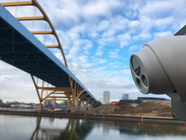
Cameras mounted on the exterior and interior of the gages are used to take photos and provide critical near real time information scientist need to address site conditions and troubleshooting of sensitive equipment. Time step photos are compiled into a video linked to the gage height hydrograph and are available for viewing at each unique sites’ USGS Water Data for the Nation (WDFN) web page.
Detroit River
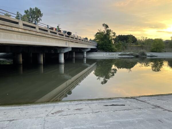
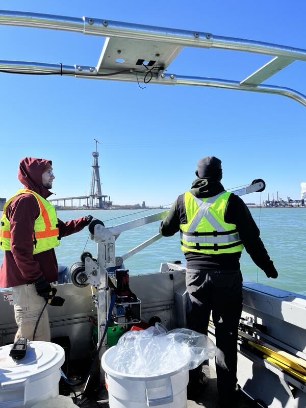
In cooperation with other studies monitoring and modeling the watershed, monthly discharge measurements and discrete water quality samples are collected at various points along the Detroit River.
Title
Project sites
The project has nine continuous water quality monitoring stations, and 12 stations that get monthly samples and continuous discharge measurements.
- 04161000 Clinton River at Auburn Hills
- 04161820 Clinton River at Sterling Heights
- 04162010 Red Run at Ryan Road Near Warren
- 04164151 N Branch Clinton R at 26 Mile NR Meade
- 04164500 North Branch Clinton River Near Mt. Clemens
- 04165500 Clinton River at Moravian Drive at Mt. Clemens
- 04166100 River Rouge at Southfield
- 04166300 Upper River Rouge at Farmington
- 04166500 River Rouge at Detroit
- 04166750 Middle River Rouge at Plymouth
- 04167625 Lower River Rouge at Wayne
- 04168400 Lower River Rouge at Dearborn
- 04168530 River Rouge at Allen Park
- 04165690 Detroit River at Grosse Point Park
- 04165701 Detroit River at Water Works Park at Detroit
- 04165705 Detroit River at Ralph Wilson Park
- 04165710 Detroit River at Fort Wayne at Detroit
- 04168557 Detroit River 1,250’ DS R. River at River Rouge
The Great Lakes Water Authority Detroit Regional Water Quality Monitoring Program provides current and accurate water quality data to track progress toward water quality standard milestones and document long-term trends.
Background
The Great Lakes Water Authority (GLWA) is a regional water authority that provides drinking water and sewer services for southeast Michigan communities. Lake Huron and the Detroit River serve as the primary sources of municipal drinking water provided by the GLWA. The GLWA services around 3.9 million customers located in Wayne, Oakland, and Macomb counties. In 2020, the GLWA developed a Wastewater Master Plan, in which they proposed developing a Regional Water Quality Monitoring Program (RWQMP) in cooperation with the USGS to collect both discrete and continuous real-time water quality data at a total of 23 sites in the Rouge, Clinton, and Detroit Rivers and Lake St Clair. Data collected in this study will benefit the GLWA by providing information needed to evaluate water quality, streamflow, and loading of nutrients, chloride, and sediment, and help support best management decisions for the source waters, rivers, and municipal water systems in southeast Michigan.
Continuous Water Quality Monitoring
Current and accurate data on water quality in the Rouge River, Clinton River, This project utilizes deployed water quality sondes to collect temperature, dissolved oxygen, specific conductance, turbidity, and pH data every 15 minutes and in-situ nitrate and phosphate sensors to analyze samples every one to two hours. This data is available to the public in real time on our USGS Water Data For the Nation (WDFN) web page and is used in comparison with discrete water quality samples.
Monthly Sampling
Monthly, discrete water samples are analyzed at our lab (National Water Quality Lab (NWQL)) for nitrogen, phosphorus, chloride, and suspended sediment. Additionally, E. coli samples are collected and analyzed at our lab – Michigan Bacteriological Research Laboratory (MI-BaRL).
Discharge
The USGS has a long history of providing essential streamflow data at gages across the nation. This study utilizes both continuous discharge measurements every 15 minutes and monthly instantaneous discharge measurements. Discharge directly influences environmental characteristics, including sediment and chemical concentrations.
Hydrologic Imagery and Visualization and Information System (HIVIS)
Cameras mounted on the exterior and interior of the gages are used to take photos and provide critical near real time information scientist need to address site conditions and troubleshooting of sensitive equipment. Time step photos are compiled into a video linked to the gage height hydrograph and are available for viewing at each unique sites’ USGS Water Data for the Nation (WDFN) web page.
Detroit River
In cooperation with other studies monitoring and modeling the watershed, monthly discharge measurements and discrete water quality samples are collected at various points along the Detroit River.
Title
Project sites
The project has nine continuous water quality monitoring stations, and 12 stations that get monthly samples and continuous discharge measurements.
- 04161000 Clinton River at Auburn Hills
- 04161820 Clinton River at Sterling Heights
- 04162010 Red Run at Ryan Road Near Warren
- 04164151 N Branch Clinton R at 26 Mile NR Meade
- 04164500 North Branch Clinton River Near Mt. Clemens
- 04165500 Clinton River at Moravian Drive at Mt. Clemens
- 04166100 River Rouge at Southfield
- 04166300 Upper River Rouge at Farmington
- 04166500 River Rouge at Detroit
- 04166750 Middle River Rouge at Plymouth
- 04167625 Lower River Rouge at Wayne
- 04168400 Lower River Rouge at Dearborn
- 04168530 River Rouge at Allen Park
- 04165690 Detroit River at Grosse Point Park
- 04165701 Detroit River at Water Works Park at Detroit
- 04165705 Detroit River at Ralph Wilson Park
- 04165710 Detroit River at Fort Wayne at Detroit
- 04168557 Detroit River 1,250’ DS R. River at River Rouge