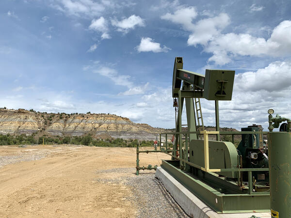
A pumpjack on an active oil or gas drilling site in New Mexico
A pumpjack on an active oil or gas drilling site in New MexicoA pumpjack on an active oil or gas drilling site near Farmington, New Mexico. Photo by Mike Duniway, USGS, SBSC.

Official websites use .gov
A .gov website belongs to an official government organization in the United States.
Secure .gov websites use HTTPS
A lock () or https:// means you’ve safely connected to the .gov website. Share sensitive information only on official, secure websites.
Associated (or associated-dissolved) gas is natural gas that is produced along with crude oil, and typically separated from the oil at the wellhead. In contrast, non-associated gas is produced from a well in conventional gas fields that do not produce crude oil.
There is also a third category of natural gas production, continuous (or unconventional) gas, that occurs as basin-centered gas, coal-bed gas, shale gas, fractured-reservoir gas, and tight-reservoir gas.
Learn More:

This question cannot be answered clearly because the methods used by those organizations to estimate oil and gas resource volumes are often not publicly available to compare step-by-step. One common reason different organizations get different results is based on what the assessments include. USGS estimates are for undiscovered, technically recoverable oil and gas resources. The USGS does not...

The USGS regularly re-examines our assessments to see if updated information warrants a reassessment. Sometimes more information is available either from USGS research or industry production, and the USGS decides to conduct a new assessment. Learn more: USGS Energy Assessments

USGS oil and gas assessments are for technically recoverable resources, meaning they can be produced using today’s technology and standard industry practices. However, our assessments do not look at what infrastructure would be required to produce these resources, nor does it look at whether it would be profitable to produce them. In addition, USGS assessments are for undiscovered resources, which...

Oil and gas estimates always involve some amounts of uncertainty. To account for this, the USGS presents its assessments of oil and gas potential in the form of a range based on how certain we are that this amount of oil and gas exist. The USGS uses a statistically based process (or model) to calculate the likely range of its estimates. The range of values extends from a 5% or greater likelihood...

“ Reserves” are quantities of oil and gas that are already discovered, recoverable, and commercial. Domestic reserves are tracked by the U.S. Energy Information Administration. The USGS assesses “undiscovered, technically recoverable resources,” which are those that are estimated to exist based on geologic knowledge and theory. Learn more: USGS Energy Resource Assessments
A pumpjack on an active oil or gas drilling site near Farmington, New Mexico. Photo by Mike Duniway, USGS, SBSC.
A pumpjack on an active oil or gas drilling site near Farmington, New Mexico. Photo by Mike Duniway, USGS, SBSC.

Water truck in background is providing maintenance water to a producing well drilled in the Bakken Formation near Williston, North Dakota.
Water truck in background is providing maintenance water to a producing well drilled in the Bakken Formation near Williston, North Dakota.

The Nation relies on oil and gas to power its economy, and unconventional gas is the fastest-growing energy resource in the United States. The U.S. Geological Survey is the authoritative, unbiased source for assessments of the world's oil and gas endowment. Come learn how these exciting new energy resources may contribute to the energy mix.
The Nation relies on oil and gas to power its economy, and unconventional gas is the fastest-growing energy resource in the United States. The U.S. Geological Survey is the authoritative, unbiased source for assessments of the world's oil and gas endowment. Come learn how these exciting new energy resources may contribute to the energy mix.

A drill rig at the Mount Elbert test site in Alaska's North Slope, just west of Prudhoe Bay. USGS joined BP Exploration (Alaska) and the U.S. Department of Energy to drill a test well to study natural gas production from gas hydrate deposits. Read more about the Mt.
A drill rig at the Mount Elbert test site in Alaska's North Slope, just west of Prudhoe Bay. USGS joined BP Exploration (Alaska) and the U.S. Department of Energy to drill a test well to study natural gas production from gas hydrate deposits. Read more about the Mt.

Test drilling in North Canadian River Valley, Canadian County, Oklahoma; Photograph by C.R. Frazier. A new length of drill-pipe is being raised into position so that hole can be deepened.
Test drilling in North Canadian River Valley, Canadian County, Oklahoma; Photograph by C.R. Frazier. A new length of drill-pipe is being raised into position so that hole can be deepened.
This question cannot be answered clearly because the methods used by those organizations to estimate oil and gas resource volumes are often not publicly available to compare step-by-step. One common reason different organizations get different results is based on what the assessments include. USGS estimates are for undiscovered, technically recoverable oil and gas resources. The USGS does not...
The USGS regularly re-examines our assessments to see if updated information warrants a reassessment. Sometimes more information is available either from USGS research or industry production, and the USGS decides to conduct a new assessment. Learn more: USGS Energy Assessments
USGS oil and gas assessments are for technically recoverable resources, meaning they can be produced using today’s technology and standard industry practices. However, our assessments do not look at what infrastructure would be required to produce these resources, nor does it look at whether it would be profitable to produce them. In addition, USGS assessments are for undiscovered resources, which...
Oil and gas estimates always involve some amounts of uncertainty. To account for this, the USGS presents its assessments of oil and gas potential in the form of a range based on how certain we are that this amount of oil and gas exist. The USGS uses a statistically based process (or model) to calculate the likely range of its estimates. The range of values extends from a 5% or greater likelihood...
“ Reserves” are quantities of oil and gas that are already discovered, recoverable, and commercial. Domestic reserves are tracked by the U.S. Energy Information Administration. The USGS assesses “undiscovered, technically recoverable resources,” which are those that are estimated to exist based on geologic knowledge and theory. Learn more: USGS Energy Resource Assessments
A pumpjack on an active oil or gas drilling site near Farmington, New Mexico. Photo by Mike Duniway, USGS, SBSC.
A pumpjack on an active oil or gas drilling site near Farmington, New Mexico. Photo by Mike Duniway, USGS, SBSC.
Water truck in background is providing maintenance water to a producing well drilled in the Bakken Formation near Williston, North Dakota.
Water truck in background is providing maintenance water to a producing well drilled in the Bakken Formation near Williston, North Dakota.
The Nation relies on oil and gas to power its economy, and unconventional gas is the fastest-growing energy resource in the United States. The U.S. Geological Survey is the authoritative, unbiased source for assessments of the world's oil and gas endowment. Come learn how these exciting new energy resources may contribute to the energy mix.
The Nation relies on oil and gas to power its economy, and unconventional gas is the fastest-growing energy resource in the United States. The U.S. Geological Survey is the authoritative, unbiased source for assessments of the world's oil and gas endowment. Come learn how these exciting new energy resources may contribute to the energy mix.
A drill rig at the Mount Elbert test site in Alaska's North Slope, just west of Prudhoe Bay. USGS joined BP Exploration (Alaska) and the U.S. Department of Energy to drill a test well to study natural gas production from gas hydrate deposits. Read more about the Mt.
A drill rig at the Mount Elbert test site in Alaska's North Slope, just west of Prudhoe Bay. USGS joined BP Exploration (Alaska) and the U.S. Department of Energy to drill a test well to study natural gas production from gas hydrate deposits. Read more about the Mt.
Test drilling in North Canadian River Valley, Canadian County, Oklahoma; Photograph by C.R. Frazier. A new length of drill-pipe is being raised into position so that hole can be deepened.
Test drilling in North Canadian River Valley, Canadian County, Oklahoma; Photograph by C.R. Frazier. A new length of drill-pipe is being raised into position so that hole can be deepened.