
Tsunami Study in American Samoa

Detailed Description
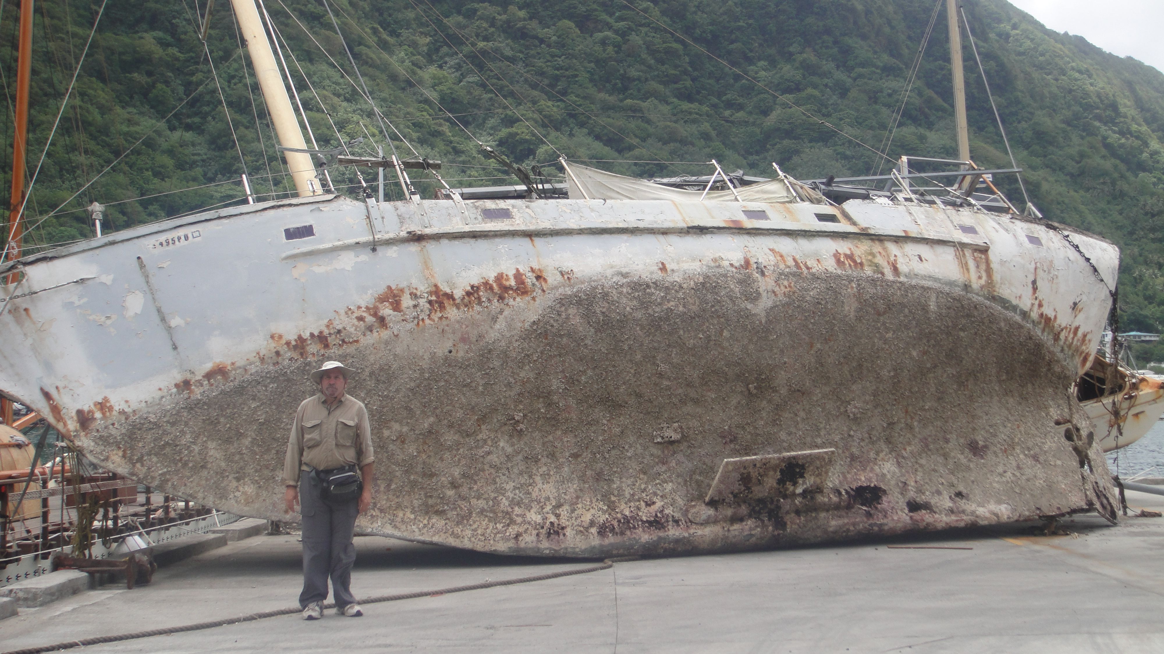
USGS oceanographer Bruce Jaffe standing next to a boat thrown ashore in Pago Pago, American Samoa by the tsunami that hit the island on Sept. 29, 2009.
Sources/Usage
Public Domain.
Related

Tsunami Field Studies
Our tsunami scientists work on international teams to study the aftermath of tsunamis around the world, to gain a better understanding the impact of potential tsunamis on coastal communities of the United States. Their work helps inform local, state, and federal coastal planning, protection, and resiliency.

USGS Scientists in Samoa and American Samoa Studying Impacts of Tsunami in 2009
On September 29, 2009, an M 8.1 earthquake in the Samoa Islands region of the South Pacific Ocean caused a tsunami that resulted in 100's of lost lives. A rapid-response team of USGS scientists traveled to the Samoa Islands in October-November 2009 to collect time-sensitive data that would have been quickly degraded or destroyed by recovery activity and natural processes.
Related
Tsunami Field Studies
Our tsunami scientists work on international teams to study the aftermath of tsunamis around the world, to gain a better understanding the impact of potential tsunamis on coastal communities of the United States. Their work helps inform local, state, and federal coastal planning, protection, and resiliency.
USGS Scientists in Samoa and American Samoa Studying Impacts of Tsunami in 2009
On September 29, 2009, an M 8.1 earthquake in the Samoa Islands region of the South Pacific Ocean caused a tsunami that resulted in 100's of lost lives. A rapid-response team of USGS scientists traveled to the Samoa Islands in October-November 2009 to collect time-sensitive data that would have been quickly degraded or destroyed by recovery activity and natural processes.