
February 13, 2019 - New Landsat Level-3 Products Released
The USGS has developed research-quality, applications-ready, Landsat Level-3 Science Products that are now available for download from EarthExplorer. These products will reduce the amount of time users spend on data processing and provide research-quality, applications-ready information on burned areas, surface water extent and snow cover.
Return to all Landsat Headlines
The Landsat Burned Area algorithm is designed to identify burned areas in all ecosystems (e.g. forest, shrubland, and grassland), the Dynamic Surface Water Extent algorithm produces images that represent surface water inundation for each pixel, and the Landsat Fractional Snow Covered Area algorithm produces per-pixel snow cover fraction maps.
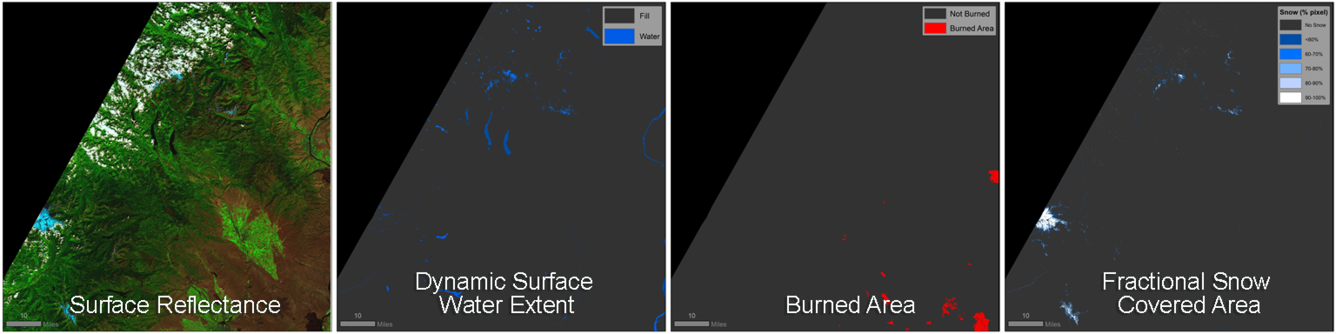
All three products are generated from U.S. Landsat 4-8 Analysis Ready Data inputs collected from the Landsat Thematic Mapper (TM), Enhanced Thematic Mapper Plus (ETM+), and Operational Land Imager (OLI)/Thermal Infrared Sensor (TIRS) instruments from 1982 to 2017 (Dynamic Surface Water Extent is available 1982 to present). This 36+ year record at 30-meter spatial resolution allows for the discrimination and study of natural and human-induced changes to the Earth’s land surface.
Download these new products from EarthExplorer or visit the Landsat Science Products webpage for more information.