



Landsat Science Team Meeting — October 27-29, 2026
The 2026-2030 Landsat Science Team met October 27-29, 2026, at the USGS National Center in Reston, Virginia.
Return to Landsat Science Team Meetings
Media
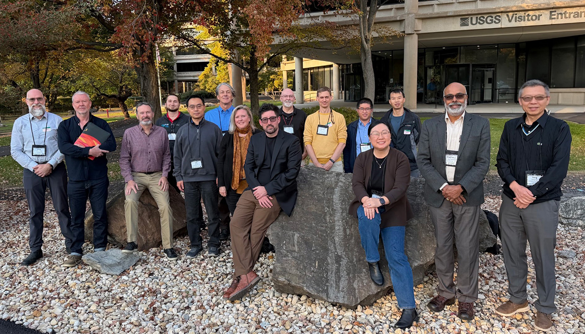
Sources/Usage: Public Domain. View Media Details
Meeting Objectives
- Review progress on 2026–2030 Landsat Science Team activities.
- Update the Landsat Science Team on USGS and NASA priorities and program status.
- Communicate status of key Landsat activities.
- Provide a venue for team members to provide insights to USGS and NASA concerning the Landsat mission.
Tuesday, October 27, 2026
- Welcome and Kickoff
- Welcome (Daniel Opstal, USGS)
- Meeting Objectives, Agenda and Ground Rules (Terry Sohl, USGS; Chris Neigh, NASA; David Roy, Michigan State University)
- USGS Director's Remarks (Ned Mamula, USGS Director)
- USGS and NASA Program Perspectives (Tim Newman, USGS; Nima Pahlevan, NASA)
- Status Updates
- Landsat 10 Project Status and Product Plans (Brian Sauer, USGS; Ross Henry, NASA; Chris Crawford, USGS; Chris Neigh, NASA)
- Landsat 8 and Landsat 9 Status Report (Joe Blahovec, USGS)
- Landsat and NASA Harmonized Landsat and Sentinel-2 (HLS) Data Updates
- HLS Updates (Chris Neigh, NASA)
- HLS Validation (Amit Angel, NASA)
- Status of LP DAAC Supported Missions, Datasets, and Services with a Focus on HLS (Cole Krehbiel, USGS)
- Landsat Sensor Updates
- Landsat 10: Landsat Instrument Suite (LandIS) Overview (Matt Montanaro, NASA)
- Landsat 10: Proxy Data Development Using the Digital Imaging and Remote Sensing Image Generation (DIRSIG) Software Engine (Aaron Gerace, Rochester Institute of Technology)
- Landsat Radiometry (Esad Micijevic, USGS)
- Landsat Geometry (Mike Choate, USGS)
- Landsat Level-2 Product Validation (Jeff Irwin, USGS)
- Joint Agency Commercial Imagery Evaluation (JACIE) Collaboration Activities (Cody Anderson, USGS)
- Funded Team Member Presentations
- Progress Towards Next-Generation Snow Cover Mapping and Establishment of a Long-Term Ground Validation Site (Lucas Zeller, Liedos; Ned Bair, Liedos)
- Optimal Estimation for Landsat: Physics-Based Surface Reflectance with Calibrated Uncertainty for 8, 9, and 10 (Nimrod Carmon, UCLA)
- Landsat 10 Continuity and Fractional Cover Modeling (Phillip Dennison, University of Utah)
- Harmonizing Inland and Coastal Water Quality Monitoring from the Landsat Program: AQUAVERSE Atmospheric Correction Validation (Ryan O’Shea, SSAI)
- Advancing Field-Scale Evapotranspiration Mapping Through Multi-Satellite Observations (Yun Yang, Cornell University)
- Using Landsat 8/9 Operational Land Imager (OLI) Data to Improve the Geometry of the Landsat 1–5 MSS L1TP Archive, and Some Observations Concerning the Tier 1 Path/Row Image Definition Used for ARD Qualification (Lin Yan, MSU; David Roy, Michigan State University)
- Daily Recap & Discussion (Terry Sohl, USGS; Chris Neigh, NASA; David Roy, Michigan State University)
Wednesday, October 28, 2026
- International Team Member Presentations
- Science Updates and Landsat Application Insights from Fall 2026 WildFireSat User Meeting (Morgan Crowley, Canadian Forest Service)
- First Landsat 8/9 L2A Results with CHIME-OSL Atmospheric Correction Using PACO (Raquel De Los Reyes, The German Aerospace Center)
- “Orthorectification Ready”: An Interoperable Level-1B product for Landsat Collection 3? (Peter Strobl, European Commission)
- Tiling as the Backbone of Sensor Interoperability and High Throughput Applications / First Experience with the Sentinel-2 L1B Product (David Frantz, Trier University)
- Landsat Collection 3: Implications of the Continental Lambert Azimuthal Equal Area (CLAEA) Projection for ARD Processing (Medavy Thankappan, Geoscience Australia)
- From Pixels to Products to Policy: Resilience of Forest Composition, Configuration, and Structure Following Wildfire and Harvest (Joanne White, Canadian Forest Service; Txomin Hermosilla, Canadian Forest Service)
- Landsat Science Team Working Group Report Backs
- Projection and Gridding WG Report Back (David Roy, Michigan State University; David Frantz, Trier University; Peter Strobl, European Commission)
- Updates from the Aquatic Reflectance Technical Working Group: Assessing Atmospheric Correction Approaches in Advance of Collection 3 (Ryan O'Shea, Science Systems and Applications, Inc., lead)
- Landsat Collection 3 Technical Status
- Landsat Collection 3 Update Overview (Chris Crawford, USGS)
- Quality assurance and Cloud Mask (Danika Wellington, KBR/USGS)
- Surface Reflectance (Danika Wellington, KBR/USGS)
- Surface Temperature and Emissivity: Internal Technical Review Out brief (Saeed Arab, KBR/USGS)
- Aquatic Reflectance (Benjamin Page, KBR/USGS)
- Data Processing and Access, User Services and Requirements
- Landsat Data Processing System Updates and Access Statistics (Jeff Hess, USGS; Tom Maiersperger, USGS)
- Landsat SpatioTemporal Asset Catalogs (STAC) Model Context Protocol (MCP) Server (Joel Krause, KBR/USGS)
- Landsat User Services (Danielle Golon, KBR/USGS)
- USGS – NLI - Requirements Capabilities and Analysis for Earth Observations (Christa Straub, USGS; Ellen Wengert, KBR)
- Federal Team Member Presentations
- Mapping Winter Cover Crop Coverage Using HLS (Feng Gao, USDA Agriculture Research Service)
- Progress in Measuring Agricultural Conservation Land Cover (Dean Hively, USGS)
- Updates on Characterizing and Monitoring Active Volcanoes and Geothermal Systems Using Landsat (Greg Vaughan, USGS)
- Updates on the LaSRC Atmospheric Correction Code (Santamaria-Artigas, University of Maryland; Sergii Skakun, University of Maryland)
- Daily Recap & Discussion (Terry Sohl, USGS; Chris Neigh, NASA; David Roy, Michigan State University)
Thursday, October 29, 2026
- USGS/NASA Commercial Activity and Interoperability
- Overview – USGS/NASA Commercial Activity (Doug Daniels, Aerospace/NLI; Nima Pahlevan, NASA; Terry Sohl, USGS; Chris Neigh, NASA)
- Challenges, Opportunities, and Gaps in EO Interoperability in the 2030s
- Landsat Science Team Business Meeting
- USGS/NASA Commercial Activity and Interoperability, Continued
- Commercial Activity and Interoperability Discussion Topics
- Calibration and Data Consistency
- Processing, Validation, and Standards
- User Needs and Operational Integration
- Commercial Activity and Interoperability Discussion Topics
- Closing Session
- Group Discussion – Topical Revisit of WG and Other Issues Based on Progress (All)
- Meeting Recap & Discussion (Terry Sohl, USGS; Chris Neigh, NASA; David Roy, Michigan State University)
- Adjourn