



Bathymetric survey on jet skis


Detailed Description
USGS researchers Patrick Barnard and Jeff Hansen surveying the bathymetry offshore of Crissy Field in San Francisco, California, on October 26, 2007. They are using the Coastal Profiling System—personal watercraft equipped with echo sounders and kinematic Global Positioning System (GPS) units. The Golden Gate Bridge is in the background.
Sources/Usage
Public Domain.
Related
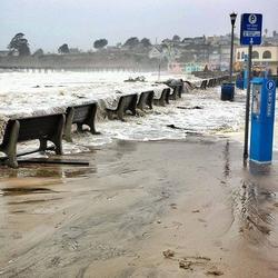
El Niño Coastal Hazards (2026-2027)
The 2026-2027 El Niño is projected to be the largest and most intense on record. Pacific storms during previous El Niño events have caused widespread coastal hazards along the California coast from flooding and erosion. The USGS is uniquely positioned to assist with coastal monitoring, data collection, science and communications with partners about these pending hazards.

Dynamic coastlines along the western U.S.
The west coast of the United States is extremely complex and changeable because of tectonic activity, mountain building, and land subsidence. These active environments pose a major challenge for accurately assessing climate change impacts, since models were historically developed for more passive sandy coasts.
Related
El Niño Coastal Hazards (2026-2027)
The 2026-2027 El Niño is projected to be the largest and most intense on record. Pacific storms during previous El Niño events have caused widespread coastal hazards along the California coast from flooding and erosion. The USGS is uniquely positioned to assist with coastal monitoring, data collection, science and communications with partners about these pending hazards.
Dynamic coastlines along the western U.S.
The west coast of the United States is extremely complex and changeable because of tectonic activity, mountain building, and land subsidence. These active environments pose a major challenge for accurately assessing climate change impacts, since models were historically developed for more passive sandy coasts.