
HERA example
By Pacific Coastal and Marine Science Center
2019 (approx.)

Detailed Description
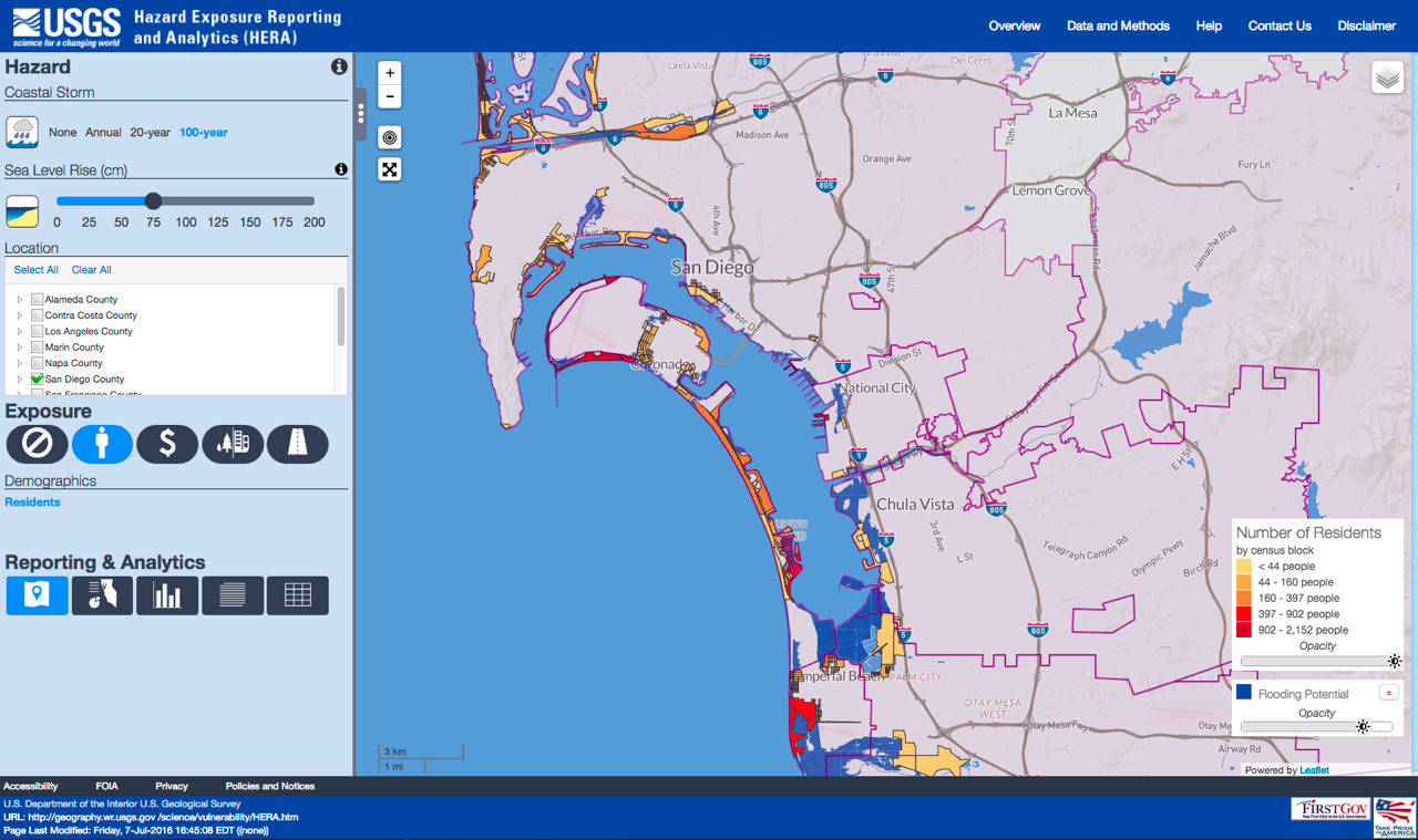
Example of Hazards Exposure Reporting and Analytics (HERA) analysis for San Diego.
Sources/Usage
Public Domain.
Related

Coastal Storm Modeling System (CoSMoS)
The Coastal Storm Modeling System (CoSMoS) makes detailed predictions of storm-induced coastal flooding, erosion, and cliff failures over large geographic scales. CoSMoS was developed for hindcast studies, operational applications and future climate scenarios to provide emergency responders and coastal planners with critical storm-hazards information that can be used to increase public safety...
Related
Coastal Storm Modeling System (CoSMoS)
The Coastal Storm Modeling System (CoSMoS) makes detailed predictions of storm-induced coastal flooding, erosion, and cliff failures over large geographic scales. CoSMoS was developed for hindcast studies, operational applications and future climate scenarios to provide emergency responders and coastal planners with critical storm-hazards information that can be used to increase public safety...