



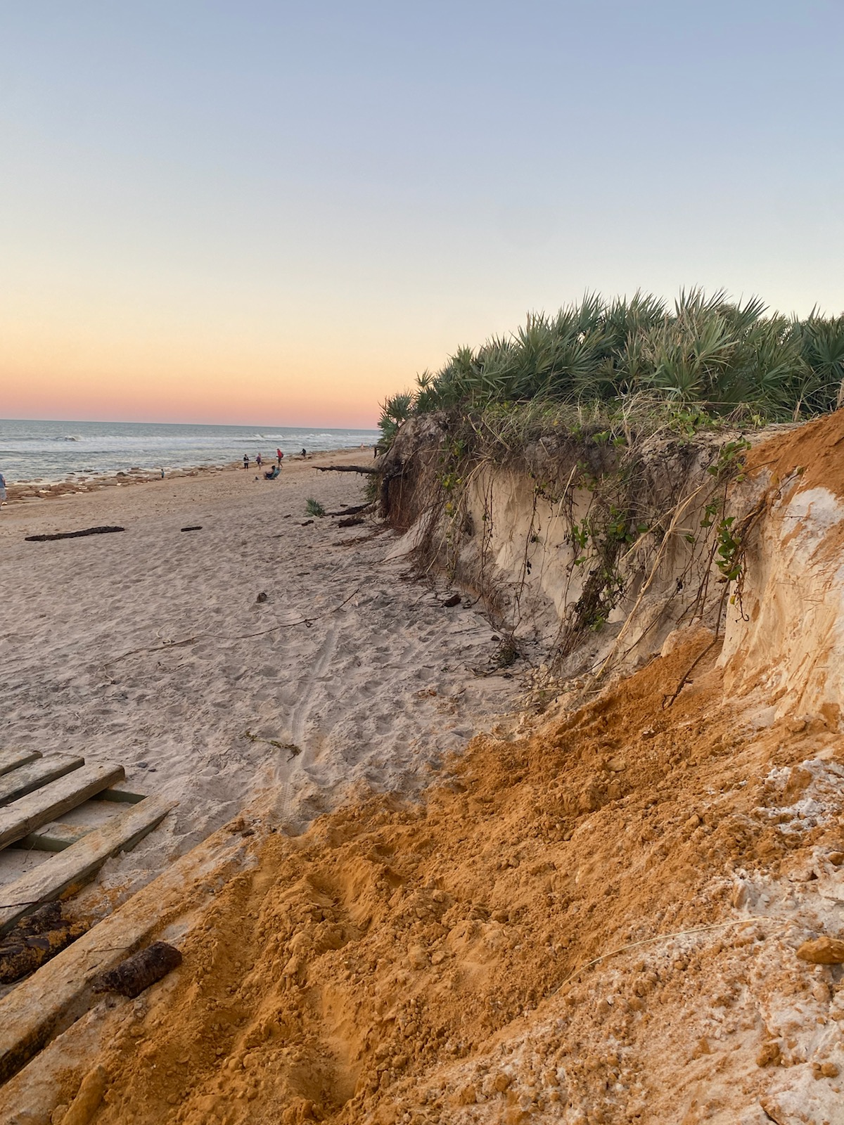
Hurricane Ian eroded Florida dunes


Detailed Description
Hurricane Ian made landfall in Southwest Florida as a Category 4 hurricane in September 2022 and impacted both the Gulf of America and Atlantic coasts. This dune in Flagler County, Florida experienced severe erosion due to waves from the storm.
Real-time forecasts of coastal change can be viewed out to 6 days for discrete locations along the U.S. coastline in the Total Water Level and Coastal Change Forecast Viewer.
Sources/Usage
Photo by Danielle Faletti. Used with permission.
Related
Total Water Level and Coastal Change Forecast Viewer Total Water Level and Coastal Change Forecast Viewer
Total water level (TWL) at the shoreline is the combination of tides, surge, and wave runup. A forecast of TWL is an estimate of the elevation where the ocean will meet the coast and can provide guidance on potential coastal erosion and flooding hazards.
By
Natural Hazards Mission Area, Water Resources Mission Area, Coastal and Marine Hazards and Resources Program, St. Petersburg Coastal and Marine Science Center, Supplemental Appropriations for Disaster Recovery Activities, Hurricane Dorian, Hurricane Florence, Hurricane Harvey, Hurricane Irma, Hurricane Isaias, Hurricane Jose, Hurricane Laura, Hurricane Marco, Hurricane Maria, Hurricane Matthew, Hurricane Michael, Hurricane Nate, Hurricane Sandy, Hurricanes
Real-Time Forecasts of Coastal Change Real-Time Forecasts of Coastal Change
U.S. Geological Survey researchers develop tools to forecast coastal change hazards. This geonarrative features research and tools developed to forecast real-time coastal change.
Related
Total Water Level and Coastal Change Forecast Viewer Total Water Level and Coastal Change Forecast Viewer
Total water level (TWL) at the shoreline is the combination of tides, surge, and wave runup. A forecast of TWL is an estimate of the elevation where the ocean will meet the coast and can provide guidance on potential coastal erosion and flooding hazards.
By
Natural Hazards Mission Area, Water Resources Mission Area, Coastal and Marine Hazards and Resources Program, St. Petersburg Coastal and Marine Science Center, Supplemental Appropriations for Disaster Recovery Activities, Hurricane Dorian, Hurricane Florence, Hurricane Harvey, Hurricane Irma, Hurricane Isaias, Hurricane Jose, Hurricane Laura, Hurricane Marco, Hurricane Maria, Hurricane Matthew, Hurricane Michael, Hurricane Nate, Hurricane Sandy, Hurricanes
Real-Time Forecasts of Coastal Change Real-Time Forecasts of Coastal Change
U.S. Geological Survey researchers develop tools to forecast coastal change hazards. This geonarrative features research and tools developed to forecast real-time coastal change.