
Landsat 8-9 Descending Acquisition Priority Map
Detailed Description
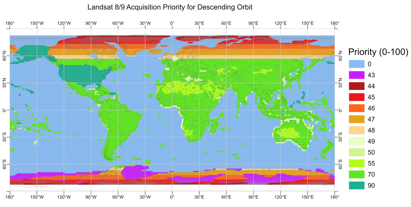
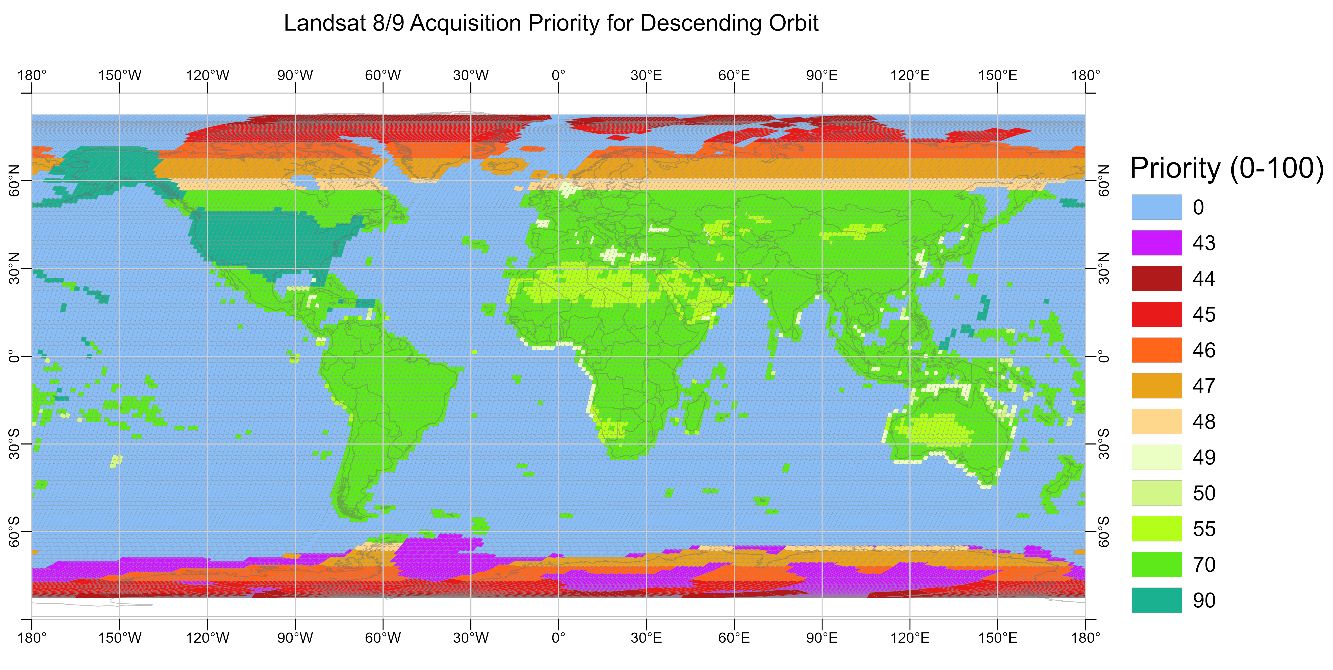
This map displays the geographic coverage of descending (daytime) image acquisition priorities for Landsat 8 and Landsat 9 on a typical day. The priority scale denotes 0 (low priority) to 100 (high priority). Lower priority scenes are more likely to be rejected to meet the daily limit, while the highest priority scenes are only rejected for maneuvers or rare calibration events.
Visit the Landsat Acquisitions webpage to learn how Landsat acquisitions are planned and performed.
Sources/Usage
Public Domain.