
Latest in Landsat April 2026 - Vol. 5 | Issue 4
Upcoming Webinar Highlights Landsat Special Requests
Join the USGS EROS User Experience Webinar on April 16, 2026, to learn more about the purpose, value, and workflow of Landsat Special Requests.
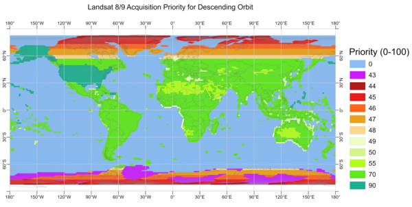
This new webinar will begin with review of the Landsat Data Acquisition Plan, the guideline for what acquisitions are made by the Landsat 8 and Landsat 9 satellites. With 1,500 images collected each day between them, the data consists mainly of Earth's land masses during daylit hours.
Special requests allow for observations that fall outside of the standard acquisition plan. This webinar will demonstrate how special requests can be submitted and explain how the data acquired by special requests expand research possibilities across a wide range of scientific applications, such as night-time urban heat measurements or polar ice studies.
Visit the link below to register for this informative webinar.
Landsat Special Requests: Expanding Acquisition Capabilities
April 16, 2026 — 12:00 to 1:00 p.m. CDT
The Latest News
-
Landsat Bulk Metadata Now Accessible in New Format Landsat Bulk Metadata Now Accessible in New Format
Landsat product metadata are now available in the Apache Parquet file format, in addition to existing CSV and XML files. Parquet files help users access metadata information more efficiently and provide faster, customized results.
-

Landsat 9 Products Impacted by 2025 Safehold Now Available Landsat 9 Products Impacted by 2025 Safehold Now Available
Landsat 9 data acquired following an October 2025 safehold event were recently processed into Landsat Level-1 and Level-2 products for the first time and are now available for download. Additionally, a small number of Landsat products processed just prior and just after the safehold were also reprocessed.
Who Will You Nominate?
-

2026 William T. Pecora Award Nominations Being Accepted 2026 William T. Pecora Award Nominations Being Accepted
The William T. Pecora Award is presented annually to individuals or teams using satellite or aerial remote sensing that make outstanding contributions toward understanding the Earth (land, oceans, and air), educating the next generation of scientists, informing decision-makers, or supporting natural or human-induced disaster response. Both national and international nominations are welcome.
Check out this new video!
-
-

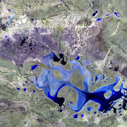
Guess the Location with Landsat
Can you guess the locations of these mystery Landsat images? Landsat satellites capture images of the Earth’s surface and help scientists study resource management, investigate land surface change, and support disaster response. Landsat is a join program between the USGS and NASA. Learn more at https://www.usgs.gov/landsat.
-
Got Questions? We’ve Got Answers!
-

Landsat Frequently Asked Questions Landsat Frequently Asked Questions
This page lists commonly asked questions pertaining to the Landsat satellite missions, the science behind maintaining high quality Landsat data, and what products are available - and how to download them.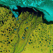
Landsat Glossary and Acronyms Landsat Glossary and Acronyms
The Landsat project uses many technical terms and acronyms to describe the satellite systems, sensors, and data formats. This information is vital for interpreting satellite imagery and using Landsat data in research and environmental monitoring. Access this information to locate the terms to learn more!
Connect Connect
Explore the Landsat social media channels, discover the latest news and resources, and find answers to your questions about Landsat Missions, science products, and data access. We are here to help you stay informed!
Stay informed with the Latest in Landsat Newsletter
Direct to your inbox! Landsat's monthly newsletter features current news, uses, tools, and announcements about America's Earth-observing satellite program.