
Landsat Portrait of America
Detailed Description
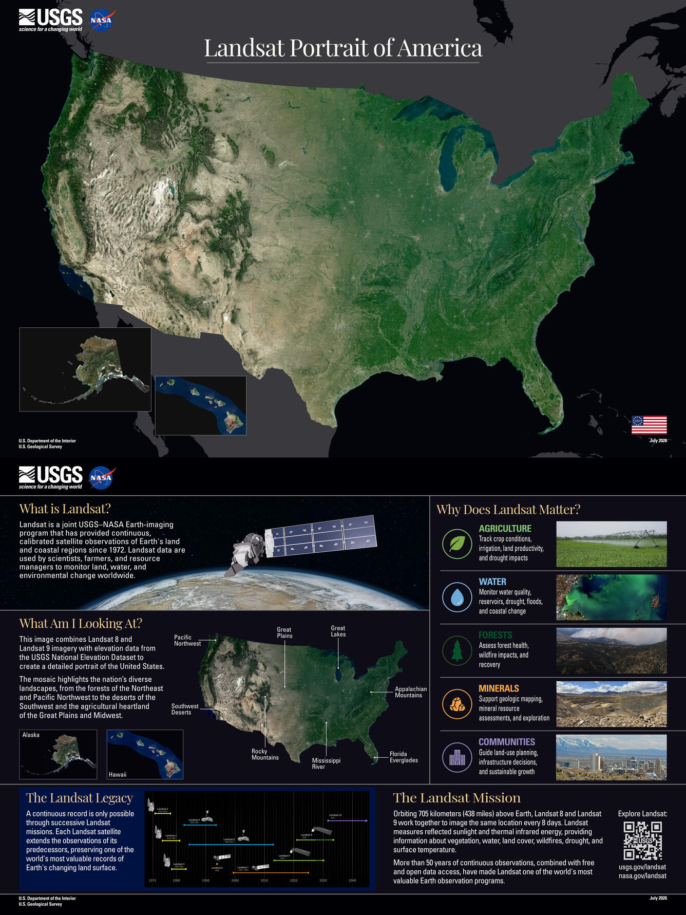
To mark the 250th anniversary of the United States, the Landsat program has released a new portrait of the nation from space. The mosaic was built by analyzing billions of Landsat 8 and Landsat 9 pixels from the USGS Landsat archive. For each location, cloud-free observations collected during the growing season were compared, and the pixel that best represented typical conditions was selected to create the mosaic. The result was then draped over elevation data to add depth and contrast.
What Am I Looking At?
This image combines Landsat 8 and Landsat 9 imagery with elevation data from the USGS National Elevation Dataset to create a detailed portrait of the United States. The mosaic highlights the nation's diverse landscapes, from the forests of the Northeast and Pacific Northwest to the deserts of the Southwest and the agricultural heartland of the Great Plains and Midwest.
What is Landsat?
Landsat is a joint USGS–NASA Earth-imaging program that has provided continuous, calibrated satellite observations of Earth's land and coastal regions since 1972. Landsat data are used by scientists, farmers, and resource managers to monitor land, water, and environmental change worldwide.
The Landsat Mission
Orbiting 705 kilometers (438 miles) above Earth, Landsat 8 and Landsat 9 work together to image the same location every 8 days. Landsat measures reflected sunlight and thermal infrared energy, providing information about vegetation, water, land cover, wildfires, drought, and surface temperature. More than 50 years of continuous observations, combined with free and open data access, have made Landsat one of the world's most valuable Earth observation programs.
Why Does Landsat Matter?
Agriculture - Track crop conditions, irrigation, land productivity, and drought impacts
Water - Monitor water quality, reservoirs, drought, floods, and coastal change
Forests - Assess forest health, wildfire impacts, and recovery
Communities - Guide land-use planning, infrastructure decisions, and sustainable growth
The Landsat Legacy
A continuous record is only possible through successive Landsat missions. Each Landsat satellite extends the observations of its predecessors, preserving one of the world's most valuable records of Earth's changing land surface.
You can download the full resolution poster at https://www.usgs.gov/media/files/landsat-portrait-america.
Sources/Usage
Public Domain.