



Latest in Landsat August 2026 - Vol. 5 | Issue 8
Landsat’s View of Mining Landscapes
Long-term satellite record documents land disturbance, restoration
Decades of Landsat imagery offer a clear view of landscapes transformed by coal mining
A recently published article describes how Landsat satellite images reveal over fifty years of transformation in Wyoming’s Powder River Basin, documenting the move from native grassland to intensive mining and then to reclaimed land. Landsat-based Annual National Land Cover Database (NLCD) maps help track land‑cover classes from 1985 to today.
The Landsat record helps land managers and researchers monitor change, guide restoration, and understand the full life cycle of mining in the region. Check out the article below to learn more!
-
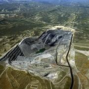
Landsat Illustrates the Life Cycle of a Mine Landsat Illustrates the Life Cycle of a Mine
Any number of satellites can show us what the Earth’s surface looks like now—but only the Landsat Program can reveal more than 50 years of change. We can watch cities grow, farmland shrink, and forests and lakes fluctuate.
Celebrating 250 years with a new snapshot from space
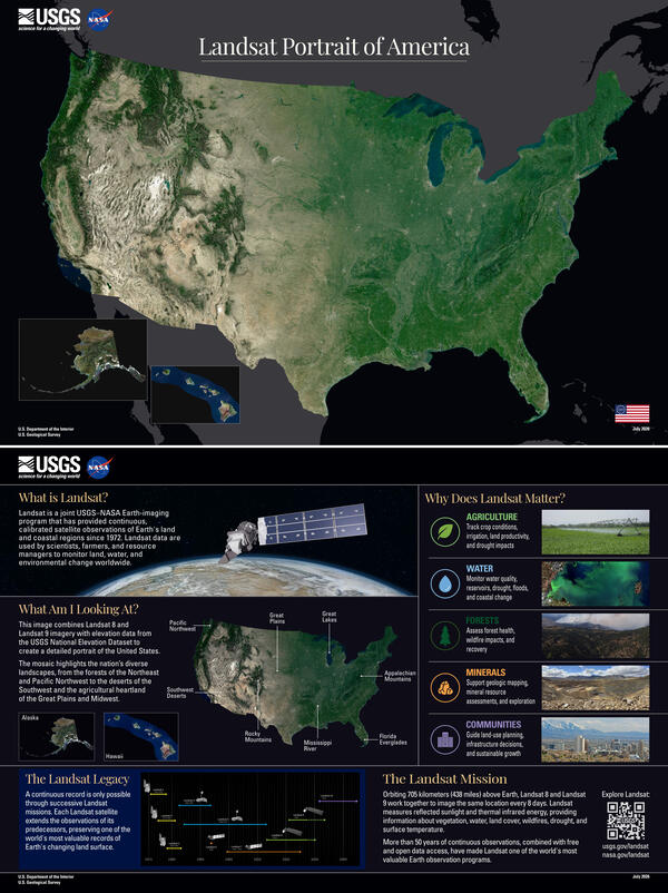
The USGS recently released a new portrait of the United States from space to mark the nation's 250th anniversary. Billions of Landsat 8 and Landsat 9 pixels from the USGS Landsat archive were analyzed and combined with elevation data from the USGS National Elevation Dataset to create the detailed portrait. The mosaic highlights the nation's diverse landscapes, from the forests of the Northeast and Pacific Northwest to the deserts of the Southwest and the agricultural heartland of the Great Plains and Midwest.
The back of the poster displays important details on why Landsat matters, highlights how ag, water, forests, minerals, and communities all benefit greatly from the joint U.S. Geological Survey and NASA Landsat Program record — which now contains over 53 years of imagery for change analysis.
Click the image to get a closer look. You can also download the full resolution poster.
Landsat Benefits Every State
Explore the Landsat’s View of the USA interactive webpage and discover the many ways Landsat supports every corner of the nation! Jump into the online jigsaw puzzle, browse USGS factsheets, and download a beautiful mosaic image for any state. It’s a fun and engaging way to see how Landsat makes a difference across the nation.
Follow Along on Social as We Highlight Each State!
We are showcasing all 50 states through stunning Landsat imagery—and placing a spotlight on each one in the order it joined the Union.
Follow the journey across America with our social media channels listed on the page below.
-

Social Media Social Media
Check out the Landsat Missions social media accounts and tap the FOLLOW button to stay in-the-know when it comes to all things Landsat!
Looking to the future with Landsat 10
Landsat 10 is the next mission in the joint USGS-NASA Landsat program. Expected to launch in 2031, the mission will continue the world’s longest space-based record of Earth’s land surface.
Landsat 10 will introduce new imaging capabilities for the next generation of Earth observation. Check out the pages below to see the details about the new mission.
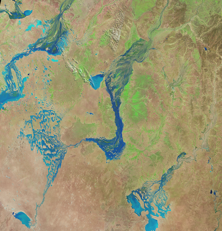
NASA Releases Landsat 10 Spacecraft Request for Proposal
The National Aeronautics and Space Administration (NASA) has published a new Request for Proposal (RFP) for the Landsat 10 Spacecraft. Proposals are due August 13, 2026.
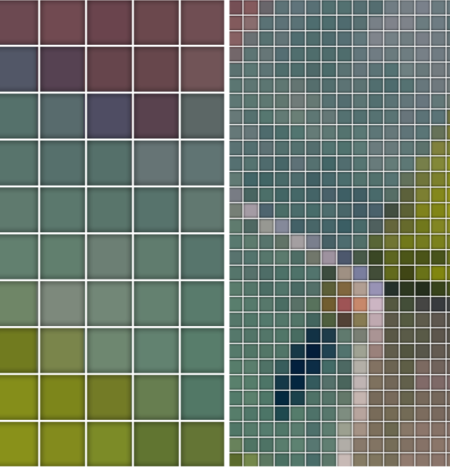
Landsat 10
Landsat 10 is the next mission in the joint USGS-NASA Landsat program. Landsat 10 is expected to launch in 2031 and will continue the world’s longest space-based record of Earth’s land surface. Landsat 10 will introduce new imaging capabilities for the next generation of Earth observation.
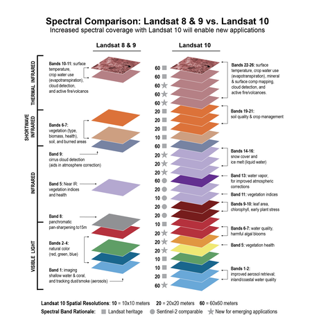
Spectral Comparison of Landsat 8-9 and Landsat 10
This illustration compares the spectral bands of the sensors onboard Landsat 8 and Landsat 9, compared to the 26 bands that will capture imagery on Landsat 10. Refined and new bands will allow easier merging of data products and support emerging Landsat applications.
Recently Released Landsat-related Publications
Across-track tilt concept for sun glint mitigation in future Earth-observing missions
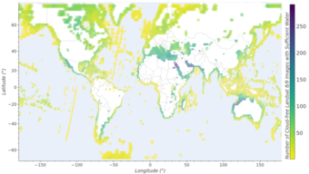
Sun glint is a major limitation for spaceborne optical remote sensing of aquatic environments, particularly in tropical and subtropical regions. By dominating the at-sensor radiance, sun glint complicates atmospheric correction and reduces the quality of aquatic reflectance products derived across Earth observation missions.
This study presents a machine learning framework to quantify sun glint probability and evaluates the across-track tilt observational concept as a potential sun glint mitigation approach for satellite remote sensing missions. Published July 3, 2026
Enhancements to the USGS Landsat Level 2 surface temperature and emissivity product for Collection 3 reprocessing
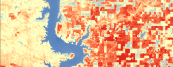
The Landsat program provides the longest continuous global record of thermal infrared observations of the Earth's surface, underpinning critical applications in climate monitoring, water resources, ecosystem dynamics, urban heat analysis, and natural hazard assessment.
This publication provides information about enhancements that will improve Level-2 Surface Temperature products during the planned Landsat Collection 3 processing in the late 2020s. Published July 31, 2026
Got Questions? We’ve Got Answers!
-

Connect Connect
Explore the Landsat social media channels, discover the latest news and resources, and find answers to your questions about Landsat Missions, science products, and data access. We are here to help you stay informed!
-
Landsat Missions Landsat Missions
Since 1972, the joint NASA/ U.S. Geological Survey Landsat series of Earth Observation satellites have continuously acquired images of the Earth’s land surface, providing uninterrupted data to help land managers and policymakers make informed decisions about natural resources and the environment.
Landsat is a part of the USGS National Land Imaging (NLI) Program.
-

Landsat Frequently Asked Questions Landsat Frequently Asked Questions
This page lists commonly asked questions pertaining to the Landsat satellite missions, the science behind maintaining high quality Landsat data, and what products are available - and how to download them.
-
EROS User Services
Your trusted resource for USGS EROS data and tools. As the primary contact point for the USGS Earth Resources Observation and Science (EROS) center, we help thousands of users each year access and understand our vast archive of remotely sensed imagery and science products.
Stay informed with the Latest in Landsat Newsletter
Direct to your inbox! Landsat's monthly newsletter features current news, uses, tools, and announcements about America's Earth-observing satellite program.
Subscribe to receive Latest in Landsat Newsletters
-

Latest in Landsat Newsletter Latest in Landsat Newsletter
Learn about the Latest in Landsat! This monthly newsletter highlights current news, uses, tools, and announcements about the Landsat suite of Earth-observing satellites and the data collected from them.