





Mapping changes in seasonal water use patterns with Landsat ETa
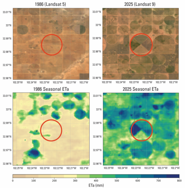
Mapping changes in seasonal water use patterns with Landsat ETaThese images illustrate how Landsat Provisional Actual Evapotranspiration (ETa) data can be used to map and quantify changes in seasonal water‑use patterns (April–September).