
Lidar plane
By Coastal and Marine Hazards and Resources Program
2003 (approx.)

Detailed Description
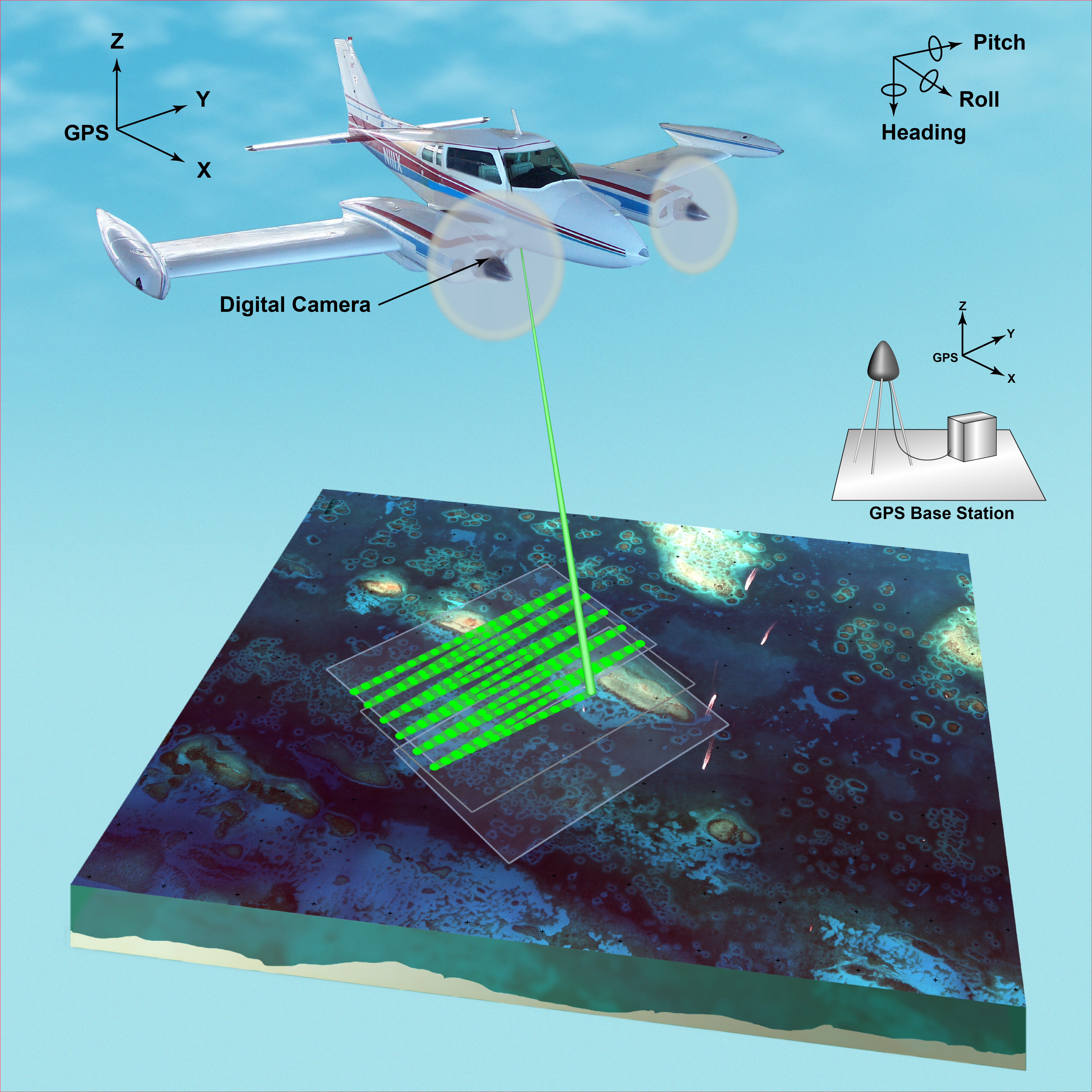
Airborne lidar is a surveying method that measures distance to a target from a survey plane by illuminating that target with a pulsed laser light, and measuring the reflected pulses with a sensor. Differences in laser return times and wavelengths can then be used to make digital 3D-representations of the target. This illustration depicts the equipment used, including the plane with digital camera mounted underneath, and the GPS base station, but does not show the satellites used to obtain the coordinates.
Sources/Usage
Public Domain.