
New USGS Flood Inundation Mapper
Detailed Description
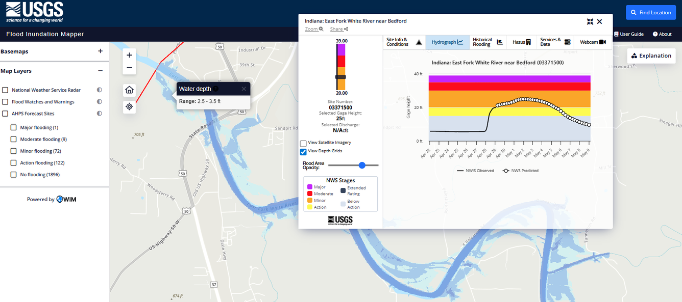
Screenshot of the new USGS Flood Inundation Mapper. This screenshot was taken on April 28, 2026, when Minor Flooding Stage (National Weather Service) was forecasted along the East Fork White River near Bedford, Indiana. The FIM Mapper also displays modeled floodwater depths for the selected gage height.
Sources/Usage
Public Domain.
Related

Flood Inundation Mapping Science
When planning for a flood, there are three key questions that must be answered: What areas will be flooded? How deep will the floodwaters get? When will the flood arrive? A flood inundation map library is a set of maps that together show where flooding may occur – and how deep it may be - over a range of potential flooding scenarios in a stream or river.
Related
Flood Inundation Mapping Science
When planning for a flood, there are three key questions that must be answered: What areas will be flooded? How deep will the floodwaters get? When will the flood arrive? A flood inundation map library is a set of maps that together show where flooding may occur – and how deep it may be - over a range of potential flooding scenarios in a stream or river.