
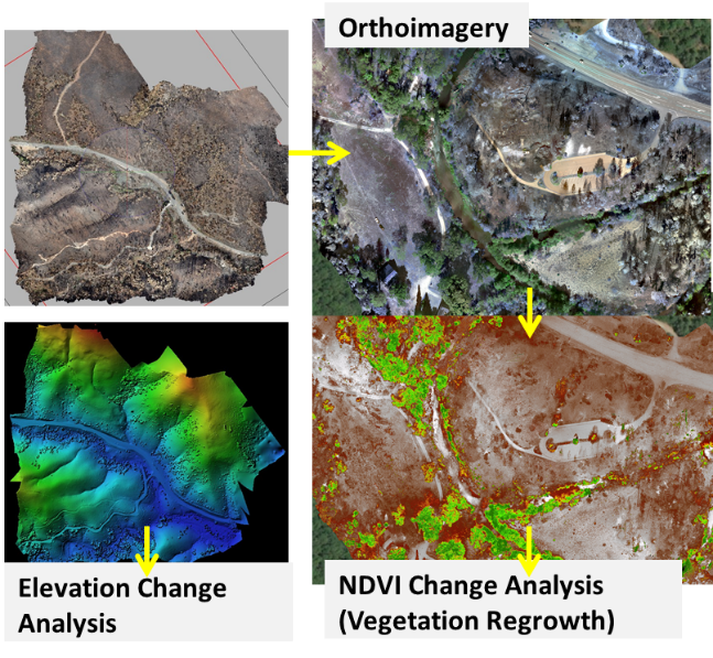
Orthoimagery used to analyze elevation changes and vegetation regrowth
Detailed Description
A series of 4 images illustrating how orthoimagery can be used to analyze elevation changes and vegetation regrowth.. 1) 3D image of valley with road running through it, 2) close up 3D image showing vegetation and structures, 3) Image 1 with color gradient to represent elevation, 4) Image 2 with color used to highlight the presence of vegetation.
Sources/Usage
Public Domain.
Related

Using Drone Imagery to Assess Impacts of the 2018 Carr Fire
USGS WERC’s Dr. Karen Thorne and her research team are using drone imagery to understand how the 2018 Carr Fire affected ecosystems and cultural resources. The study, a collaboration with the National Park Service (NPS), focuses on Whiskeytown National Recreation Area in northern California. The drone images will help the WERC researchers identify changes in topography, cultural sites, debris...
Related
Using Drone Imagery to Assess Impacts of the 2018 Carr Fire
USGS WERC’s Dr. Karen Thorne and her research team are using drone imagery to understand how the 2018 Carr Fire affected ecosystems and cultural resources. The study, a collaboration with the National Park Service (NPS), focuses on Whiskeytown National Recreation Area in northern California. The drone images will help the WERC researchers identify changes in topography, cultural sites, debris...