
Seafloor shaded relief and submarine landslides offshore of Santa Barbara area
By Pacific Coastal and Marine Science Center
2017 (approx.)
Detailed Description
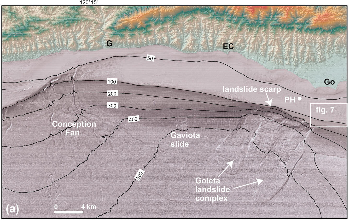
Seafloor geology map from a 2017 journal article by Johnson and others, published in Coastal and Ocean Management. Shaded digital elevation model (DEM) showing submarine landslides and sites of potential future landslides along the steep upper continental slope in the western Santa Barbara Channel area. EC, El Capitan; G, Gaviota; Go, Goleta; PH, Platform Holly. Contours are in meters.
Sources/Usage
Public Domain.
Related

California Seafloor Mapping Program
The California Seafloor Mapping Program (CSMP) is a cooperative program to create a comprehensive coastal and marine geologic and habitat base map series for all of California's State waters.

Seafloor Faults off Southern California
More than 22 million people live along Southern California’s coast, and many more migrate there every year. Faults and earthquake threats in this region have been heavily studied on land. USGS aims to boost our knowledge about faults on the seafloor, so they can be included in hazard assessments.

Underwater Landslides off Southern California
An earthquake can trigger a landslide along the ocean floor, which can then set off a tsunami. Without modern, high-resolution imaging of the seafloor, many historical slides and threats from future slides remain undetected.
Related
California Seafloor Mapping Program
The California Seafloor Mapping Program (CSMP) is a cooperative program to create a comprehensive coastal and marine geologic and habitat base map series for all of California's State waters.
Seafloor Faults off Southern California
More than 22 million people live along Southern California’s coast, and many more migrate there every year. Faults and earthquake threats in this region have been heavily studied on land. USGS aims to boost our knowledge about faults on the seafloor, so they can be included in hazard assessments.
Underwater Landslides off Southern California
An earthquake can trigger a landslide along the ocean floor, which can then set off a tsunami. Without modern, high-resolution imaging of the seafloor, many historical slides and threats from future slides remain undetected.