The Denver Basin aquifer system is composed of Late Cretaceous to Tertiary-age sandstone bedrock aquifers and intervening claystone confining units that occur in the uppermost layers of the structural Denver Basin above the Cretaceous Pierre Shale confining layer.

From oldest to youngest, the four primary aquifers are the Laramie-Fox Hills, Arapahoe, Denver, and Dawson. The Arapahoe and Dawson aquifers are further differentiated into upper and lower units in parts of the basin. Thus, the six Denver Basin bedrock aquifers and five intervening confining units used to develop geologic layers for the groundwater flow model, from oldest to youngest, are the Laramie-Fox Hills aquifer, Laramie confining unit, lower Arapahoe aquifer, Arapahoe confining unit, upper Arapahoe aquifer, lower Denver confining unit, Denver aquifer, upper Denver confining unit, lower Dawson aquifer, Dawson confining unit, and upper Dawson Aquifer. Alluvial sand, gravel, and clay deposits overlie the bedrock formations primarily along stream channels in the South Platte and Arkansas River basins, and these materials form an unconfined alluvial aquifer where saturated.
The data below are supplemental to Groundwater Availability of the Denver Basin aquifer system, Colorado (USGS Professional Paper 1770). The report includes a description of methods used to derive the data.
Click on the links below to download files for this aquifer. For information about the available file types, see Aquifer data: Explanation of spatial data formats.
Spatial datasets (shapefiles and metadata) for six Denver Basin bedrock aquifers and five intervening confining units including, from oldest to youngest:
- Laramie-Fox Hills aquifer (KLF)
- Laramie confining unit (KLC)
- lower Arapahoe aquifer (LKA)
- Arapahoe confining unit (KAC)
- upper Arapahoe aquifer (UKA)
- Denver lower confining unit (TKDLC)
- Denver aquifer (TKD)
- Denver upper confining unit (TKDUC)
- lower Dawson aquifer (LTDW)
- Dawson confining unit (TDWC)
- upper Dawson aquifer (UTDW).
Below are other science projects associated with aquifer.
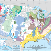
Principal Aquifers of the United States
Regional Groundwater Availability Studies
Below are publications associated with this aquifer.
Groundwater availability of the Denver Basin aquifer system, Colorado Groundwater availability of the Denver Basin aquifer system, Colorado
Ground Water Atlas of the United States Ground Water Atlas of the United States
Principal aquifers [of the United States] Principal aquifers [of the United States]
The Denver Basin aquifer system is composed of Late Cretaceous to Tertiary-age sandstone bedrock aquifers and intervening claystone confining units that occur in the uppermost layers of the structural Denver Basin above the Cretaceous Pierre Shale confining layer.

From oldest to youngest, the four primary aquifers are the Laramie-Fox Hills, Arapahoe, Denver, and Dawson. The Arapahoe and Dawson aquifers are further differentiated into upper and lower units in parts of the basin. Thus, the six Denver Basin bedrock aquifers and five intervening confining units used to develop geologic layers for the groundwater flow model, from oldest to youngest, are the Laramie-Fox Hills aquifer, Laramie confining unit, lower Arapahoe aquifer, Arapahoe confining unit, upper Arapahoe aquifer, lower Denver confining unit, Denver aquifer, upper Denver confining unit, lower Dawson aquifer, Dawson confining unit, and upper Dawson Aquifer. Alluvial sand, gravel, and clay deposits overlie the bedrock formations primarily along stream channels in the South Platte and Arkansas River basins, and these materials form an unconfined alluvial aquifer where saturated.
The data below are supplemental to Groundwater Availability of the Denver Basin aquifer system, Colorado (USGS Professional Paper 1770). The report includes a description of methods used to derive the data.
Click on the links below to download files for this aquifer. For information about the available file types, see Aquifer data: Explanation of spatial data formats.
Spatial datasets (shapefiles and metadata) for six Denver Basin bedrock aquifers and five intervening confining units including, from oldest to youngest:
- Laramie-Fox Hills aquifer (KLF)
- Laramie confining unit (KLC)
- lower Arapahoe aquifer (LKA)
- Arapahoe confining unit (KAC)
- upper Arapahoe aquifer (UKA)
- Denver lower confining unit (TKDLC)
- Denver aquifer (TKD)
- Denver upper confining unit (TKDUC)
- lower Dawson aquifer (LTDW)
- Dawson confining unit (TDWC)
- upper Dawson aquifer (UTDW).
Below are other science projects associated with aquifer.
Principal Aquifers of the United States
Regional Groundwater Availability Studies
Below are publications associated with this aquifer.


