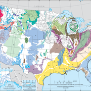
Northern Atlantic Coastal Plain aquifer system
The Northern Atlantic Coastal Plain (NACP) aquifer system occupies a land area of more than 30,000 square miles and a total area of 50,000 square miles along the eastern seaboard of the United States from Long Island, New York, southward to the northeastern part of North Carolina.

The aquifer system is composed of a seaward-dipping wedge of mostly unconsolidated layers of clay, silt, sand, and gravel ranging in age from Early Cretaceous to Holocene and overlying a basement of Precambrian to Paleozoic consolidated bedrock. The NACP sedimentary wedge dips and thickens to the south and east from its thin western limit in the Fall Zone, the transition between the igneous and metamorphic rocks of the Piedmont Province and the sedimentary environment of the Coastal Plain. The Coastal Plain sediments are several miles thick where they terminate along the edge of the Atlantic Continental Shelf, though the extent of the freshwater part of the aquifer system is more limited and reaches a maximum thickness of 1,000 to 3,000 feet in the approximate vicinity of the shoreline. The NACP sedimentary wedge forms a complex groundwater system in which strata of sand and gravel function predominantly as aquifers, and those of silt and clay function as confining units. Ten regional aquifers and nine interlayered confining units have been defined at the regional scale.
Data files delineating the NACP aquifers and confining units are supplemental to Hydrogeology and Hydrologic Conditions of the Northern Atlantic Coastal Plain Aquifer System from Long Island, New York, to North Carolina (USGS Scientific Investigations Report 2013-5133). This report includes a detailed description of the regional hydrogeologic units. A description of the methods used to create the digital data files of the hydrogeologic units can be found in Digital Elevations and Extents of Regional Hydrogeologic Units of the Northern Atlantic Coastal Plain Aquifer System in New York, New Jersey, Delaware, Maryland, Virginia, and North Carolina (Data Series 996).
Click on the links below to download files for this aquifer. For information about the available file types, see Aquifer data: Explanation of spatial data formats.
Hydrogeologic Unit Extents and Surface Elevations (shapefiles, ASCII, raster, and metadata)
Land Surface Elevation (ASCII, raster, and metadata)
Below are other science projects associated with this aquifer.
Principal Aquifers of the United States
Regional Groundwater Availability Studies
Below are publications associated with this aquifer.
Digital elevations and extents of regional hydrogeologic units in the Northern Atlantic Coastal Plain aquifer system from Long Island, New York, to North Carolina Digital elevations and extents of regional hydrogeologic units in the Northern Atlantic Coastal Plain aquifer system from Long Island, New York, to North Carolina
Hydrogeology and hydrologic conditions of the Northern Atlantic Coastal Plain aquifer System from Long Island, New York, to North Carolina Hydrogeology and hydrologic conditions of the Northern Atlantic Coastal Plain aquifer System from Long Island, New York, to North Carolina
Ground Water Atlas of the United States Ground Water Atlas of the United States
Principal aquifers [of the United States] Principal aquifers [of the United States]
The Northern Atlantic Coastal Plain (NACP) aquifer system occupies a land area of more than 30,000 square miles and a total area of 50,000 square miles along the eastern seaboard of the United States from Long Island, New York, southward to the northeastern part of North Carolina.

The aquifer system is composed of a seaward-dipping wedge of mostly unconsolidated layers of clay, silt, sand, and gravel ranging in age from Early Cretaceous to Holocene and overlying a basement of Precambrian to Paleozoic consolidated bedrock. The NACP sedimentary wedge dips and thickens to the south and east from its thin western limit in the Fall Zone, the transition between the igneous and metamorphic rocks of the Piedmont Province and the sedimentary environment of the Coastal Plain. The Coastal Plain sediments are several miles thick where they terminate along the edge of the Atlantic Continental Shelf, though the extent of the freshwater part of the aquifer system is more limited and reaches a maximum thickness of 1,000 to 3,000 feet in the approximate vicinity of the shoreline. The NACP sedimentary wedge forms a complex groundwater system in which strata of sand and gravel function predominantly as aquifers, and those of silt and clay function as confining units. Ten regional aquifers and nine interlayered confining units have been defined at the regional scale.
Data files delineating the NACP aquifers and confining units are supplemental to Hydrogeology and Hydrologic Conditions of the Northern Atlantic Coastal Plain Aquifer System from Long Island, New York, to North Carolina (USGS Scientific Investigations Report 2013-5133). This report includes a detailed description of the regional hydrogeologic units. A description of the methods used to create the digital data files of the hydrogeologic units can be found in Digital Elevations and Extents of Regional Hydrogeologic Units of the Northern Atlantic Coastal Plain Aquifer System in New York, New Jersey, Delaware, Maryland, Virginia, and North Carolina (Data Series 996).
Click on the links below to download files for this aquifer. For information about the available file types, see Aquifer data: Explanation of spatial data formats.
Hydrogeologic Unit Extents and Surface Elevations (shapefiles, ASCII, raster, and metadata)
Land Surface Elevation (ASCII, raster, and metadata)
Below are other science projects associated with this aquifer.
Principal Aquifers of the United States
Regional Groundwater Availability Studies
Below are publications associated with this aquifer.


