
The USGS has updated the 3D Hydrography Program (3DHP) web service (accessible at https://3dhp.nationalmap.gov/arcgis/rest/services/usgs_3dhp_all/FeatureServer). This updated service includes the first new hydrography data published by the 3DHP and aligned with 3
Multimedia
Multimedia includes photography, graphics, and videos. All items in this gallery are considered public domain unless otherwise noted.
Images
Holston River NHD to 3DHP Animation
The USGS has updated the 3D Hydrography Program (3DHP) web service (accessible at https://3dhp.nationalmap.gov/arcgis/rest/services/usgs_3dhp_all/FeatureServer). This updated service includes the first new hydrography data published by the 3DHP and aligned with 3

Using Google Earth Engine to Generate Monthly-to-Weekly Maps of Surface Water Thumbnail
Using Google Earth Engine to Generate Monthly-to-Weekly Maps of Surface Water Thumbnail-
Our topic will be "Using Google Earth Engine to Generate Monthly-to-Weekly Maps of Surface Water." The presenter will be Chris Soulard with the USGS Western Geographic Science Center.

Title page from WBD Standards TM11-a3 publication Version 5
Title page from WBD Standards TM11-a3 publication Version 5Title page from the Federal Standards and Procedures for the National Watershed Boundary Dataset (WBD), Techniques and Methods 11-A3, Fifth Edition, 2022.This document establishes Federal standards and procedures for creating the WBD as seamless and hierarchical hydrologic unit data, based on topographic and hydrologic features at a 1:24,000 scale (Alaska at 1:

Introducing the NHDPlus HR National Release 1 Video Thumbnail
Introducing the NHDPlus HR National Release 1 Video ThumbnailThe USGS is pleased to announce the release of the National Hydrography Dataset Plus (NHDPlus HR) National Release 1 downloadable staged product.
Introducing the NHDPlus HR National Release 1 Video Thumbnail
Introducing the NHDPlus HR National Release 1 Video ThumbnailThe USGS is pleased to announce the release of the National Hydrography Dataset Plus (NHDPlus HR) National Release 1 downloadable staged product.

3DHP Proposed Nine Year Costs
This is a graph and illustration representation of the 3DHP Proposed Nine Year Costs
This is a graph and illustration representation of the 3DHP Proposed Nine Year Costs

USGS Announces NHDPlus HR National Release 1
The NHDPlus HR National presents a continuous representation of the most recent NHDPlus HR vector data for the contiguous United States, Puerto Rico, Hawaii, and parts of Alaska.
The NHDPlus HR National presents a continuous representation of the most recent NHDPlus HR vector data for the contiguous United States, Puerto Rico, Hawaii, and parts of Alaska.
Videos
 Data")
December 2024 USGS Hydrography Community Call: Delivering and Using 3D Hydrography Program (3DHP) Data
December 2024 USGS Hydrography Community Call: Delivering and Using 3D Hydrography Program (3DHP) DataThe 3D Hydrography Program (3DHP) database will initially be populated with the National Hydrography Dataset (NHD) features, mapped to the new data model. The NHD-source features will be replaced with hydrography derived from the 3D Elevation Program (3DEP) lidar and IfSAR data as it becomes available.

A Statewide Hydraulic Modeling Tool for Stream Crossing Projects in Massachusetts
A Statewide Hydraulic Modeling Tool for Stream Crossing Projects in MassachusettsThe U.S. Geological Survey and the University of Massachusetts at Amherst (UMass Amherst), in cooperation with the Massachusetts Department of Environmental Protection (MassDEP), began a series of studies in 2019 to develop a web-based statewide hydraulic modeling tool to provide preliminary culvert designs for stream-crossing projects in Massachusetts.

Understanding the Transition from NHDPlus HR to 3DHP
Understanding the Transition from NHDPlus HR to 3DHPThe new 3D Hydrography Program (3DHP) is the focus of USGS efforts to acquire and produce detailed surface-water mapping information, such as lakes, ponds, rivers and streams.
Understanding the Transition from NHDPlus HR to 3DHP
Understanding the Transition from NHDPlus HR to 3DHPThe new 3D Hydrography Program (3DHP) is the focus of USGS efforts to acquire and produce detailed surface-water mapping information, such as lakes, ponds, rivers and streams.
 Transitioning to 3DHP")
Watershed Boundary Dataset (WBD) Transitioning to 3DHP
Watershed Boundary Dataset (WBD) Transitioning to 3DHPThe U.S. Geological Survey (USGS) Watershed Boundary Dataset (WBD) is a national hydrologic unit (HU) geospatial dataset that defines surface drainage areas for the United States. This dataset provides a foundation for local, regional, and national applications to manage, archive, exchange, and analyze data by HU.

The Latest Updates to the HydroAdd Tool
The HydroAdd tool is a web application built by USGS that allows collaborative addressing (or linear referencing) of diverse datasets to the NHD. HydroAdd also provides tools that allow users to migrate datasets that have been previously addressed to the NHD.
The HydroAdd tool is a web application built by USGS that allows collaborative addressing (or linear referencing) of diverse datasets to the NHD. HydroAdd also provides tools that allow users to migrate datasets that have been previously addressed to the NHD.

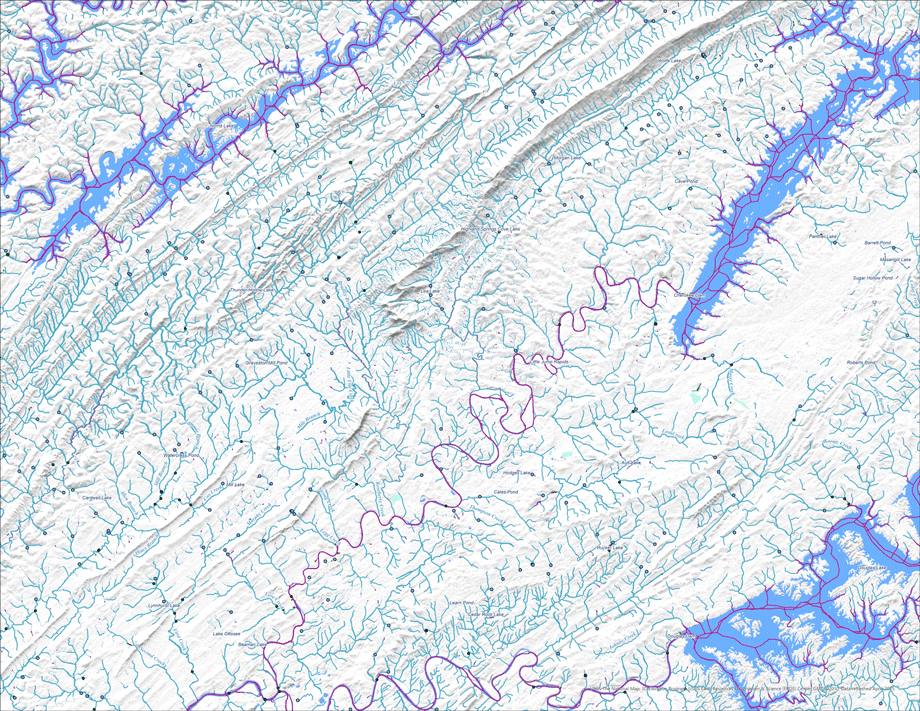
topoBuilder: OnDemand, Custom, Topographic Maps
The U.S. Geological Survey’s National Geospatial Program has released the topoBuilder application, which enables users to create topographic maps on demand using the best available National Map data.
The U.S. Geological Survey’s National Geospatial Program has released the topoBuilder application, which enables users to create topographic maps on demand using the best available National Map data.